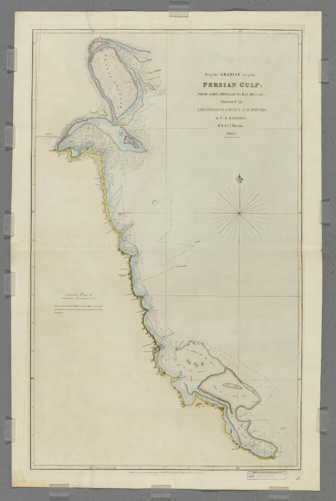
1. 'Part of the Arabian Side of the Persian Gulf; from Core Abdullah to Ras Reccan. Sheet 1st. and 5th.' Creator: Cartographer: Bateman & Son Date: 1828/1828 Language: English Geographic region: Ras el GharCore Abdullah
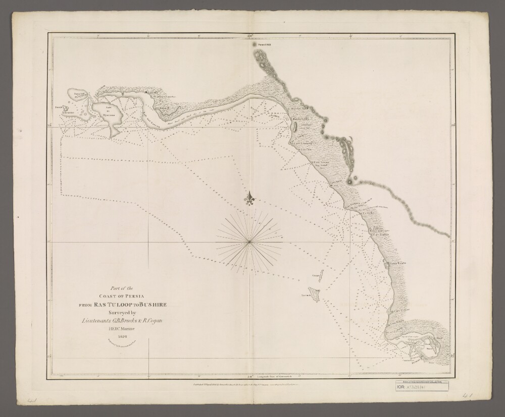
2. 'Part of the Coast of Persia from Ras Tuloop to Bushire' Creator: Cartographer: Bateman & Son Date: 1828/1828 Language: English Geographic region: PersiaRas TuloopBushirePersian Gulf
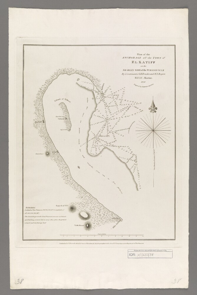
3. 'Plan of the Anchorage off the Town of El Katiff on the Arabian Side of the Persian Gulf' Creator: Cartographer: Bateman & Son Date: 1828/1828 Language: English Geographic region: El KatiffPersian GulfArabian Peninsula
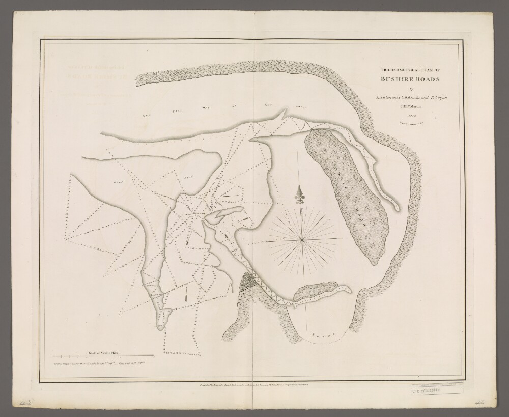
4. 'Trigonometrical Plan of Bushire Roads' Creator: Cartographer: Bateman & Son Date: 1828/1828 Language: English Geographic region: BushirePersian GulfPersia
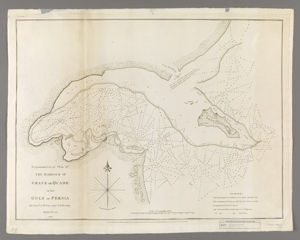
5. 'Trigonometrical Plan of the Harbour of Grane or Quade in the Gulf of Persia' Creator: Cartographer: Bateman & Son Date: 1828/1828 Language: English Geographic region: Grane (city)Persian GulfKuwait Bay