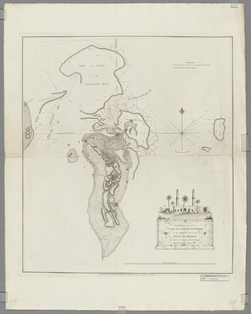
Abstract: Covers the island of Bahrein [Bahrain] and surrounding waters of the Persian Gulf to a radius of up to thirty miles. Portrays hydrology, including depths by soundings, sands and rocks, relief by hachures, vegetation, settlements and place names, and includes topographical and hydrographic notes. Hydrographic information is shown only around the north coast and the seas to the north.Surveyed by Lieutenants George Barnes Brucks and William Eales Rogers, 1825. Drawn by Lieutenant Michael Houghton. Published by James Horsburgh, Hydrographer to the Honourable East India Company.Physical description: Materials: Printed on paperDimensions: 647 x 576mm, on sheet 846 x 663mm
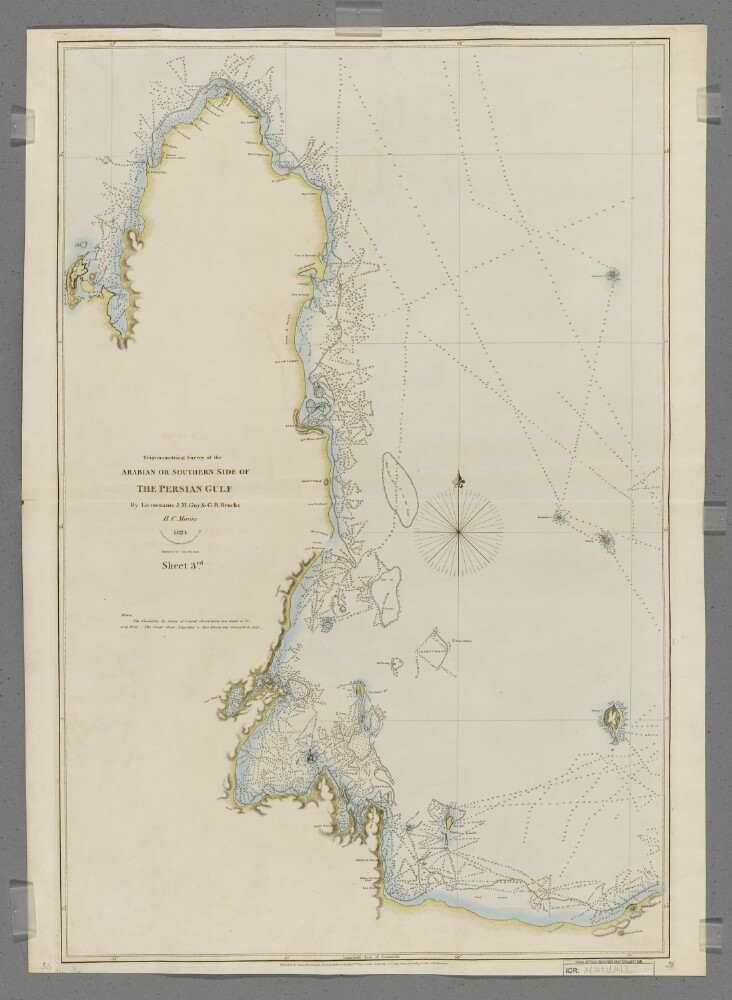
Abstract: Covers the Qatar Peninsula and the adjacent Arabian coastline for seventy miles westwards.The printed sheet has been enhanced by watercolour.Drawn by Lieutenant Michael Houghton, Draughtsman, Honourable Company Marine. Engraved by John Bateman.Physical description: Materials: Printed, with manuscript additions in watercolour, on paper (backed with linen)Dimensions: 788 x 518mm, on sheet 826 x 591mm