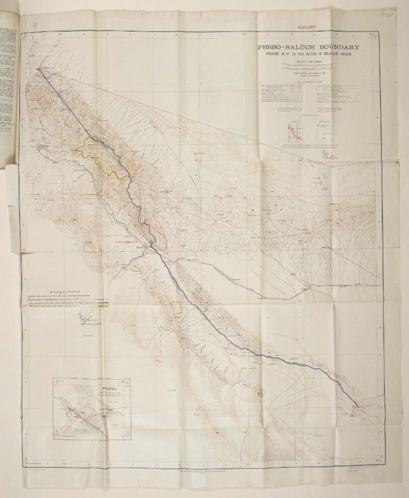
1. ‘Perso-Balūch Boundary from B.P. 11 to Kūh-i-Malik Sīāh’ Creator: Author: Surveyor GeneralAuthor: Survey of India Date: 1932/1932 Language: English
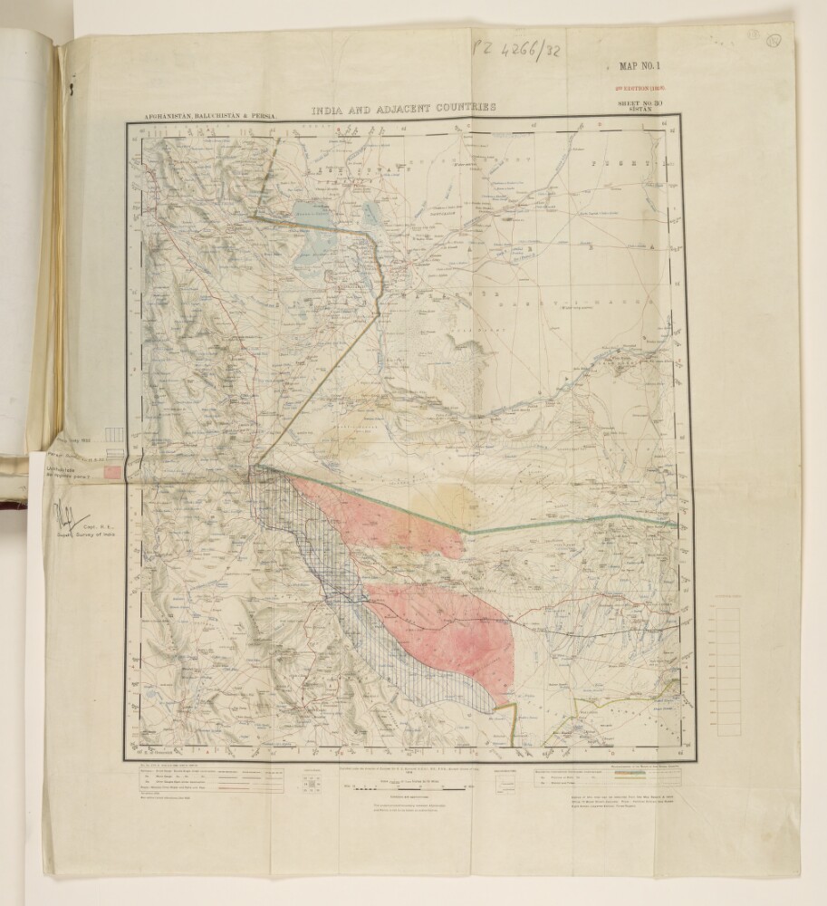
2. ‘India and adjacent countries’ Creator: Author: Surveyor GeneralAuthor: Survey of India Date: 1918/1932 Language: English
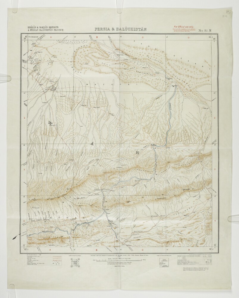
3. ‘Persia & Balūchistān; Khārān & Makrān Districts & Persian Balūchistān Province’ Creator: Author: Surveyor General Date: 1915/1915 Language: English
4. ‘PRELIMINARY MAP OF THE BOMBAY PRESIDENCY TO ACCOMPANY THE ADMINISTRATION REPORT FOR 1872-73’ Creator: Author: Surveyor General Date: 1874/1874 Language: English
5. ‘Copy of the Survey of India map of Baluchistan. Published in 1894.’ Creator: Author: Surveyor General Date: 1894/1896 Language: English
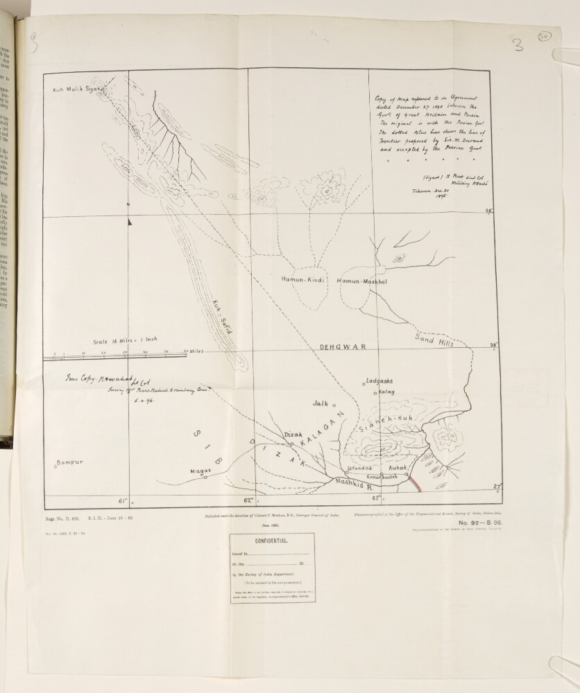
6. Map of Sir Henry Mortimer Durand’s proposed frontier between Persia and Baluchistan Creator: Author: Military Attaché, TehranAuthor: Surveyor General Date: 1896/1896 Language: English
7. Map showing the route of the North Western Railway from Duzdap [Zahedan] to Nok Kondī [Nok Kundi] and beyond Creator: Author: Surveyor General Date: 1915/1916 Language: English Geographic region: DuzdapNok Kundi