121. ‘Table of Court Fees. For P.A’s office’ Creator: Author: Bahrain Political Agency Date: 1933/1933 Language: English Geographic region: Bahrain
123. ‘Persian Gulf Tranquillity of the – Vol: 1’ Date: 1846/1847 Language: English Geographic region: BahreinBushire
124. ‘Expedition of the Imaum of Muscat against Sevee, and His Highness' right to Bahrain’ Date: 1845/1845 Language: English Geographic region: Bahrein
125. 'Ext 1948/43 Iraqi dinar notes repatriated from Bahrain' Date: 1943/1943 Language: English Geographic region: BagdadBahrain
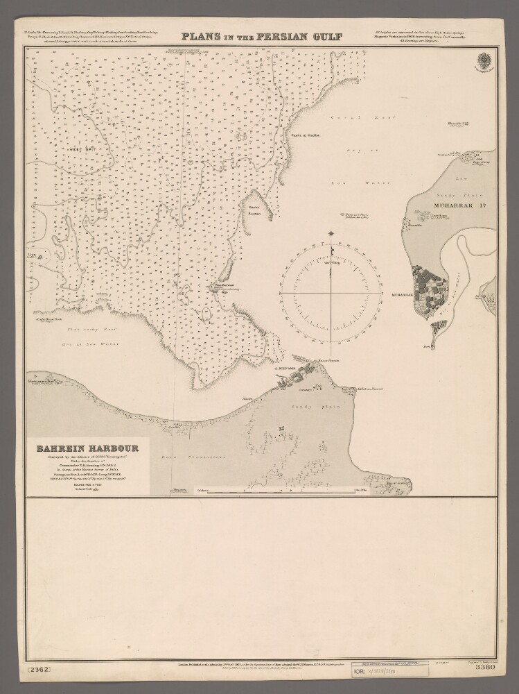
126. 'Plans in the Persian Gulf. Bahrein Harbour' Creator: Cartographer: Malby & Sons Date: 1903/1903 Language: English Geographic region: Persian GulfBahreinBahrein HarbourMuharrak Island
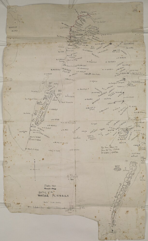
127. ‘Rough Map of the KATAR PENINSULA’ Date: 1936/1938 Language: English Geographic region: ZubarahQatar
128. ‘SKETCH OF THE ISLAND OF KENN, In the Persian Gulf. Thos. Remon, Captn., Engineers’ Date: 1822/1822 Language: English Geographic region: جزيرة كيشمسقطالبحرينالكويتالإمارات المتصالحةقطرسِتْرة
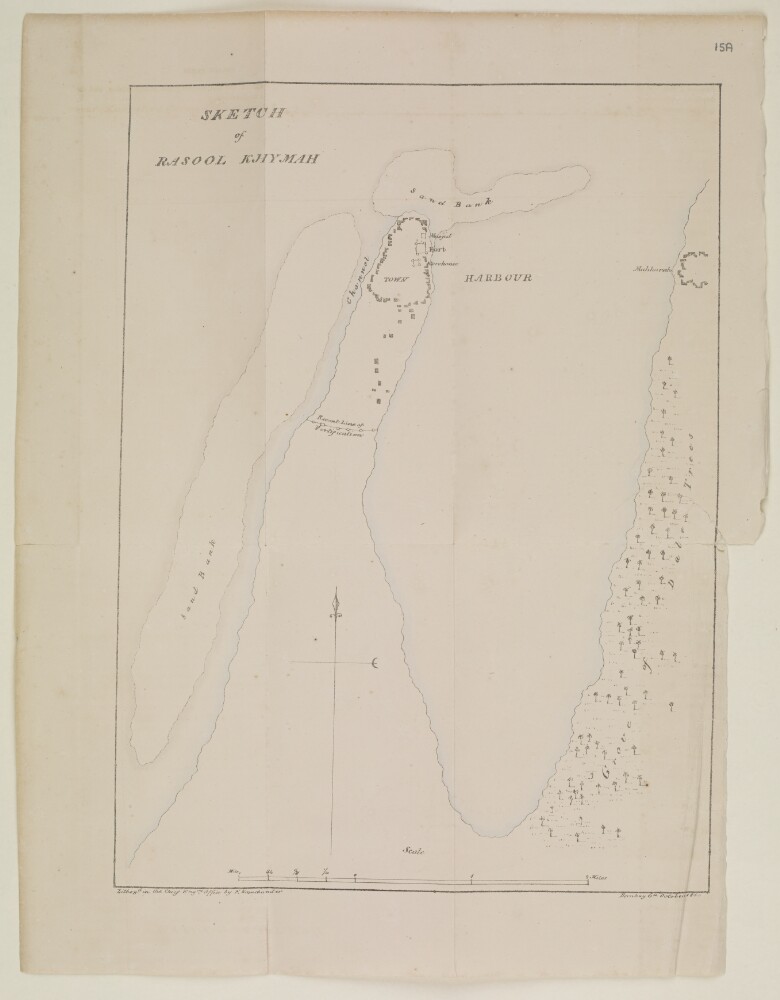
129. ‘Sketch of Rasool Khymah’ Date: 1855/1855 Language: English Geographic region: رأس الخيمةمسقطالبحرينالكويتالإمارات المتصالحةقطرسِتْرة
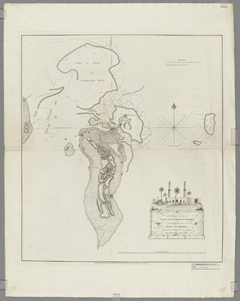
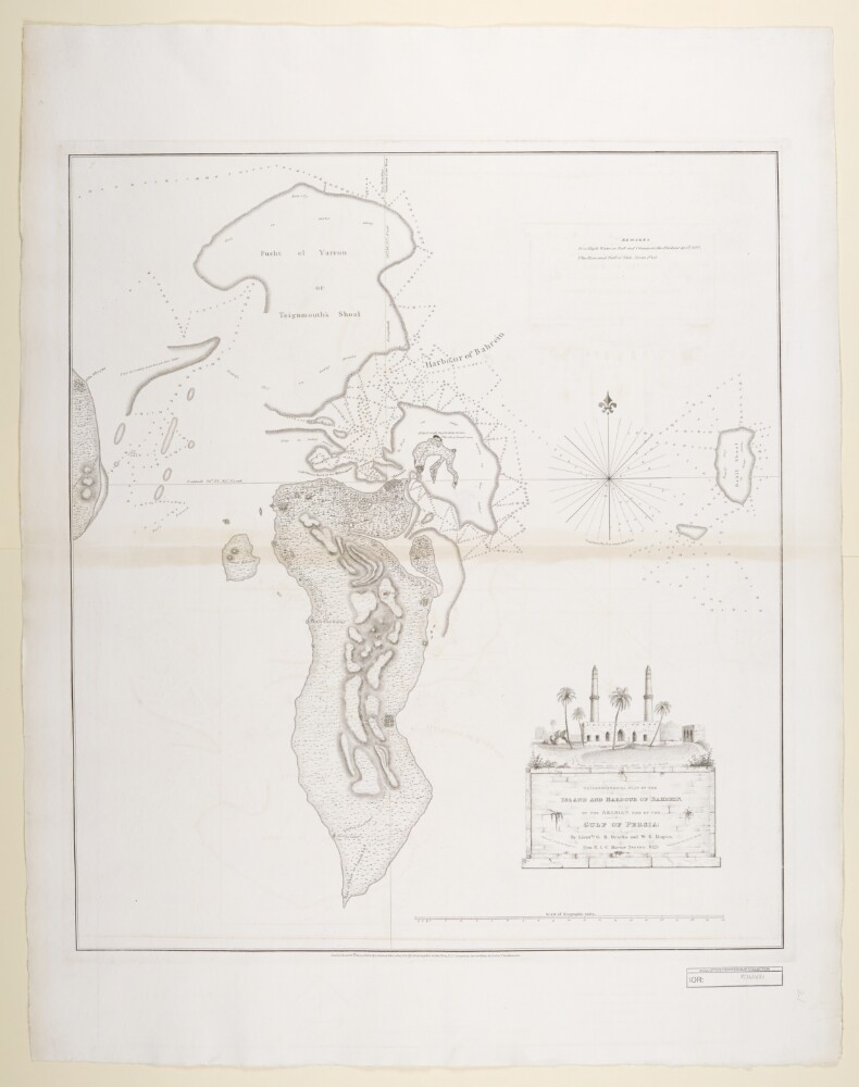
130. 'Trigonometrical Plan of the Island and Harbour of Bahrein, on the Arabian Side of the Gulf of Persia' Creator: Cartographer: Michael Houghton Date: 1828/1828 Language: English Geographic region: BahreinPersian Gulf
131. ‘Trigonometrical Plan of the Island and Harbour of Bahrein, on the Arabian Side of the Gulf of Persia; by Lieutts. G.B. Brucks, and W.E. Rogers. Hon. E.I.C. Marine Service: 1825. Drawn by Lieutt. M. Houghton; Draughtsman Hon. E.I.C. Marine. Engraved by Bateman and Son’ Date: 1828/1828 Language: English Geographic region: Bahrain
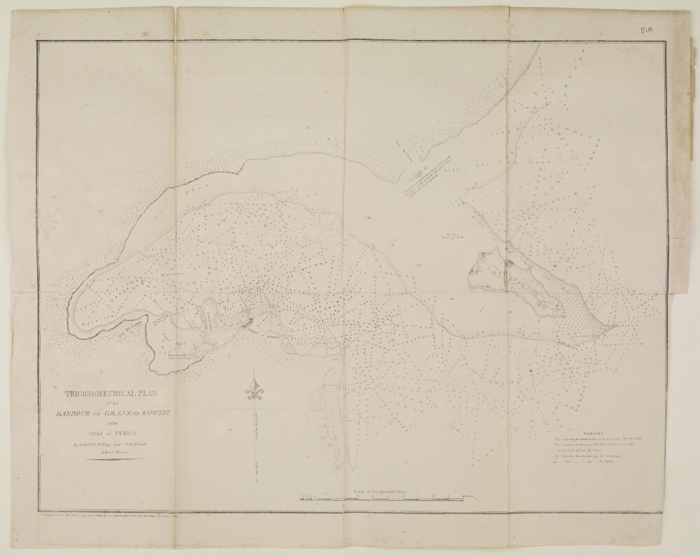
132. ‘TRIGONOMERTICAL PLAN of the HARBOUR OF GRANE OR KOWEIT in the GULF OF PERSIA. By Lieutts. J.M. Guy and G.B. Brucks, H.E.I.C. Marine’ Date: 1855/1855 Language: English Geographic region: خليج الكويتمسقطالبحرينالكويتالإمارات المتصالحةقطرسِتْرة