Skip to search
Skip to main content
Skip to first result
Digital Library of the Middle East
Show facets
Hide facets
English
العربية
Contact us
Contact us
To contact us about any matter related to DLME, please use the form below.
Message
Your name
Ignore this text box. It is used to detect spammers. If you enter anything into this text box, your message will not be sent.
Your email
Cancel
Digital Library of the Middle East
Preserve. Access. Inspire.
Home
Explore
Contributors
About
Search in
Everything
Title
Creator / Contributor
Identifier
search for
Search
Home
Search results
Search
Search Constraints
Start Over
You searched for:
Spatial
بلوشستان
✖
Remove constraint Spatial: بلوشستان
« Previous
|
13
-
24
of
70
|
Next »
Sort
by Relevance
Relevance
Title
Creator
Date (old to new)
Date (new to old)
Number of results to display per page
12
per page
per page
12
per page
24
per page
48
per page
96
per page
View results as:
List
Gallery
Slideshow
Search Results
×
'Persian Baluchistan (including the Sarhad and Persian Mekran) The Quetta-Nushki extension railway'
13 of 70
'Baluchistan and Persia. Note by Sir Dennis Fitzpatrick'
14 of 70
'REPORT on the Working of the Line of Communication AND ON THE Withdrawal of the British Military Mission IN EAST PERSIA, 1919-20. GENERAL STAFF INDIA.
15 of 70
'Military Report of the Nushki-Chagai-Western Sinjarani Country'
16 of 70
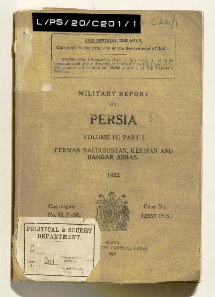
'MILITARY REPORT ON PERSIA. VOLUME IV, PART I.'
17 of 70
‘Military report on Persia. Vol IV, part I. Persian Baluchistan, Kerman and Bandar Abbas.’
18 of 70
‘A PART OF BELUCHISTAN WITH PART OF MEKRAN AND THE PERSO-BELUCH BOUNDARY DRAWN & COMPILED BY CAPTAIN BERESFORD LOVETT R.E. attached to the Special Mission to Mekran UNDER MAJOR GENERAL F.J. GOLDSMID, C.B. From actual surveys by Major E.C. Ross, Assistant Political Agent, Gwadur; Captain Beresford Lovett, R.E.; and Quarter Master Serjeant D. Bower, R.E.’
19 of 70
‘Map of Western Baluchistan Compiled by Order of H.M. Secretary of State for India to Show the Western Frontier of the Territories H.H. the Khan of Kalat as Determined by the Frontier Commission Under Major General Sir Frederic J. Goldsmid C.B., K.C.S.I., by Major O.B.C. [Oliver Beauchamp Coventry ] St. John R.E.’
20 of 70
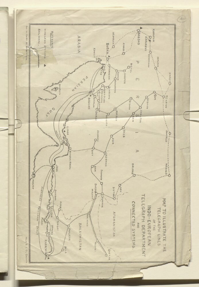
‘MAP TO ILLUSTRATE THE TELEGRAPH LINES OF THE INDO-EUROPEAN TELEGRAPH DEPARTMENT AND CONNECTED SYSTEMS’
21 of 70
'Gazetteer of the Persian Gulf. Vol I. Historical. Part II. J G Lorimer. 1915'
22 of 70
'Gazetteer of the Persian Gulf. Vol. II. Geographical and Statistical. J G Lorimer. 1908'
23 of 70
‘Seistan Persia & Seistan’
24 of 70
« Previous
Next »
1
2
Current Page, Page 2
3
4
5
6


![‘Map of Western Baluchistan Compiled by Order of H.M. Secretary of State for India to Show the Western Frontier of the Territories H.H. the Khan of Kalat as Determined by the Frontier Commission Under Major General Sir Frederic J. Goldsmid C.B., K.C.S.I., by Major O.B.C. [Oliver Beauchamp Coventry ] St. John R.E.’](https://images.qdl.qa/iiif/images/81055/vdc_100022879252.0x000001/IOR_X_3094_1-4_0001.jp2/full/!1000,1000/0/default.jpg)