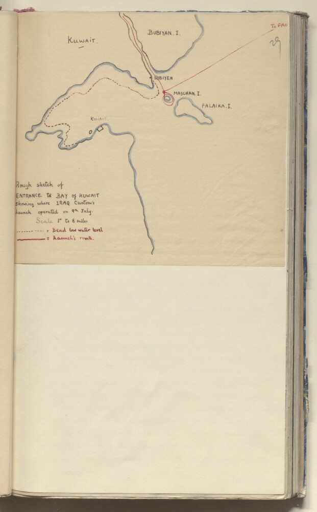
1. ‘Rough sketch of Entrance to Bay of Kuwait Showing where Iraq Custom’s Launch Operated on 9th July’ Date: 1935/1935 Language: English Geographic region: Kuwait Bay
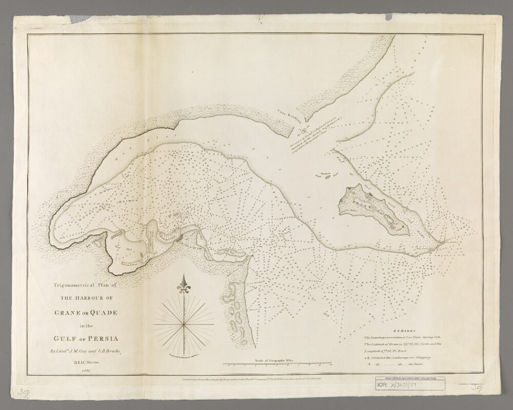
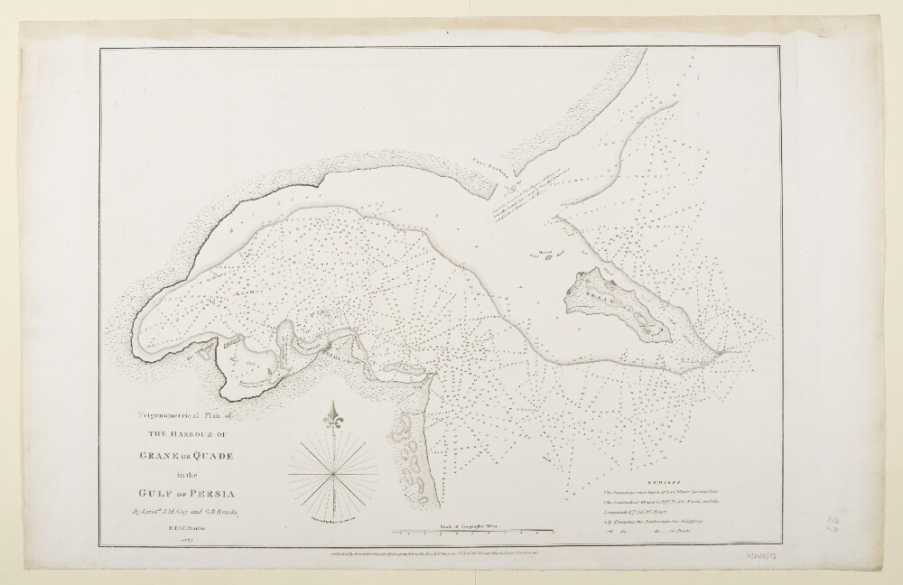
2. 'Trigonometrical Plan of the Harbour of Grane or Quade in the Gulf of Persia' Creator: Cartographer: Bateman & Son Date: 1828/1828 Language: English Geographic region: Grane (city)Persian GulfKuwait Bay
3. ‘Trigonometrical Plan of the Harbour of Grane or Quade in the Gulf of Persia By Lieutts. J.M. Guy and G.B. Brucks H.E.I.C. Marine. 1825. Engraved by Bateman and Son’ Date: 1828/1828 Language: English Geographic region: Kuwait Bay
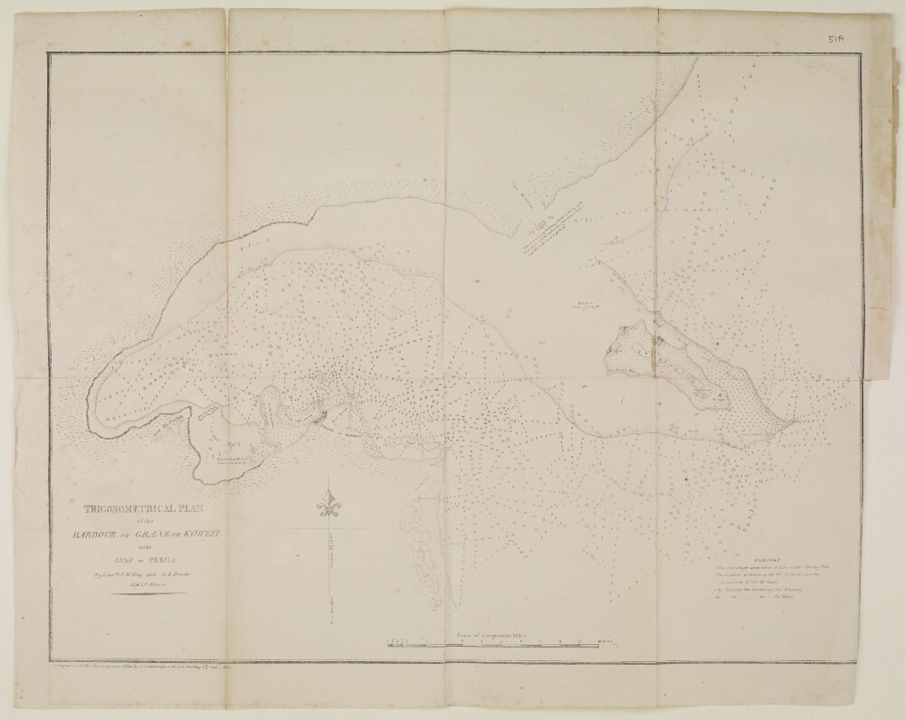
4. ‘TRIGONOMERTICAL PLAN of the HARBOUR OF GRANE OR KOWEIT in the GULF OF PERSIA. By Lieutts. J.M. Guy and G.B. Brucks, H.E.I.C. Marine’ Date: 1855/1855 Language: English Geographic region: خليج الكويتمسقطالبحرينالكويتالإمارات المتصالحةقطرسِتْرة
5. ‘The Shaṭṭ el ‘Aráb from Baṣrah to the Bar of the River Euphrates and the River Kárún from Salmánah Isle to Moḥommerah with the Bah-a-mishìr surveyed by Colonel Chesney and the Officers of the expeditions’ Date: 1849/1849 Language: English Geographic region: Kuwait Bay
6. 'File 86/66 Status of Kuwait Bay and Extent of Territorial Waters in Kuwait' Date: 1946/1947 Language: English Geographic region: KuwaitKuwait BayBūshehr