37. 'Southern Arabia, by Theodore Bent, F.R.G.S., F.S.A., Author of 'The Ruined Cities of Mashonaland' 'The Sacred City of the Ethiopians' 'The Cyclades, Or Life Among the Insular Greeks' etc. and Mrs Theodore Bent' Creator: Author: James Theodore BentAuthor: Mabel Virginia Anna BentAuthor: Robin Leonard Bidwell Date: 1994/1994 Language: English Geographic region: Arabian Peninsula
38. 'Maps illustrating Memorandum respecting the Settlement of Turkey and the Arabian Peninsula.' Creator: Author: Foreign Office, Political Intelligence Department Date: 1918/1918 Language: English Geographic region: TurkeyArabian Peninsula
39. 'Maps illustrating Memorandum respecting the Settlement of Turkey and the Arabian Peninsula.' Creator: Author: Foreign Office, Political Intelligence Department Date: 1918/1918 Language: English Geographic region: Arabian PeninsulaTurkey
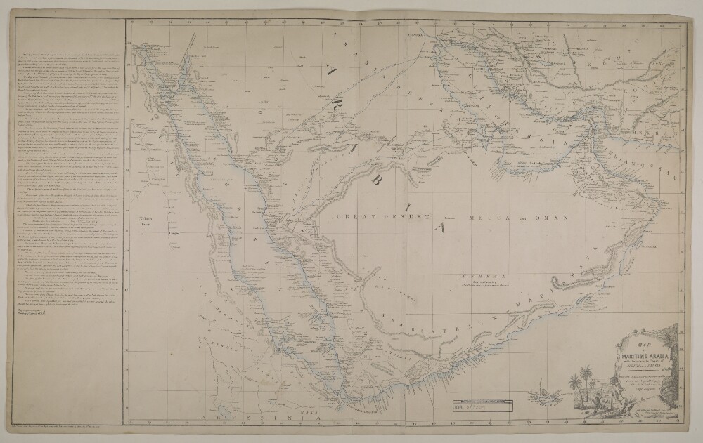
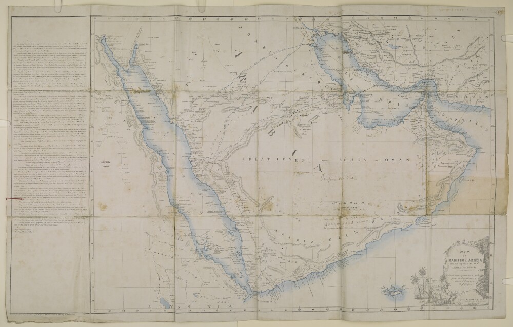
40. ‘Map of the maritime Arabia with the opposite coasts of Africa and Persia’ Date: 1856/1856 Language: English Geographic region: Arabian Peninsula
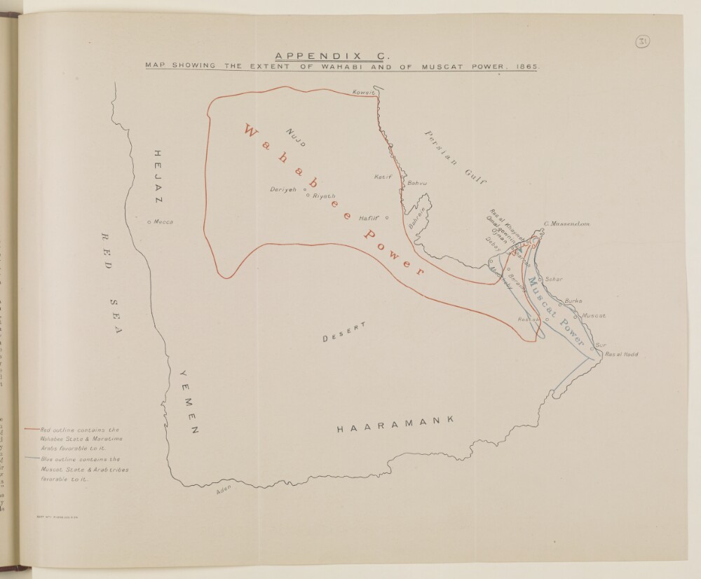
41. ‘Map showing the extent of Wahabi and of Muscat Power, 1865’ Date: 1934/1934 Language: English Geographic region: Arabian Peninsula
42. ‘Map showing the extent of Wahabi and of Muscat Power, 1865’ Date: 1934/1934 Language: English Geographic region: Arabian Peninsula
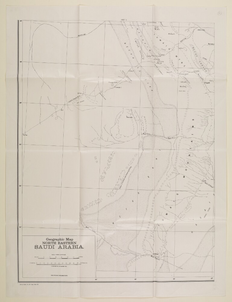
43. 'Geographic Map NORTH EASTERN SAUDI ARABIA' Date: 1940/1940 Language: English Geographic region: Arabian PeninsulaPersia
44. 'Map of Maritime Arabia with the opposite coasts of Africa and Persia' Date: 1856/1856 Language: English Geographic region: Arabian Peninsula
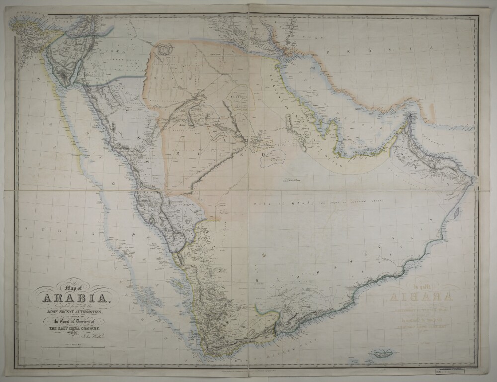
45. ‘Map of Arabia. Compiled from all the most recent authorities, by order of the Court of Directors of the East India Company by John Walker’ Date: 1849/1849 Language: English Geographic region: Arabian Peninsula
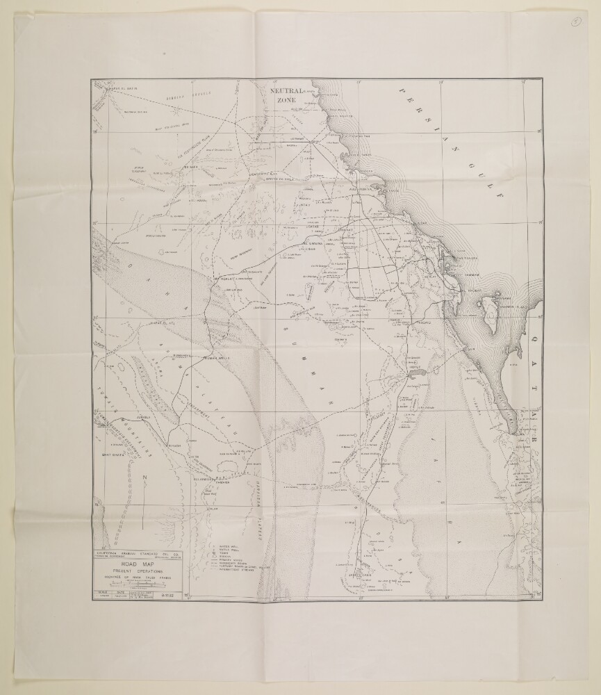
46. 'ROAD MAP PRESENT OPERATIONS PROVINCE OF HASA SAUDI ARABIA' Date: 1940/1940 Language: English Geographic region: HasaArabian Peninsula
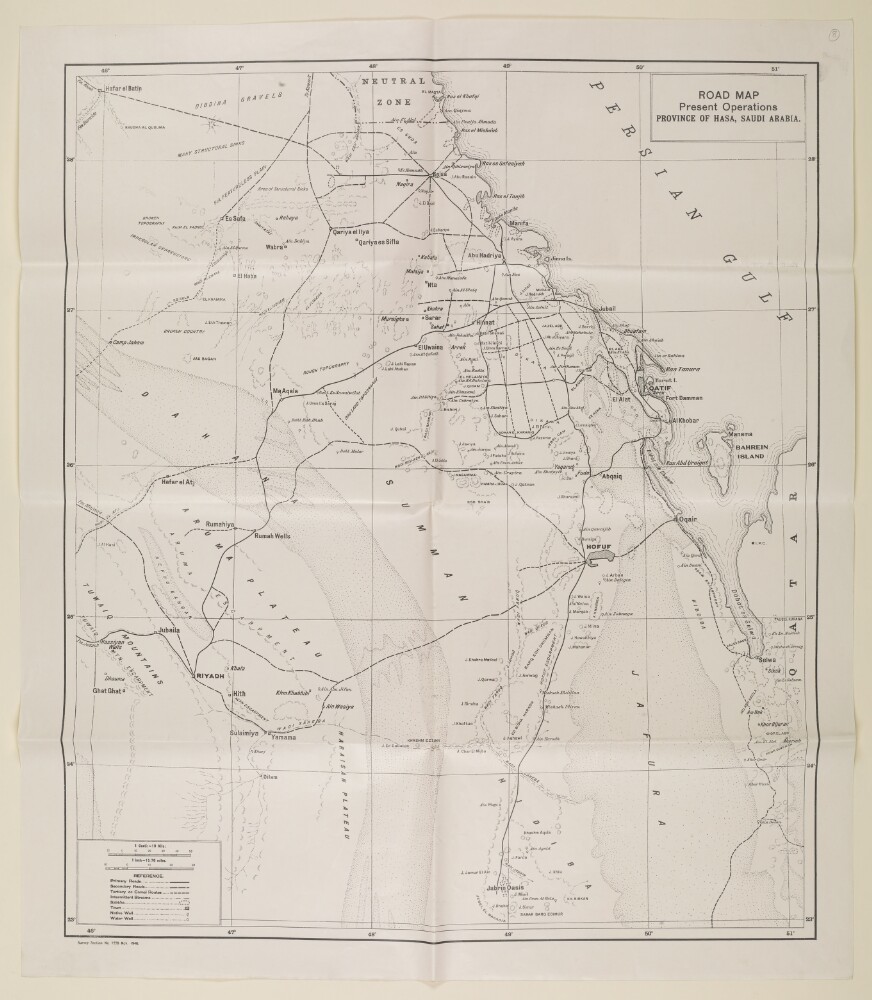
47. 'ROAD MAP Present Operations PROVINCE OF HASA, SAUDI ARABIA.' Date: 1940/1940 Language: English Geographic region: Arabian PeninsulaHasa
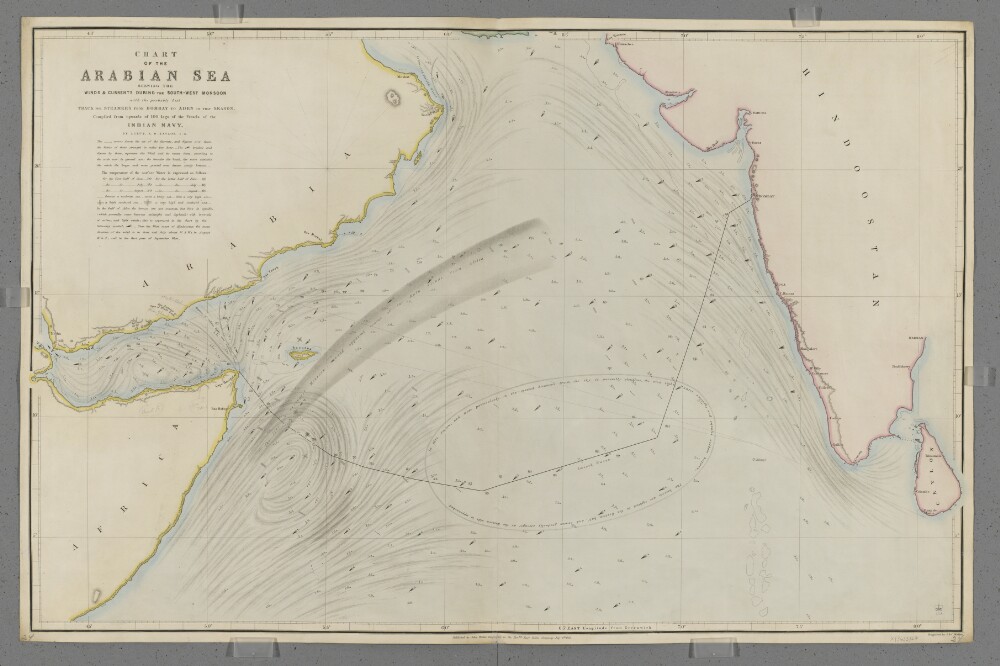
48. 'Chart of the Arabian Sea Shewing the Winds & Currents during the South-West Monsoon with the probably best Track for Steamers from Bombay to Aden in that Season.' Creator: Cartographer: J & C Walker Date: 1853/1853 Language: English Geographic region: Arabian Sea