Skip to search
Skip to main content
Skip to first result
Digital Library of the Middle East
Show facets
Hide facets
English
العربية
Contact us
Contact us
To contact us about any matter related to DLME, please use the form below.
Message
Your name
Ignore this text box. It is used to detect spammers. If you enter anything into this text box, your message will not be sent.
Your email
Cancel
Digital Library of the Middle East
Preserve. Access. Inspire.
Home
Explore
Contributors
About
Search in
Everything
Title
Creator / Contributor
Identifier
search for
Search
Home
Search results
Search
Search Constraints
Start Over
You searched for:
Spatial
قطر
✖
Remove constraint Spatial: قطر
« Previous
|
37
-
48
of
175
|
Next »
Sort
by Relevance
Relevance
Title
Creator
Date (old to new)
Date (new to old)
Number of results to display per page
12
per page
per page
12
per page
24
per page
48
per page
96
per page
View results as:
List
Gallery
Slideshow
Search Results
×
'Military Report and Route Book. The Arabian States of the Persian Gulf. 1939'
37 of 175
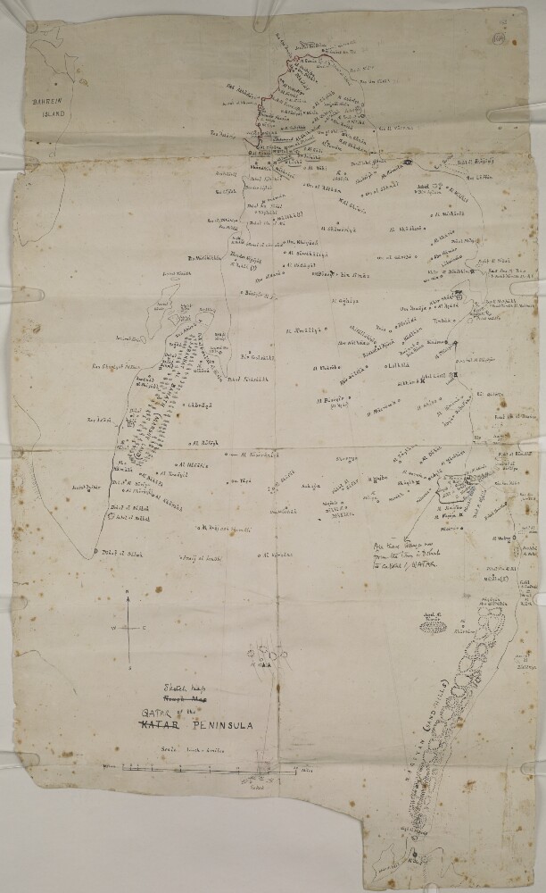
‘Rough Map of the KATAR PENINSULA’
38 of 175
‘SKETCH OF THE ISLAND OF KENN, In the Persian Gulf. Thos. Remon, Captn., Engineers’
39 of 175
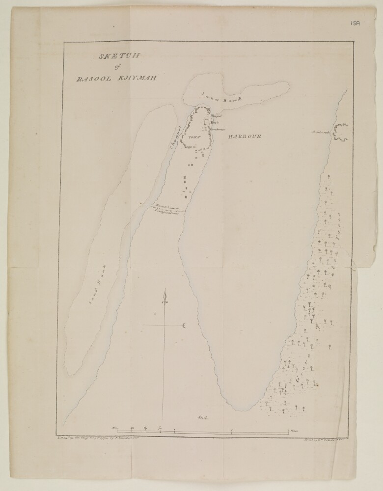
‘Sketch of Rasool Khymah’
40 of 175
'SKETCH MAP OF THE UNSURVEYED QATAR PENINA FROM THE BEST AVAILABLE AUTHORITIES SHOWING THE DISPUTED BOUNDARY'
41 of 175
‘Sketch map of Qatar Peninsula’
42 of 175
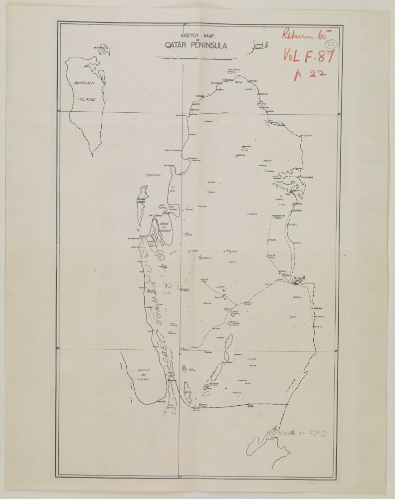
‘Sketch map of Qatar Peninsula’
43 of 175
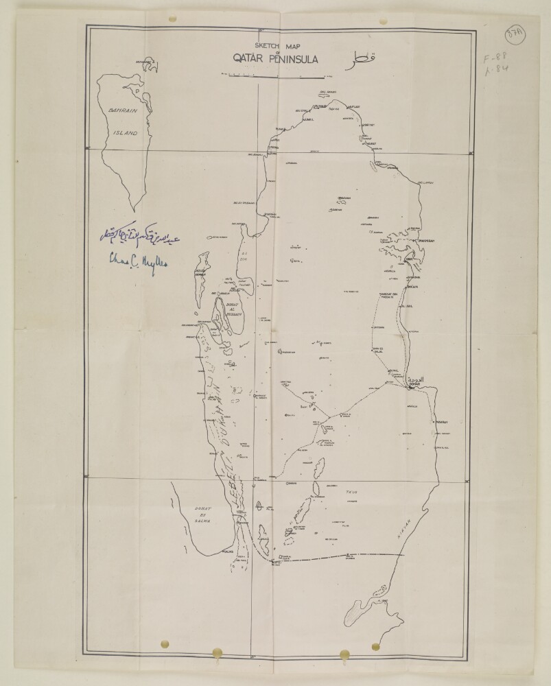
‘Sketch map of Qatar Peninsula’
44 of 175
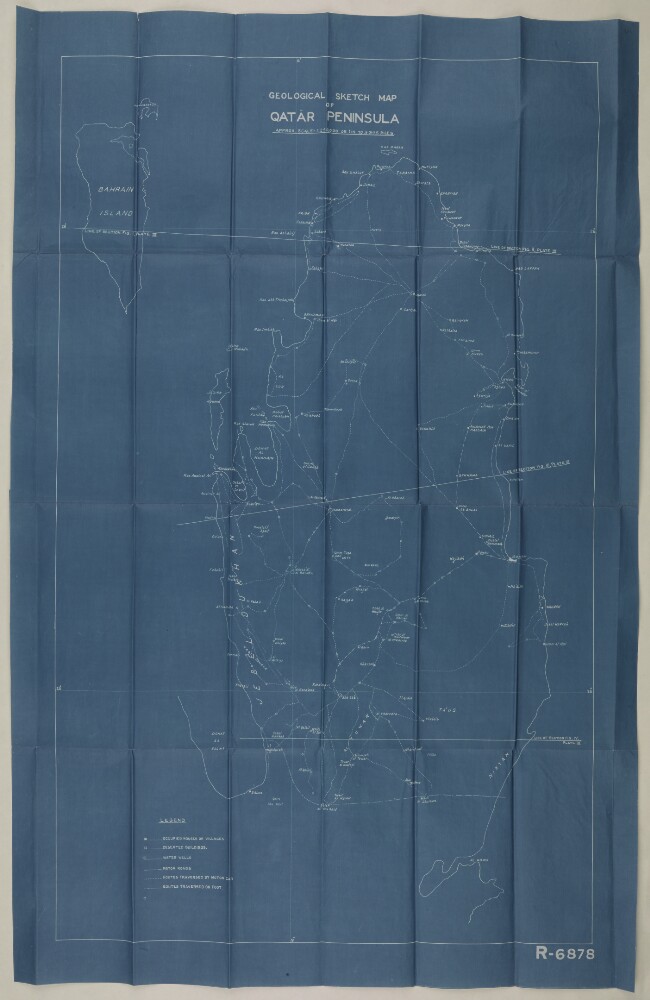
‘Geological Sketch map of Qatar Peninsula’
45 of 175
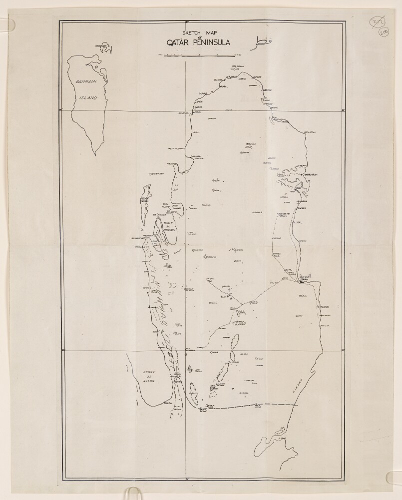
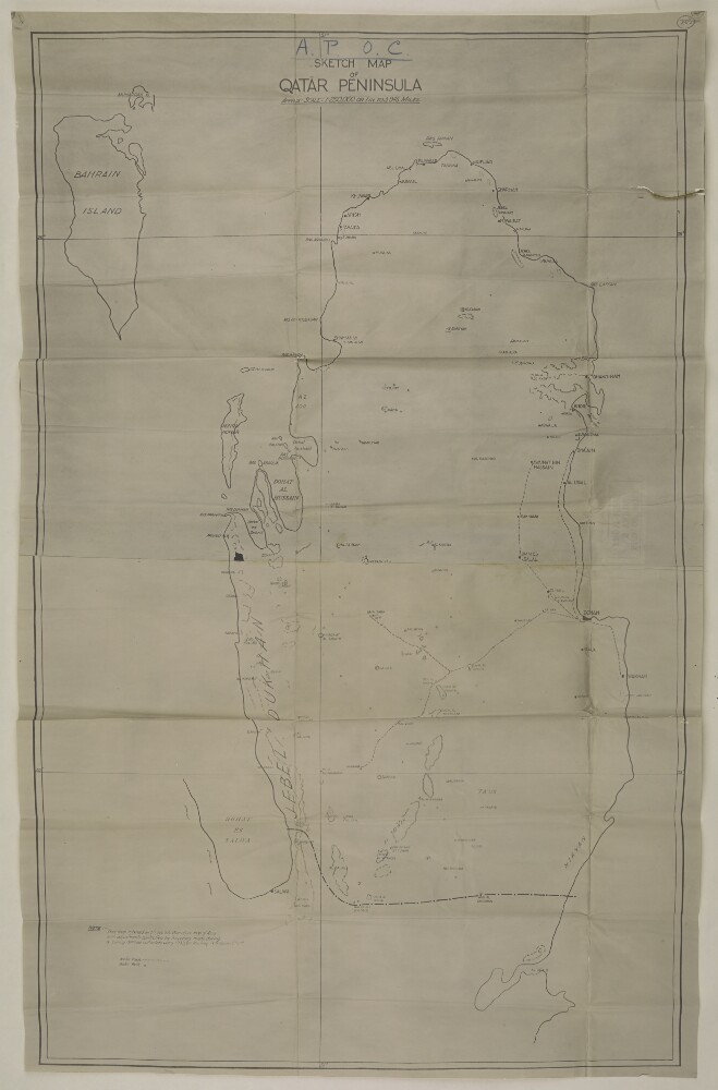
‘Sketch map of Qatar Peninsula’
46 of 175
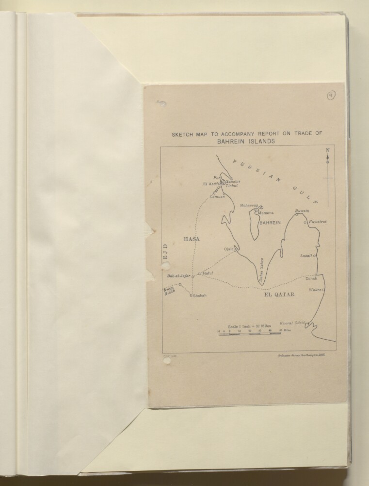
'SKETCH MAP TO ACCOMPANY REPORT ON TRADE OF BAHREIN ISLANDS'
47 of 175
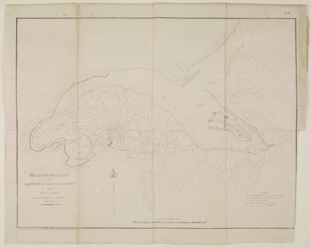
‘TRIGONOMERTICAL PLAN of the HARBOUR OF GRANE OR KOWEIT in the GULF OF PERSIA. By Lieutts. J.M. Guy and G.B. Brucks, H.E.I.C. Marine’
48 of 175
« Previous
Next »
1
2
3
4
Current Page, Page 4
5
6
7
8
…
14
15