1 entry found
Number of results to display per page
Search Results
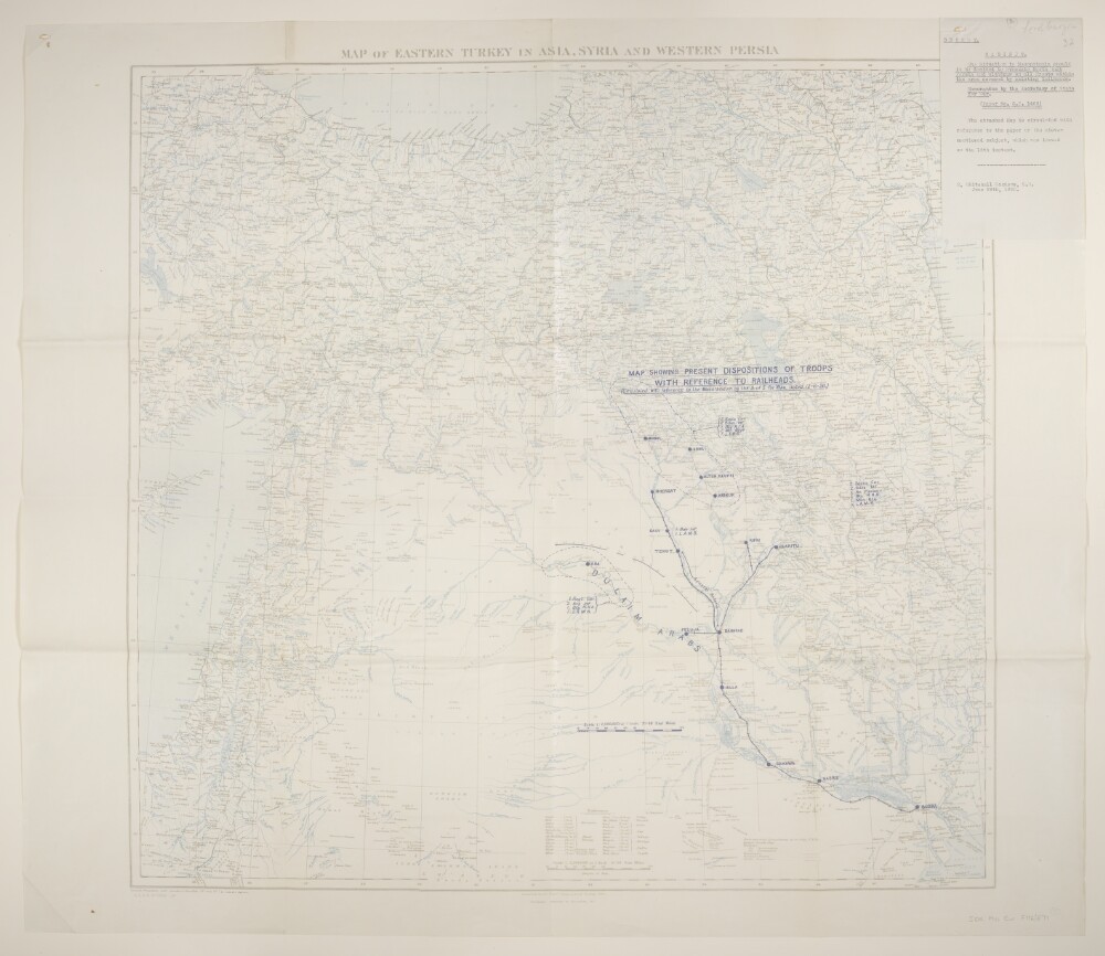
1. 'Map of Eastern Turkey in Asia, Syria and Western Persia. Map Showing Present Disposition of Troops With Reference to Railheads.'
- Description:
- Abstract: Folio 8:Geographical Section, General Staff No. 2901, comprising a base map with overprint.The base map bears the imprint 'Published by the Royal Geographical Society, 1910. Railways inserted to November, 1917' and portrays hydrology, relief by spot heights, roads, telegraphs, settlements, place names and international boundaries. The sheets bear the printed note 'International Boundaries as in July, 1914'. A 1921 edition of this base map is at Maps 46970.(44.) and includes accompanying notes (including compilation details) published by the Royal Geographical Society in 1910, although lacks a GSGS designation yet contains an additional red plate (railways) and grey plate (hachures and ancient canals) that are both lacking from this version.An overprint in blue depicts the disposition of troops and bears the printed note 'Circulated with reference to the Memorandum by the S[ecretary]. of S[tate]. for War. Dated 12-6-20.' Also portrays the railway system from Busra [Basra] to Baghdad and thence to Feluja [Al Fallūjah], Shergat [Ash Sharqāţ], Kifri and Quaritu; railways are absent from the rest of the sheet.Folio 8a:Classified 'Secret'.An attached folio (typescript, with manuscript additions in pencil; 192 x 122mm) dated 29 June 1920 reads:'Secret. Cabinet. The Situation in Mesopotamia should it be decided to evacuate North West Persia [Iran] and withdraw on all Fronts within the area covered by existing Railheads. Memorandum by the Secretary of State for War. (Paper No. C.P. 1469). The attached Map is circulated with reference to the paper on the above-mentioned subject, which was issued on the 15th instant.'Physical description: Materials: Printed in colourDimensions: 701 x 728mm, on sheet 792 x 915mm