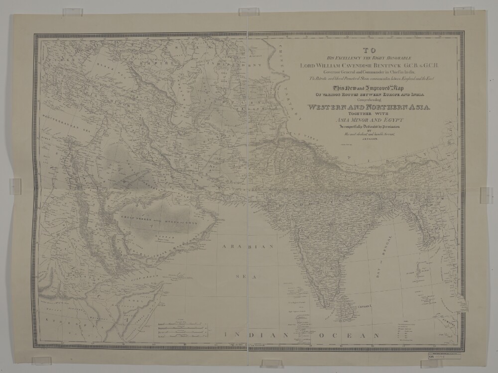
1. ‘New and Improved Map OF VARIOUS ROUTES BETWEEN EUROPE AND INDIA Comprehending WESTERN AND NORTHERN ASIA, TOGETHER WITH ASIA MINOR AND EGYPT BY J.B. TASSIN’ Date: 1834/1834 Language: English Geographic region: AfricaAsiaEurope
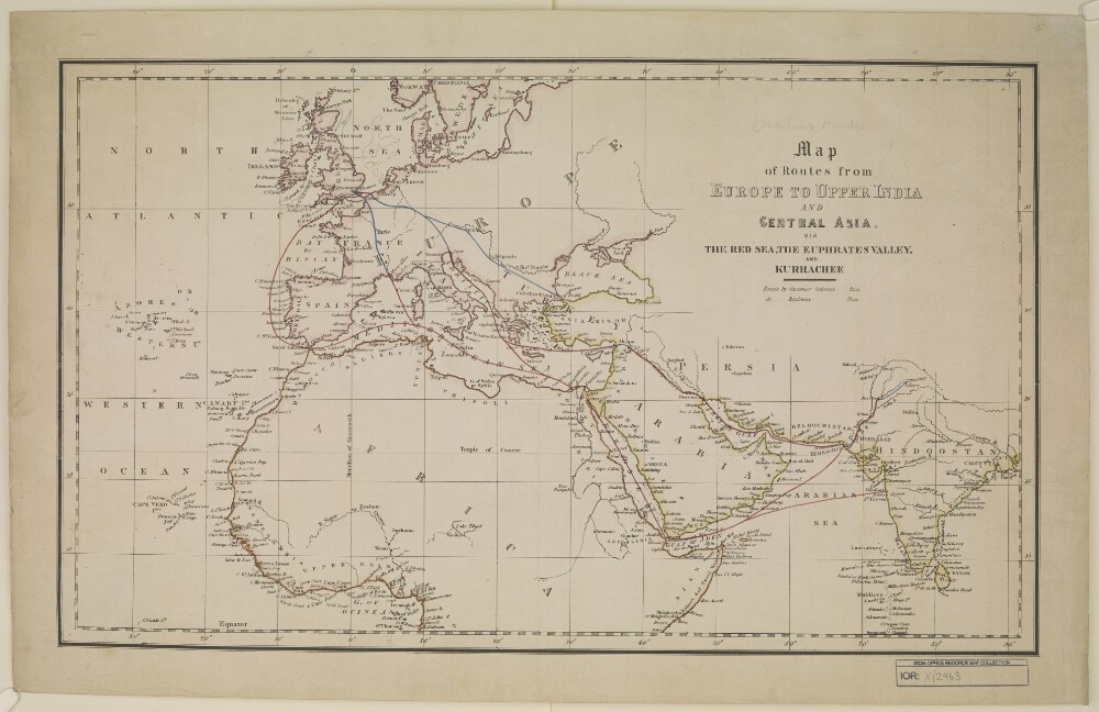
2. 'Map of routes from Europe to Upper India and Central Asia via Red Sea, the Euphrates Valley, and Kurrachee’ Date: 1845/1855 Language: English Geographic region: EuropeAfricaAsia
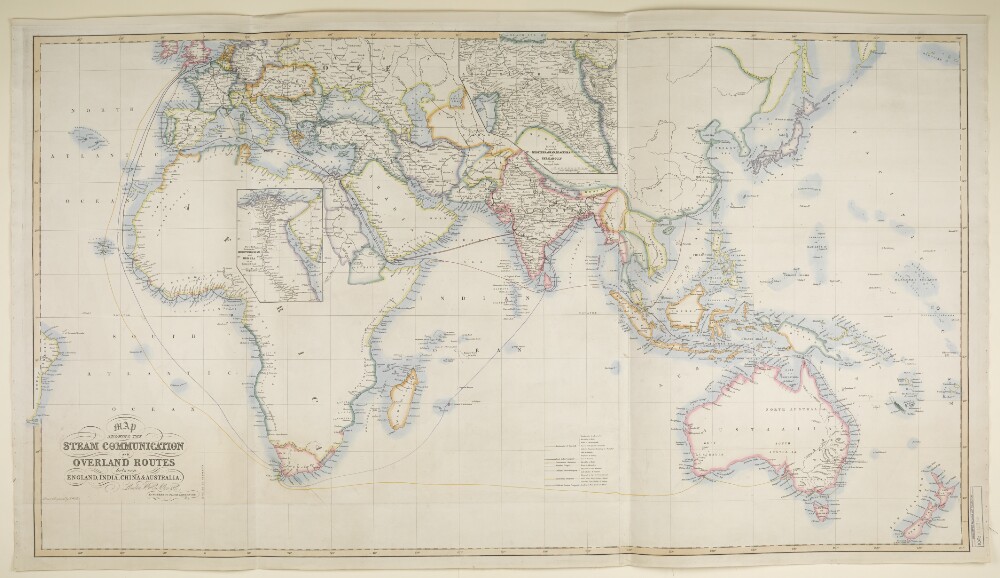
3. ‘MAP SHOWING THE STEAM COMMUNICATION AND OVERLAND ROUTES between ENGLAND, INDIA, CHINA & AUSTRALIA. Drawn & Engraved by J. Walker’ Date: 1853/1853 Language: English Geographic region: EuropeAsiaAfricaAustralia
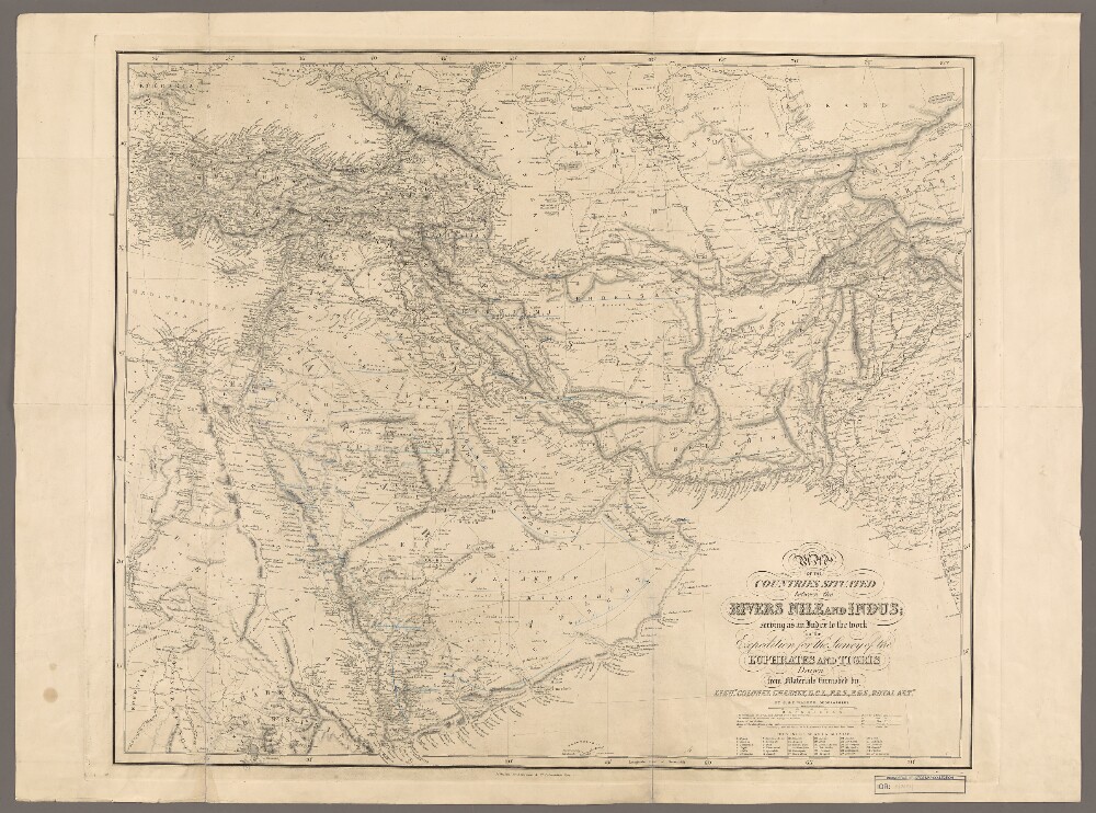
4. 'Map of the Countries Situated between the Rivers Nile and Indus Serving as an Index to the Work on the Expedition for the Survey of the Euphrates and Tigris' Date: 1850/1850 Language: English Geographic region: AsiaIndus RiverNile River
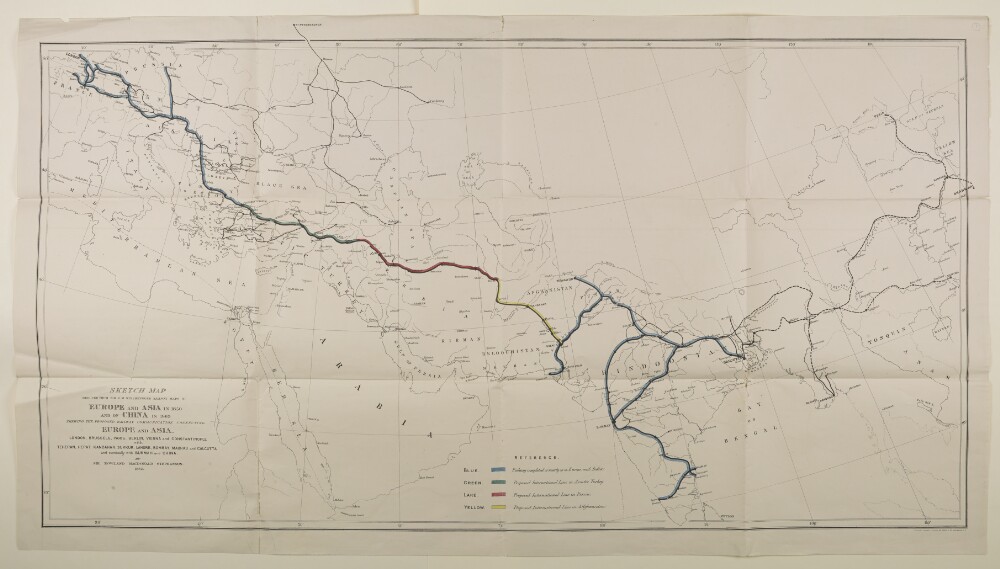
5. ‘Sketch map reduced from Sir R.M. Stephenson’s Railway map of Europe and Asia in 1850 and of China in 1863 Shewing the Proposed Railway Communication Connecting Europe and Asia. By Sir Rowland Macdonald Stephenson. 1882’ Date: 1882/1882 Language: English Geographic region: EuropeAsia
6. Magnae Tartariae, magni Mogolis Imperii, Iaponiae et Chinae Creator: Wit, Frederik deWitsen, Nicolaas Language: Latin Geographic region: AmstelodamiAsia Extent: 1 map : hand col. ; 41 x 52 cm.
7. Regnum Persicum Imperium Turcicum in Asia Russorum Provinciae ad Mare Caspium Language: Latin Geographic region: AmstelaedamMiddle EastAsiaAsia, CentralCaucasusTurkey Extent: 1 map : col. ; 48 X 83 cm.
8. Chorasmiae et MawaralnahraeTaqwīm al-buldān. Latin & Arabic Creator: Abū al-Fidāʼ Ismāʻīl ibn ʻAlīGreaves, Johnابو الفداء اسماعيل بن علي، Language: LatinArabic Geographic region: LondiniAsiaEngland
9. Coll 5/84(4A) ‘Eastern Summaries from Ministry of Civil Aviation’ Creator: Author: Ministry of Civil Aviation Date: 1947/1947 Language: English Geographic region: Asia