« Previous |
1 - 12 of 49
|
Next »
Number of results to display per page
Search Results
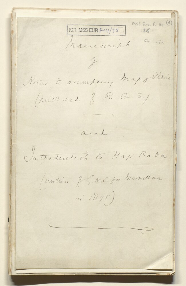
1. '(Manuscript of Notes to accompany Map of Persia (published by R.G.S) and the introduction to Haji Baba written by G.N.C. for Macmillan in 1895)'
- Description:
- Abstract: This file is comprised of the correspondence and notes relating to two manuscripts by George Nathaniel Curzon. Firstly, 'Notes to accompany Map of Persia' (Published by the Royal Geographical Society), and secondly, the notes for Curzon's introduction to an edition published by Macmillan of 'The Adventures Haji Baba of Ispahan' by James Morier. In particular there is correspondence with the Macmillan publishers.The file consists of:The handwritten 'Notes to accompany the Map of Persia' (ff 1-11)The printed journal article (ff 12-14)A handwritten index to maps and plans (ff 16-21). This is divided into A) general maps i. Persia ii. Afghanistan. iii. Baluchistan. And B) Divisional maps. i Persia ii. Afghanistan iii. Baluchistan. These categories are all organised into five columns: title of map; author; number of sheets; scale of miles to inch; place and date of publication.Headed notelets (ff 28-30) from 'Kedleston, Derby' with Curzon's notes on Haji BabaCorrespondence between George Augustin Macmillan and George Nathaniel CurzonA flyer (ff 37-38) from Macmillan and Co for 'Illustrated Standard Novels' including a specimen illustrationNotes (ff 39-72) for Curzon's introduction to the account of Haji Baba.Physical description: Foliation: the main foliation sequence (used for referencing) commences at the front cover with 1, and terminates at the inside back cover with 72; these numbers are written in pencil, are circled, and are located in the top right corner of the recto side of each folio. Two additional foliation sequences are also present in parallel between ff 4-11, and ff 48-74; these numbers are also written in pencil, but are not circled.
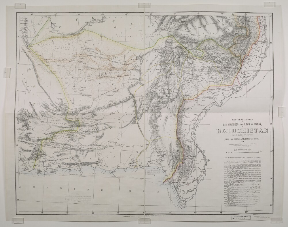
2. ‘THE TERRITORIES OF HIS HIGHNESS THE KHAN OF KELAT, OR BALUCHISTAN WITH THE ADJACENT PORTIONS OF SIND, THE PUNJAB, AFGHANISTAN AND PERSIA. 1876’
- Description:
- Abstract: Imprint:Published under the direction of Major-General H.L. Thuillier, C.S.I.-F.R.S., Surveyor General of India, Surveyor General’s Office, Calcutta. December 1877. Photozincographed under the Superintendence of Capt.n. J. Waterhouse.Edition statement:‘Compiled from the most authentic materials available in the Office of the Surveyor General of India, Calcuta, May 1876. With Corrections to November 1877’.Distinctive Features:Relief shown by shading. Boundaries coloured for reference with a key at the bottom left. Routes of various expeditions shown with names of explorers and dates of their journeys given. Notations on topographic features inserted on the map. Shows Telegraph Cable laid in 1864, Indus Valley State Railway, and Sind Punjab and Delhi Railway lines. Includes ‘List of Authorities Consulted in the Compilation of this map’.Inscriptions:In the lower centre above imprint, black faded ink: ‘A.A. 28-10’.Physical description: Dimensions:779 x 1050 mm, on sheet 860 x 1108 mm
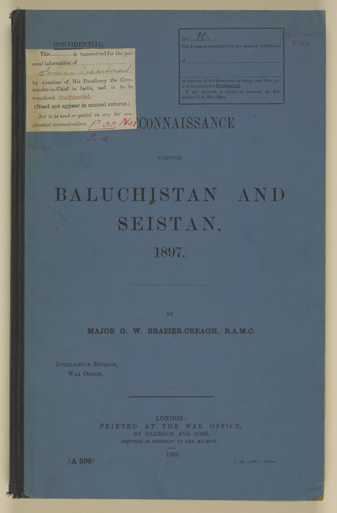
3. 'Reconaissance through Baluchistan and Seistan, 1897'
- Description:
- Abstract: This volume is a confidential report, printed at the War Office, by Harrison and Sons, printers in ordinary to Her Majesty, in 1899, and authored by Major George Washington Brazier-Creagh, Intelligence Division, War Office, concerning the resources, administration and general affairs in Baluchistan and Seistan [Sīstān] following his political mission in 1897. The report contains an introduction by the author, (folio 4), dated 5 December 1898, in which he mentions that details from the report are being incorporated into the Baluchistan Gazetteer and Route books. He also pays tribute to Colonel Bell and Captain Henry Dundas Napier who preceded him, as well as Captain Arthur Henry McMahon and George Passman Tate. The text of the report is accompanied by footnotes and section headings appear in the left and right hand margins.The report includes a table of contents on folio 5 with the following five chapters:'Chapter I. General Account of Journey across the Baluchistan Desert' (folios6-8), including details of incidents en route, future trade prospects, danger threatening commerical prospects, and a list of leading merchants in Seistan;Chapter II. Russian Designs and Political Consideration' (folios 8v-10), includsing details of future policy, approaches to Seistan, alternative routes, influential Sardars of Seistan, treatment of refugees by the British Government, and the feeling of the people;'Chapter III. Resources and Population of Seistan' (folios 11-24), including details of administration, fertile places, a list of villages, climate, seasons and winds, sanitation, population, transport (camels, donkeys and horses), windmills, agriculture, industries and trade, Camel Corps, sport and shooting, locusts, and fish;'Chapter IV. Exploration of the District in the West and South' (folio 25), including details of crossing the Dasht-i-Shelag, pollution of wells, character of country, routes, and pilgrimage;'Chapter V. Land System - Revenue and Productions &c' (folios 26-29), including details of ijaras [ ijārah], tenant rights and responsibilities, hardship of tenants, collection of revenue, culturable area, annual yield, surplus grain, irregularity and delayed water supply, and ancient ruins.There is a list of nine appendices (folio 5v) as follows:'A.- Geneaological tables of Sarbandi, Kayani, and Naroi tribes' (folios 30-31);'B.- List of Taoki tribes in Seistan' (folio 31v);'C.- Average temperature of each camp', April to November 1897 (folios 32-35);'D.- Aneroid readings', April to November 1897 (folios 36-39);'E.- List of wells and springs', with serial numbers corresponding to 'Map No. II' (folio 39v);'F.- List of villages', with serial numbers corresponding to 'Map No. II' (folios 40-41);'G.- Table of meteorological observations, Baluchistan' (folios 41v-43);'H.- Table of meteorological observations, Seistan' (folios 44-50);'I.- Table of meteorological observations, Neh and Birjand Districts' (folios 50v-51).The file also includes five maps and sketches, store in a pocket (folio 58). They are listed on folio 5v as follows:'No. 1. Baluchistan and Seistan' (folio 53);'No. 2. Seistan' (folio 54);'No. 3. Route plan of Robat Nala' (folio 55);'No. 4. Waterways of the Helmund [Helmand] Delta' (folio 56);’No. 5. Nasratabad [Naṣratābād] Fort' (folio 57).Physical description: Foliation: The foliation sequence commences at the front cover, and terminates at the inside back cover; these numbers are written in pencil, are circled, and are located in the top right corner of the recto side of each folio.Pagination: The volume also contains an original printed pagination sequence.

4. 'Boundary between Persia and North-West Baluchistan'
- Description:
- Abstract: Two documents exist within these folios, one of which was written by Hermann Anderson Haines, Assistant, Public Works Department, on 19 September 1893, and the next by Captain Frederick Weston Peile MacDonald on 15 August 1893. The first document by Haines explains the history leading up to the boundary dispute between Persia and Baluchistan over the ownership of Mekran and the actions that have been taken by each party. It also focuses on the original documents, drawn up by Major-General Sir Frederic John Goldsmid, which marked the boundary. Haines closes the document by stating the necessity of speedy delimitation. The second document by MacDonald focuses mainly upon the benefits of quickly arranging a settlement over the boundary as he believes that it shows the support of the British for the people of Mekran and also provides a countermove against recent Russian involvement in the region.Physical description: Foliation: the foliation sequence for this description commences at f 23, and terminates at f 31, as it is part of a larger physical volume; these numbers are written in pencil, are circled, and are located in the top right corner of the recto side of each folio.
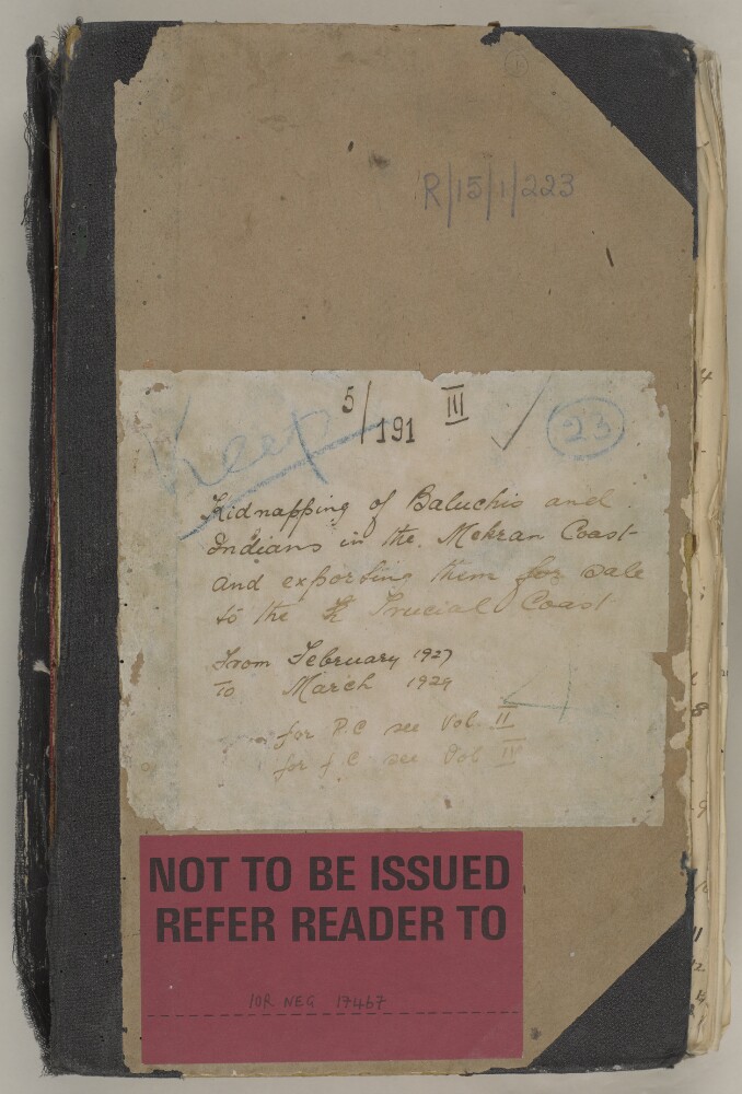
5. 'File 5/191 III Individual slavery cases'
- Description:
- Abstract: Twenty cases relating to individuals and small groups, kidnapped or transported from Baluchistan or India, to the Trucial Coast, in particular Dubai. Some of the cases are straightforward and involve the appearance or retrieval of slaves in the Dubai area, often initiated by the Sharjah Residency Agent ('Isa bin 'Abd al-Latif) and their manumission, plans for repatriation, and punishment of traders/kidnappers, where they are identified. Other cases are more complex, where the identification of slaves, their parents, or those who traded them, is more difficult. Of particular note in the volume:Subject 8, relating to a young Persian boy kidnapped from Sind and brought to Dubai, which stretches over 100 folios. Difficulties are encountered in obtaining a photograph of the boy for purposes of identification. The extensive correspondence in the case is in part also cause by obstructions and procrastinations of al-Latif. Subject 16, relating to two Baluchi men kidnapped by Bedouins in the interior of the Trucial coast. The case reveals tensions between the coastal Sheikhs of the Trucial region, and the Bedouin chiefs of the interior. Questions over the control how much control Sheikhs, who have signed treaties with the British, have over actions of Bedouins from the interior. Subject 20, account of the capture of a dhow carrying slaves at Dubai, and the burning of the dhow by the British navy, off the Dubai coast.Physical description: Foliation: The volume is foliated with a circled number in the top right-hand corner of each front-facing page. Cover (containing cover title), blank front page and 2 blank rear pages are unnumbered. Each of the subjects into which the volume is divided has its own internal pagination system, expressed as page number xof subject number y.
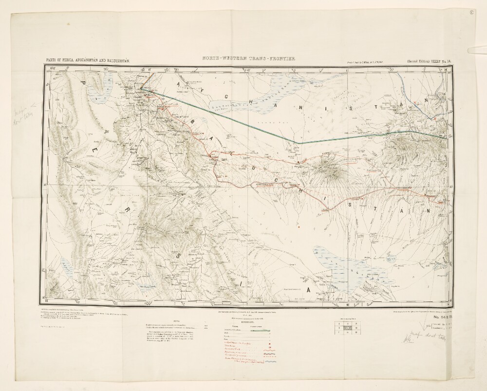
6. 'NORTH-WESTERN TRANS-FRONTIER'
- Description:
- Abstract: Map showing parts of Persia [Iran], Afghanistan and Baluchistan. Produced and published by the Survey of India, the map is the second edition of a map that was first compiled in 1897. The map indicates boundaries, wells, springs, and lakes, as well as hills and mountains. Additional lines have been added in crayon to emphasize existing boundary lines, as well as to show settlements, routes and roads. First published in March 1900, and republished with a corrected boundary in October 1902.Physical description: Materials: Printed in coloured ink with manuscript annotations in pencil and crayonDimensions: 464 x 800mm, on sheet 711 x 891mm
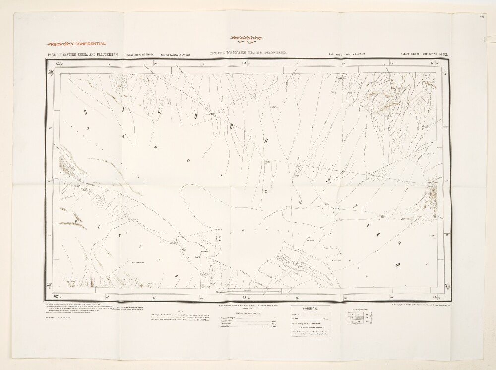
7. 'NORTH WESTERN TRANS-FRONTIER'
- Description:
- Abstract: Map showing parts of eastern Persia [Iran] and Baluchistan. Produced and published by the Survey of India, this is the third edition of the map, following on from the second edition, which was compiled in 1894. The map indicates boundaries and hydrology, and provides some indication of relief.Physical description: Materials: Printed in ink on paperDimensions: 497 x 828mm, on sheet 710 x 961mm
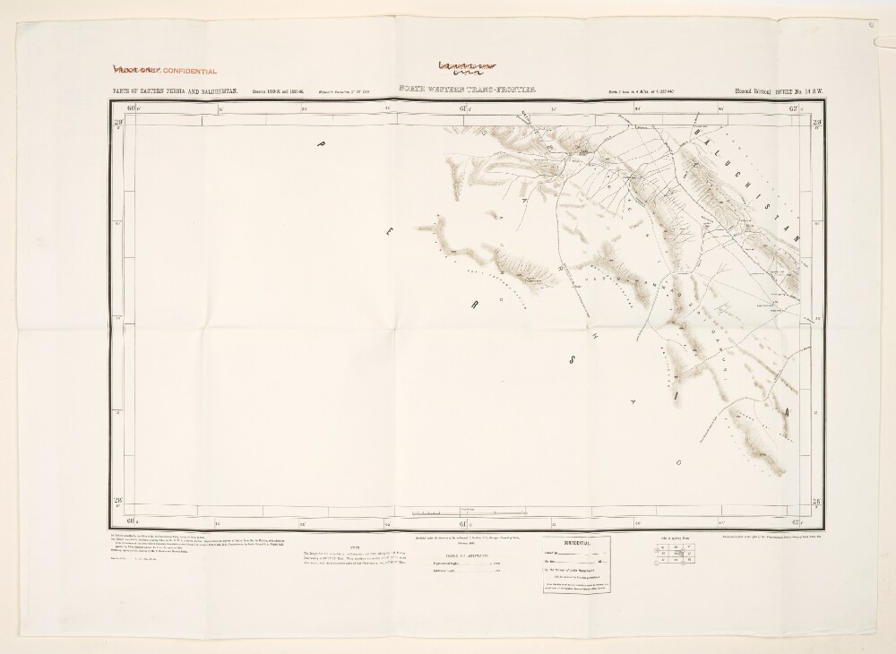
8. 'NORTH WESTERN TRANS-FRONTIER'
- Description:
- Abstract: Map showing parts of eastern Persia [Iran] and Baluchistan. Produced and published by the Survey of India, this is the second edition of a map that was first compiled in 1892.The map indicates boundaries, settlements, and hydrology, and provides some indication of relief.Physical description: Materials: Printed in ink on paperDimensions: 494 x 823mm, on sheet 711 x 984mm

9. 'Persian Baluchistan (including the Sarhad and Persian Mekran) The Quetta-Nushki extension railway'
- Description:
- Abstract: The memorandum is concerned with Persian Baluchistan, specifically focusing on Mekran [Makran] and Sarhad, which are regarded as being of particular geopolitical interest to Britain's Indian Empire. It includes a brief description of these regions, outlines local British activities during the First World War to counter threats to their interests, and presents the current situation in Mekran and Sarhad. It also outlines proposals put forward by the Government of India in 1917 for reorganising the administration of Persian Baluchistan, with a view to protecting Britain's Indian Frontier and telegraph lines through Persia. This includes an explanation of objections put forward by the Foreign Office to these proposals.The rest of the memorandum is dedicated to the Quetta-Nushki railway extension to Duzdap [Zāhedān]; it is considering a proposal for the destruction of this extension. To this end, it includes a short history of its construction, examines the economic and political advantages of the line, and considers the possibility of a further extension of the line into Seistan [Sīstān].Physical description: Foliation: the foliation sequence commences at the first folio with 1 and terminates at the last folio with 17; these numbers are written in pencil, are circled, and are located in the top right corner of the recto side of each folio.
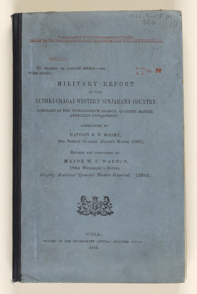
10. 'Military Report of the Nushki-Chagai-Western Sinjarani Country'
- Description:
- Abstract: A report, marked as secret, on the area of Nushki, Chagai, and Western Sinjarani. The report was compiled in the Intelligence Branch, Quarter Master General's Department. The report was commenced in 1897 by Captain R E Roome, 6th Bombay Cavalry (Jacob's Horse), and revised and completed by Major W C Walton, 104th Wellesley's Rifles, Deputy Assistant Quarter Master General in 1903. It was printed at the Government Central Printing Office, Simla, in 1904.The report includes a preface by Colonel John E Nixon, Assistant Quarter Master General, Intelligence Branch (folio 5) and a glossary of vernacular terms used (folio 6). The main body of the report contains chapters on geography, communications, fortified posts and forts, climate, sanitation, resources, ethnography, history, administration, and military strength.The second part of the report includes a gazetteer of topographical and ethnographic information (folios 36-127) and appendices covering wells, canals, and meteorology, and including a report on the signalling stations of the Dalbandin-Robat line, with sketches (folios 131-147).The volume includes the following maps:Map of Southern Baluchistan (folio 2)Sketch Map of Signalling Line from Dalbandin to Robat (folio 148)Map of Persian Seistan [Sistan] Cultivated Area (folio 149).Physical description: Foliation: the foliation sequence (used for referencing) commences at the front cover with 1, and terminates at the inside back cover with 149; these numbers are written in pencil, are circled, and are located in the top right corner of the recto side of each folio.
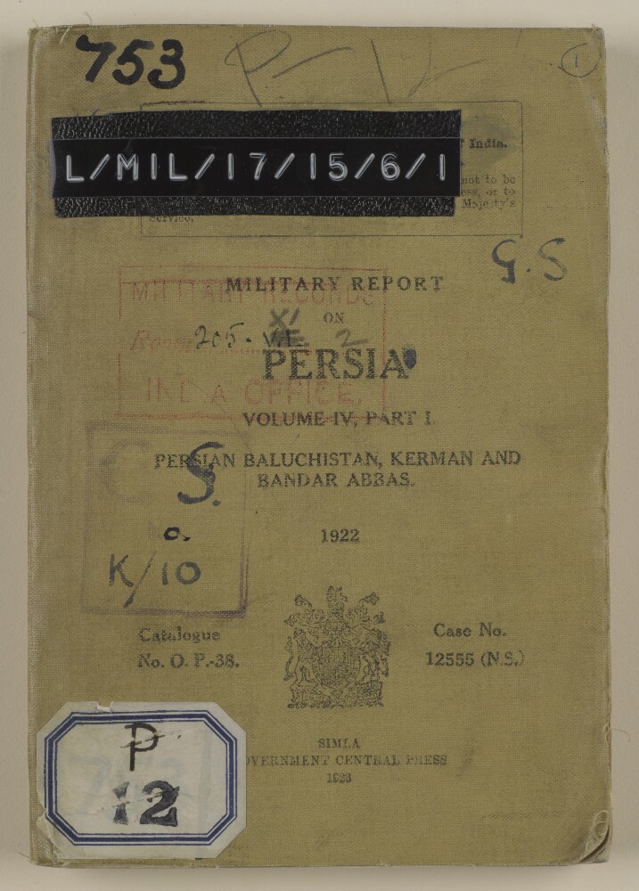
11. 'MILITARY REPORT ON PERSIA. VOLUME IV, PART I.'
- Description:
- Abstract: The volume is entitled Military Report on Persia. Volume IV Part I. Persian Baluchistan, Kerman and Bandar Abbas.(Simla, Government Central Press, 1923). The volume was originally published in 1921.The report contains sections on history, geography, population, climate and health, resources, military affairs, communications, and political matters. Appendices give the following information: details of nomad tribes of Kerman Province; a list of Chiefs and Headmen in Persian Baluchistan, who are in receipt of subsidies from the Indo-European Telegraph Department (IETD); statistics of natural resources; and distribution statement of the Sarhad Levy Corps on 1 July 1922. There are also seven maps (folios 75-81), entitled:Map accompanying Military Report on Persia Vol. IV Part I.Kerman and environsBandar AbbasDiagram of Mirjawa station yardDiagram of Duzdap station yardSignalling and heliograph posts between Chahbar and GehSketch Map shewing communications between Kerman and SaidabadPhysical description: Foliation: the foliation sequence for this description commences at the front cover with 1, and terminates at the inside back cover with 82; these numbers are written in pencil, are circled, and are located in the top right corner of the recto side of each folio. Pagination: the volume also contains an original printed pagination sequence.
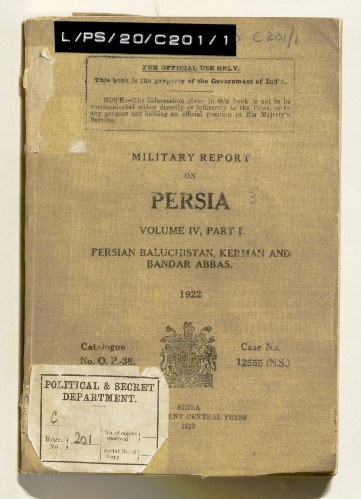
12. ‘Military report on Persia. Vol IV, part I. Persian Baluchistan, Kerman and Bandar Abbas.’
- Description:
- Abstract: Military report on Persia (volume IV, part I, covering Persian Baluchistan, Kermān and Bandar Abbas [Bandar-e ʻAbbās]), dated 1922, and published by the Central Government Press at Simla in 1923. The report’s chapters cover:History, including: Persia’s recent political history; a recent history of Persian Baluchistan, and military operations in Persia Baluchistan, notably the operations at Dizak in 1901-02, operations against maritime arms trafficking in 1909, an expedition against Makrān in 1911 to check arms trafficking, and operations against the Dāmānīs in East Persia in 1916, to protect British interests in Persia; b) a brief history of Kermān; and c) a brief history of Bandar-e ʻAbbās.Geographyfor Persian Baluchistan; Kermān; and Bandar-e ʻAbbās, with headings for boundaries, administrative districts, and the principal villages for each region, as well as sections on rivers, lakes, mountains, harbours and deserts as appropriate. The section on Bandar-e ʻAbbās includes a description of buildings, water supply, camping grounds, roads and local industry. There are also descriptions of the principal islands off the Persian Baluchistan coast: Qishm [Qeshm], Henjam [Hengam] and Hormuz.Ethnography, including: general characteristics; notes for intelligence officers; sections on the population and tribes of Persian Baluchistan, Kermān Bandar-e ʻAbbās.Climate and Health, including details of medical facilities.Resources, including: transport (camels, mules, donkeys, horse and oxen); and supplies, chiefly of agricultural crops, by region and village.Military, including: British garrisons and South Persia Rifles; the Persian Army; the fighting strength of the Persian tribes, organised by region and village; military notes on Persian Baluchistan, including the arms traffic in the Persian Gulf.Communications, including: the railway line between Mirjāwā [Mīrjāveh] and Duzdāp, its facilities (water, rolling stock, telegraph), and risks of damage to the line; other proposed lines between Bandar-e ʻAbbās and Kermān, and Gwadar and Kermān; cable, wireless, telephone lines, and visual signalling stations.Political, including an outline of administration in Persian Baluchistan, Kermān and Bandar-e ʻAbbās, and information on currency, weights and measures.Appendix A is a list of the nomadic tribes of the Kermān province, listed by district and the number of families in each tribe. Appendix B is a list of the annual subsidies paid to chiefs in Persian Baluchistan by the Indo-European Telegraph Department, for the protection of lines passing through their district. Appendix C is a table of resources (livestock, agricultural produce), with figures indicating the requirements for local consumption in each district. Appendix D is a distribution statement of the Sarhad Levy Corps as of 1 July 1922.The maps and plans include: a map of Persian Baluchistan (folio 78); a map of Kerman and its environs (folio 77); a diagram of the Mīrjāveh station yard (folio 74); a diagram of Duzdāp station yard (folio 76); a sketch map showing signalling and heliograph posts between Chahbar and Geh (folio 75); and a sketch map showing communications between Kerman and Saidabad (folio 79).Physical description: Pagination: The report has a printed pagination sequence. Page numbers appear at the top and centre of each page.Foliation: There is a foliation sequence, which is circled in pencil, in the top-right corner of the recto of each folio. It begins on the first folio with text, on number 1, and ends on the last of the various maps and plans that are inserted at the back of the volume, on number 79. Total number of folios: 79. Total including covers and flysheets: 81. Note that the foliation sequence on the maps and plans does not follow the order that the maps and plans are listed on the volume’s contents page (f.2). The plan of Bandar Abbās, listed on the report contents page, is missing from the volume.