« Previous |
1 - 12 of 15
|
Next »
Number of results to display per page
Search Results
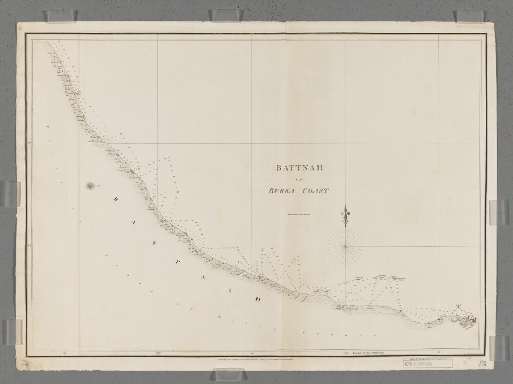
1. 'Battnah or Burka Coast'
- Description:
- Abstract: Covers a 200-mile length of the Battnah [Al Batinah, Oman] coast west of Muscat on the Gulf of Oman. Includes a hinterland of approximately five miles.Portrays hydrology, including depths by soundings, prominent relief by hachures, vegetation, settlements, forts and place names, and includes topographical notes.Engraved by Richard Bateman. Published by James Horsburgh, Hydrographer to the Honourable East India Company.Physical description: Materials: Printed on paperDimensions: 494 x 712mm, on sheet 559 x 769mm
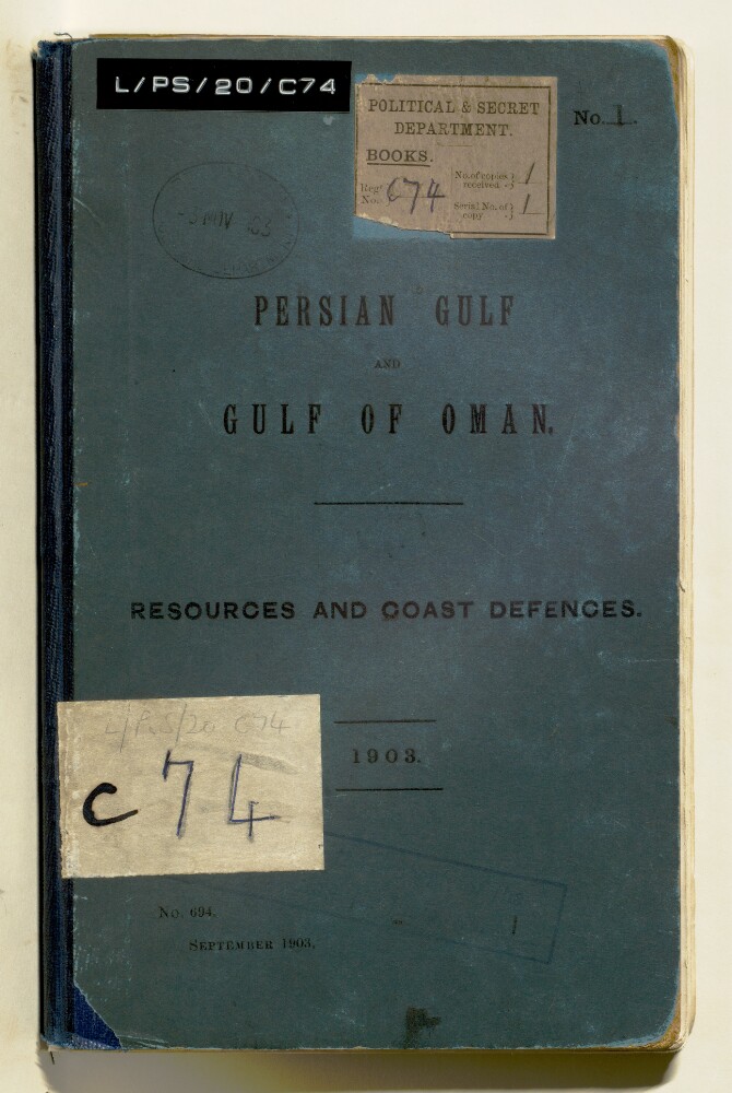
2. 'PERSIAN GULF AND GULF OF OMAN. RESOURCES AND COAST DEFENCES.'
- Description:
- Abstract: Printed report published by the Intelligence Department of the Admiralty, 1903. The report includes advice on collecting information on defences such as defended areas, minefields, ordnance, under-water defences. Much of the information was extracted from the Persian Gulf Report, 1898.There are details on Muscat; Mussandam Promontory; Khor Kawi [Khawr al Quway‘], Elphinstone Inlet [Khawr ash Shamm], Khasab; Pirate Coast; Bahrain; Kuwait; Fao [Al Fāw]; Basra; Bushire; Lingah; Bundar Abbas [Bandar Abbas].Also included is an 'Official statement of British Policy with regard to (1) the proposed Baghdad Railway; and (2) Persia and the Persian Gulf generally' given in the House of Lords, May 5, 1903.Maps include: rough sketch of operations in the vicinity and Bushire from the 3rd to the 10th February 1857 (Reproduced from Outram's Persian Campaign 1857); sketch of the attack on the batteries of Mohumra [Khorramshahr]: combined naval and military forces under command of Sir James Outram; sketch of the ground in the neighbourhood of Ahwaz [Ahvāz] on the Karun [Kārūn], showing the position occupied by the Persian Army, and the advance of the British detachment upon the town, March 1857. At the back of the report there is a large fold-out map: General Outline Map of the Persian Gulf showing Submarine Cables and the Principal Places mentioned in the Report.Physical description: Foliation: There is a foliation sequence, which is circled in pencil, in the top right corner of the recto of each folio. It begins on the front cover, on number 1, and ends on a map that is stored in a sleeve at the back of the volume, on number 57.

3. 'PERSIAN GULF AND GULF OF OMAN. RESOURCES AND COAST DEFENCES. 1903.'
- Description:
- Abstract: The file contains a printed report published by the 'Admiralty, Intelligence Department (No. 694). September 1903.', providing a compilation of available information of naval, military and political value about various locations in the Persian Gulf and the Gulf of Oman. Places described include Muscat, Mussandam Promontory, Khor Kawi [Khawr al Quway‘], Elphinstone Inlet [Khawr ash Shamm], Khasab, Pirate Coast [Arabian Coast], Bahrain, Kuwait, Fao [Al Fāw], Basra, Mohammerah [Khorramshahr], Bushire, Lingah and Bundar Abbas [Bandar Abbas].Much of the information was extracted from the Persian Gulf Pilot, 1898. The report also includes an 'Official statement of British Policy with regard to (1) the proposed Baghdad Railway; and (2) Persia and the Persian Gulf generally' given in the House of Lords, 5 May 1903; and advice on collecting information on defences such as defended areas, minefields, ordnance and under-water defences.Two hand-stamps appear on the front cover and on folio 3, which read, 'War Office Library 27 Nov 1903', and, 'Mobilization and Intelligence Dept. 27 Nov 1903'.The volume contains seven maps.Physical description: Foliation: the foliation sequence commences at the front cover with 1, and terminates at the inside back cover with 57; these numbers are written in pencil, are circled, and are located in the top right corner of the recto side of each folio.Pagination: an original printed pagination sequence is present in parallel throughout.
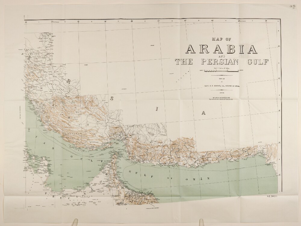
4. 'MAP OF ARABIA AND THE PERSIAN GULF'
- Description:
- Abstract: Map depicting the Persian Gulf and the Gulf of Oman, with the south-eastern edge of the Arabian Peninsula on one side and southern Persia [Iran] and south-western India [Pakistan] on the other. The map indicates hydrology, boundaries, settlements and routes, and provides some indication of relief in the form of hachures.Compiled by Captain F F Hunter, Indian Army, Survey of India in 1908. Reprinted with minor additions and corrections, 1930 (this copy is dated February 1932).Physical description: Materials: Printed in colour on paper.Dimensions: 600 x 865mm, on sheet 742 x 989mm.
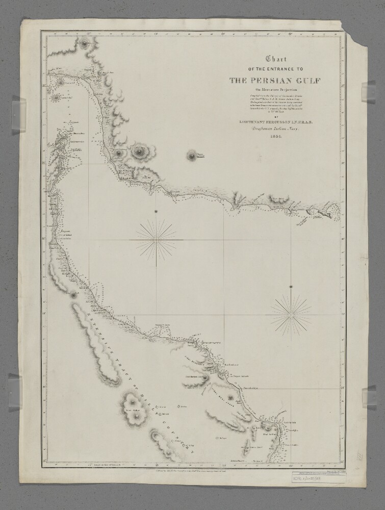
5. 'Chart of the Entrance to the Persian Gulf'
- Description:
- Abstract: Covers the eastern part of the Strait of Hormuz, the western part of the Gulf of Oman and the coastlines of southern Persia [Iran], northern Oman and the eastern side of the Musandam Peninsula, including a hinterland of approximately thirty miles. Portrays hydrology, including depths by soundings, sands and rocks, relief by hachures, rock drawing and occasional spot heights, vegetation, settlements, forts and place names, and includes topographical notes.Compiled by Lieutenant E F T Fergusson, Indian Navy from the surveys of Commander George Barnes Brucks and Lieutenants Stafford Bettesworth Haines and Albany Moore Grieve, Indian Navy, 1854. Engraved by J & C Walker. Published by John Walker, Geographer to the Honourable East India Company, 1857.Physical description: Materials: Printed on paperDimensions: 426 x 620mm, on sheet 678 x 508mm
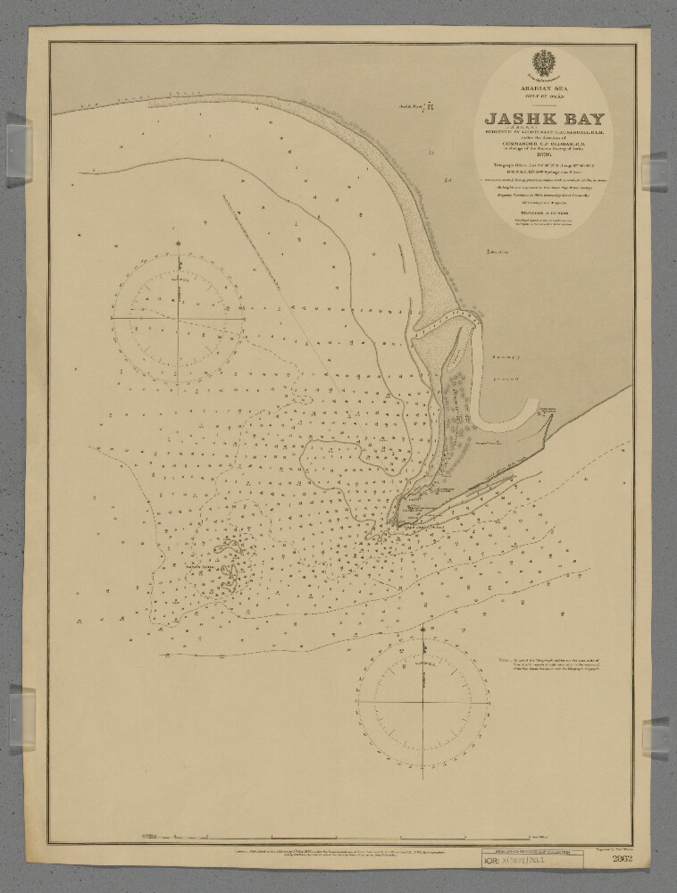
6. 'Jashk (Jashak) Bay'
- Description:
- Abstract: Chart 2862.Hydrographic chart covering the eastern half of Jashk Bay [Khalij-e Jask], Cape Jashk [Damagheh-ye Jashk] and Mason Shoal, Persia [Iran] in the Gulf of Oman. Portrays hydrology, including depths by soundings and contours, sands and rocks, anchorages, relief by spot heights, hachures and shading, vegetation, cultivation, settlements, public buildings, telegraph offices, forts and place names, and includes topographical notes and navigational aids, including beacons, and prominent landmarks.Surveyed by Lieutenant Charles James Cope Kendall, Royal Indian Marine, 1896. Engraved by Edward Weller. Published at the Admiralty, 1897.Physical description: Materials: Printed on paperDimensions: 628 x 457mm, on sheet 658 x 494mm
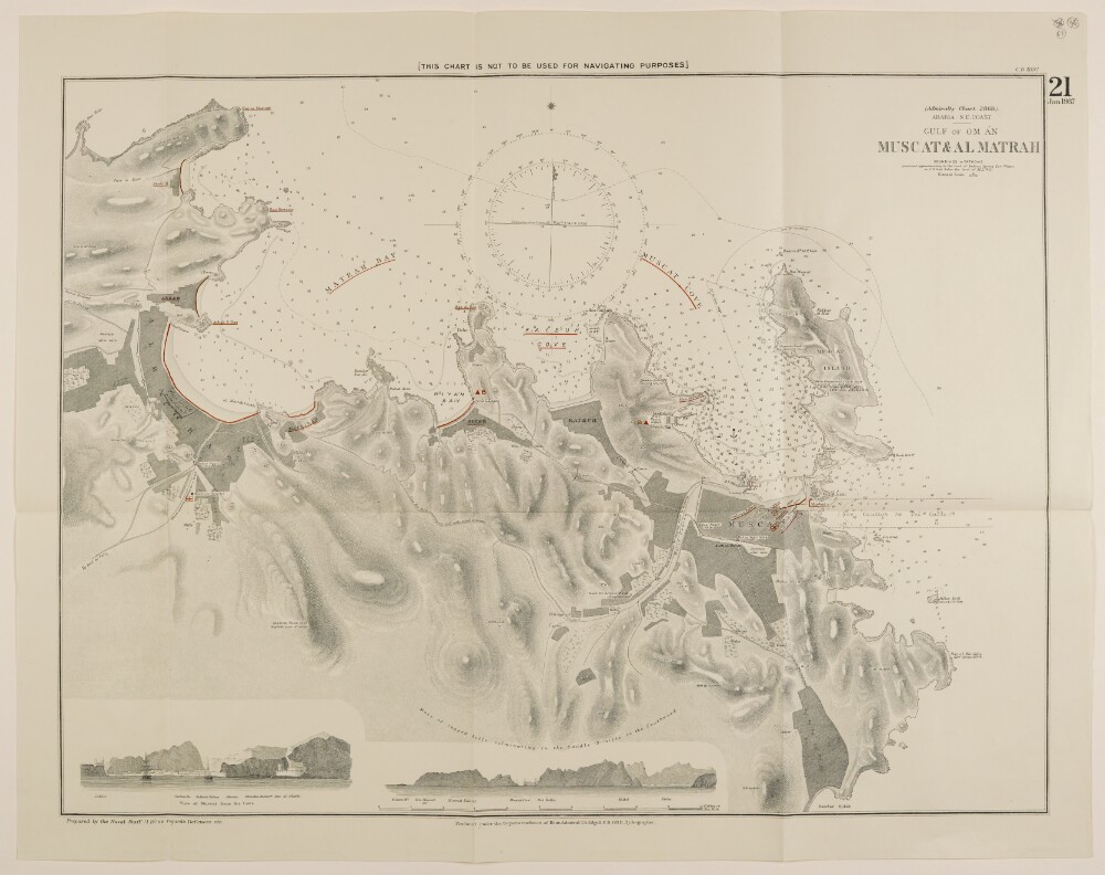
7. 'GULF OF OM ĀN: MUSCAT & AL MATRAH'
- Description:
- Abstract: Plan depicting soundings in fathoms in Matrah Bay [Dawḩat Maţraḩ], Kalbuh Cove [Khawr Kalbūh] and Muscat Cove [Khawr Masqaţ], in the Gulf of Oman. The plan indicates hydrology, settlements and roads, as well as providing some indication of relief. A number of place names and locations have been underlined in red ink. Below the plan are landscape depictions of Muscat from the sea and the wider landscape from the Gulf of Oman.Includes the printing statement: 'Produced under the Superintendence of Rear-Admiral J.A. Edgell, C.B., O.B.E., Hydrographer.' Prepared by naval staff in the Admiralty's Naval Intelligence Division.Physical description: Materials: Printed on paper.Dimensions: 487 x 647mm, on sheet 556 x 699mm.
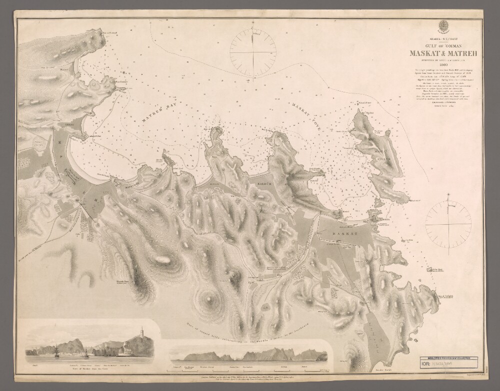
8. 'Maskat & Matreh'
- Description:
- Abstract: Chart 2869.Hydrographic chart covering a four-mile length of the Omani coast from Maskat [Muscat] north-eastwards to Matreh [Mutrah] on the Gulf of Oman. Portrays hydrology, including depths by soundings and contours, sands, mud and rocks, anchorages, relief by spot heights and hachures, vegetation, cultivation, roads, paths, walls, settlements and public buildings, military buildings, wells and place names, and includes topographical notes and navigational aids, including prominent buildings.Includes annotated sketch views, at unspecified scales, of Maskat from the north-north-east and the approach to Maskat Cove [Khawr Masqat] from the north-north-west.Surveyed by Lieutenant Arthur William Stiffe, Indian Navy, 1860, with upright soundings from Lieutenant Ward, 1849, and the sloping soundings from Lieutenant George Barnes Brucks and Lieutenant Stafford Bettesworth Haines, 1828. Engraved by J & C Walker. Published at the Admiralty, 1862.Physical description: Materials: Printed on paperDimensions: 481 x 624mm, on sheet 508 x 643mm
9. 'Précis on slave trade in the Gulf of Oman and the Persian Gulf, 1873-1905 (With a Retrospect into previous history from 1852) By J A Saldanha BA, LL B'
- Description:
- Abstract: This volume is a summary of events, treaties and correspondence about the suppression of slavery and the slave trade in the Gulf of Oman and the Persian Gulf, curated by Jerome Anthony Saldanha, and printed in Simla in June 1906.The volume is marked as secret and divided into chapters:Measures for the suppression of slavery and slave trade in the Indian Ocean and the Persian Gulf, up to 1873 (ff 5-7);Measures against traffic in slaves by Natives of India (ff 8-16);General measures taken for the suppression of Slave Trade from 1874 to 1905 (ff 16v-22);Anti-Slave Trade Operations (ff 22v-30);Runaway slaves at Gwadur (ff 31-34);Trade in Baluchi slaves from Mekran to the Arab coast (ff 34-35);Reception of fugitive slaves on board Her Majesty's ships of war and other British vessels (ff 35v-38);Grant of protection to fugitive slaves on the Coast (ff 39-40);Some questions of practice of courts (ff 41-45);Miscellaneous questions and facts (ff 45v-48.In Appendix, Reports on Slave Trade in the Persian Gulf, 1852-1859(folios 59-61).Physical description: Foliation: the foliation sequence commences at the front cover, and terminates at the inside back cover; these numbers are written in pencil, are circled, and are located in the top right corner of the recto side of each folio. The volume also contains an original printed pagination sequence.
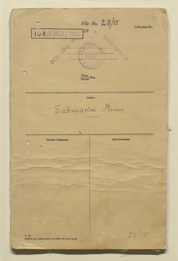
10. ‘File 28/15 Submarine Menace’
- Description:
- Abstract: The file comprises correspondence and other papers relating to enemy submarine activity in the Persian Gulf and Gulf of Oman throughout the War. The principal correspondents in the file are: the Political Agent at Bahrain (Major Reginald George Evelin William Alban; Edward Birkbeck Wakefield; Major Tom Hickinbotham); the Political Officer on the Trucial Coast (POTC: Captain Roy Douglas Metcalfe; Captain Maurice O’Connor Tandy); and the Senior Naval Officer in the Persian Gulf (SNOPG: Commodore Cosmo Moray Graham; Commodore Charles Ford Hammill).The file includes:various reports of sightings of enemy submarines (f 4, f 14, ff 48-52);the ramming and sinking of the Italian submarine Galvaniby HMS Falmouth, off the Oman coast in June 1940 (f 2);correspondence and memoranda relating to the import from India into Bahrain and the Trucial Coast of distilled water, which might indicate the possible presence in the area of an enemy submarine (distilled water being required for repairs to submarine batteries) (ff 5-10). Government of India correspondence raises concerns over distilled water imports into Bahrain by Khalil bin Ebrahim Kanoo [Khalīl Ibrāhīm Kānū], though the Political Agent writes that Kanoo imports his water for car servicing and is above suspicion (ff 16-17). Further imports of distilled water into Bahrain and the Trucial Coast are closely monitored (ff 19-24, f 30);reports of a heavy explosion off the coast of Kalba in January 1941, with fresh oil seen on the sea shortly thereafter (ff 25-26);a note on enemy submarine activity off the Mekran [Makran] coast, prepared by H K Dawson Shepherd of the Combined Intelligence Centre Iraq (CICI), dated 14 February 1943, with details on: German and Japanese interests in Persia; German agents in Persia; reports of a German submarine landing arms at Jask; the possibility of U-Boats making contact with the Persian coast (ff 33-34);investigation into the background of a resident of Khor Fakkan [Khawr Fakkān] in November 1943, believed to have pro-Axis sympathies, and whose presence at Khor Fakkan is considered suspicious in light of the sinking of a submarine off the coast of Khor Fakkan (f 37). A report by the POTC reveals that no pro-Axis connections or suspicious activities have been discovered (ff 35-36, f 43);a request by the SNOPG, 17 November 1943, to investigate the Danish employees of a fish canning factory at Bandar Abbas [Bandar-e ʻAbbās], some of whom may hold pro-German sympathies (f 39).Physical description: Foliation: the main foliation sequence (used for referencing) commences at the front cover with 1 and terminates at the back cover with 58; these numbers are written in pencil, are circled, and are located in the top right corner of the recto side of each folio. An additional foliation sequence is also present in parallel between ff 2-53; these numbers are also written in pencil, but are not circled, and are located in the same position as the main sequence. Paginated: the file notes at the back (ff 54-57) have been paginated using pencil.
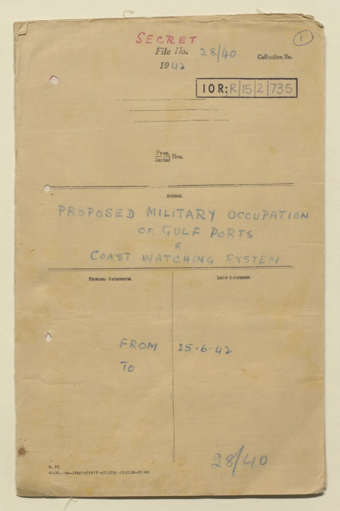
11. ‘File 28/40 Proposed military occupation of Gulf ports & coast watching system’
- Description:
- Abstract: The file comprises three items of correspondence relating to plans for reconnaissance flights over parts of the coast in the Persian Gulf and Gulf of Oman, with a view to their occupation by British forces if necessary:a memorandum from Tenth Army headquarters, dated 25 June 1942 and marked most secret, detailing locations for reconnaissance (Jask, Ras el Hadd [Ra’s al Ḥadd], Muscat, Khor Jamara [Khawr al Jarāmah], Kalba, Sharjah, Dibai [Dubai], Bushire, Asal, Lingeh [Bandar-e Lengeh], Bandar Abbas [Bandar-e ʻAbbās], Kuwait, Massira [Maṣīrah]), the need for coast watching organisations in each area, and proposals for the organisation of local tribes to assist in action against enemy attack (f 2);an express letter from the British Consul at Bushire, dated 4 August 1942, stating that the proposed reconnaissance is unlikely to take place for some considerable time (f 3);a telegraph from the Political Resident in the Persian Gulf to the Political Agents in the Persian Gulf, dated 5 November 1942, informing them of proposals for reconnaissance for defence purposes, calling at: Bahrain, Sharjah, Lingah, Kalba, Muscat, Khor Jamara, Ras al Hadd, Masirah, Jask, Sharjah, and returning via Sharjah and Bahrain (f 4).The file notes record the Political Agent’s (Edward Birkbeck Wakefield) anxiety over the Tenth Army’s proposals to organise the Trucial Coast tribes to assist in the event of enemy attacks, suggesting that organised tribes would be ‘more likely to attack our RAF stations than a disembarking enemy’. (f 5)Physical description: Foliation: the main foliation sequence (used for referencing) commences at the front cover with 1, and terminates at the inside back cover with 6; these numbers are written in pencil, are circled, and are located in the top right corner of the recto side of each folio. An additional foliation sequence is present in parallel between ff 2-5; these numbers are also written in pencil, but are not circled, and are located in the same position as the main sequence.
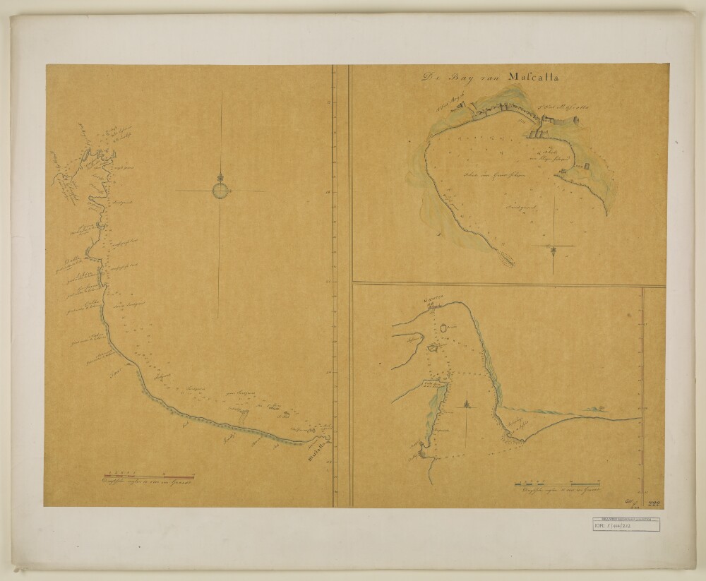
12. Charts of the Gulf of Oman and Strait of Hormuz
- Description:
- Abstract: Distinctive Features:Depths shown by soundings with shoals and rocks represented by dots and crosses. Some settlements shown pictorially.Contains three charts showing: the coast from the Musandam Peninsula to Muscat, at the left portion of sheet; ‘De Bay van Mascatta’ in the top right; and Strait of Hormuz in the bottom right. Copied from original chart produced during an expedition along the Oman coast in 1666.Physical description: Materials:Pen and ink with wash on tracing paperDimensions:523 x 349 mm or smaller, on sheet 525 x 738 mm
- « Previous
- Next »
- 1 Current Page, Page 1
- 2