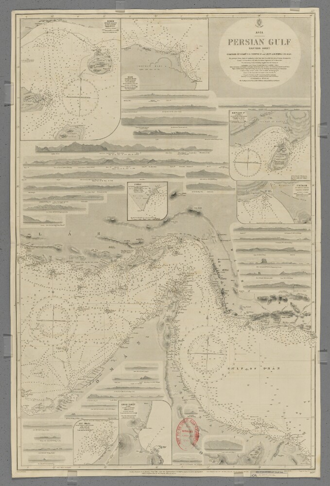
1. 'Persian Gulf. Eastern Sheet' Creator: Cartographer: J & C Walker Date: 1912/1912 Language: English Geographic region: Persian GulfPersiaMusandam Peninsula
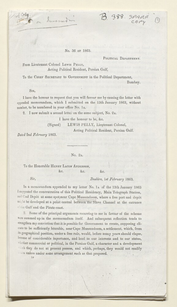
2. 'Memo on Mussondomom' Date: 1863/1863 Language: English Geographic region: BushirePersian GulfMusandam Peninsula
3. File 351/1904 'Persian Gulf:- Erection of British flagstaffs at Musandam’ Date: 1902/1908 Language: English Geographic region: Musandam PeninsulaTelegraph IslandSheep IslandKhor Kawi
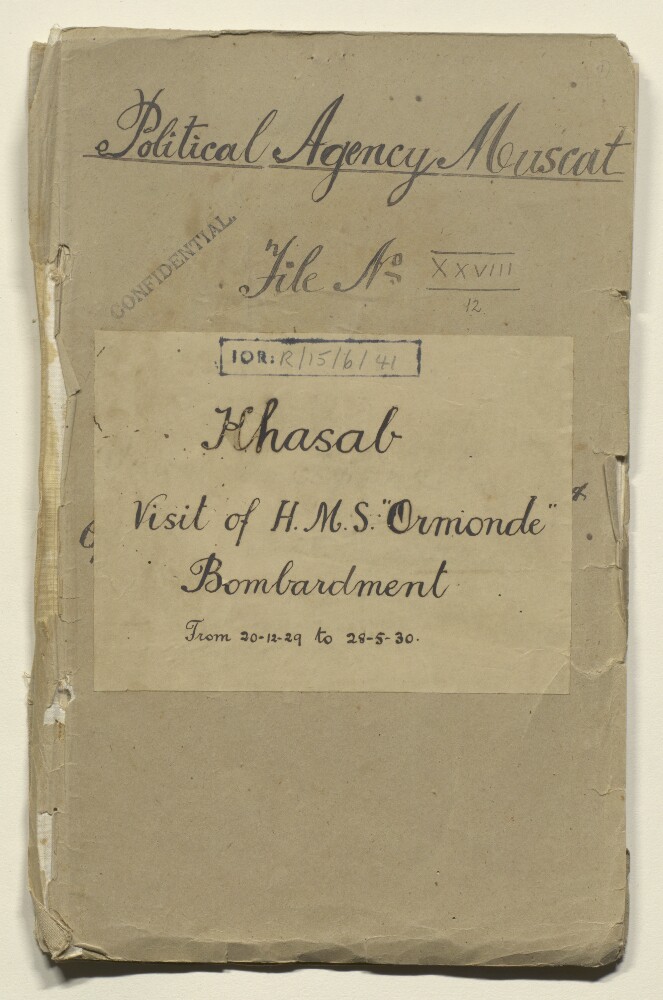
4. ‘File No XXVIII/12 Khasab Visit of H.M.S. “Ormonde and Bombardment from 20-12-29 to 28-5-30.’ Date: 1929/1931 Language: English Geographic region: BukhaMusandam PeninsulaKhassab
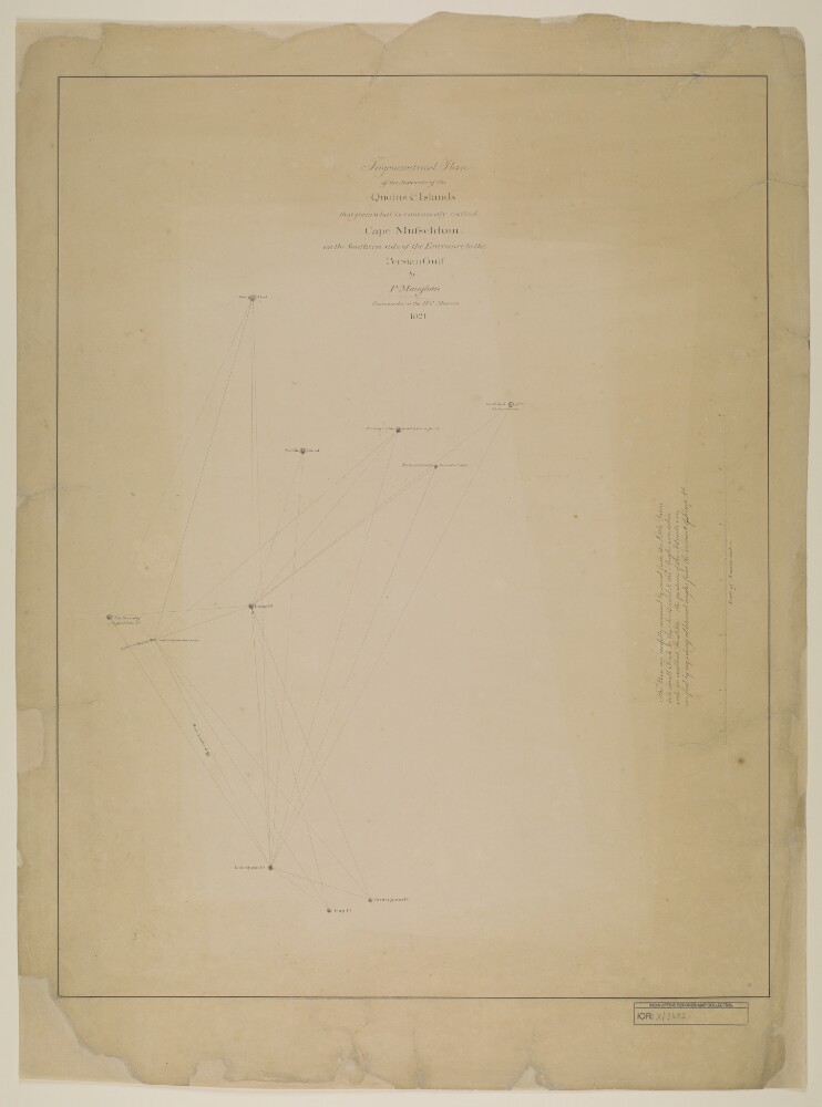
5. ‘Trigonometrical Plan of the Summits of the Quoins & Islands that form what is commonly called Cape Musseldom on the Southern side of the Entrance to the Persian Gulf by P. Maughan, Commander in the H.C. Marine. 1821’ Date: 1821/1821 Language: English Geographic region: Musandam Peninsula
6. File XXIII/8 'Travels in Oman. Visit of B. Thomas to the Musandam Peninsula. 1928. Notes on Shihuh dialects & people, also Kumzaris' Creator: Author: Bertram Sidney Thomas Date: 1927/1927 Language: English Geographic region: OmanMusandam Peninsula