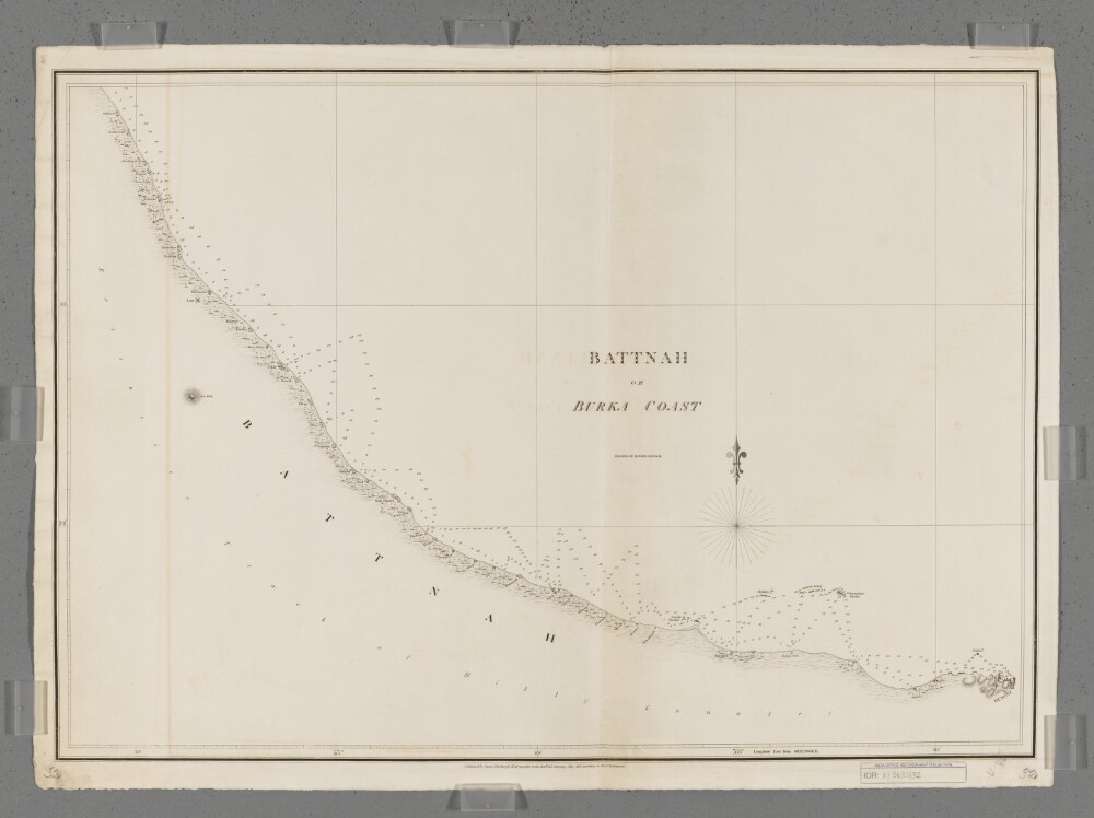
Abstract: Covers a 200-mile length of the Battnah [Al Batinah, Oman] coast west of Muscat on the Gulf of Oman. Includes a hinterland of approximately five miles.Portrays hydrology, including depths by soundings, prominent relief by hachures, vegetation, settlements, forts and place names, and includes topographical notes.Engraved by Richard Bateman. Published by James Horsburgh, Hydrographer to the Honourable East India Company.Physical description: Materials: Printed on paperDimensions: 494 x 712mm, on sheet 559 x 769mm
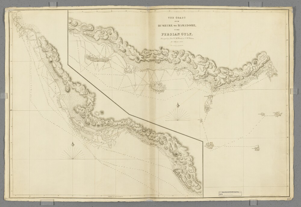
Abstract: Covers a 400-mile length of the Persian Gulf coast from Bushire [Bushehr] south-eastwards to Basadore [Basaidu] in Persia [Iran], including a fifteen-mile hinterland. Portrays hydrology, including depths by soundings, sands and rocks, relief by hachures and rock drawings, vegetation, settlements and place names, and includes topographical and hydrographic notes.Surveyed by Lieutenants George Barnes Brucks and Stafford Bettesworth Haines, 1828. Engraved by Richard Bateman. Published by James Horsburgh, Hydrographer to the Honourable East India Company.Physical description: Materials: Printed on paperDimensions: 637 x 948mm, on sheet 670 x 1005mm
Abstract: Covers a 280-mile length of coastline from the western side of the Qatar Peninsula north-westwards to Ras el Ghar [Ras al Ghar, Saudi Arabia], including Bahrein [Bahrain].Engraved by Richard Bateman.Physical description: Materials: Printed on paperDimensions: 875 x 616mm, on sheet 1006 x 670mm
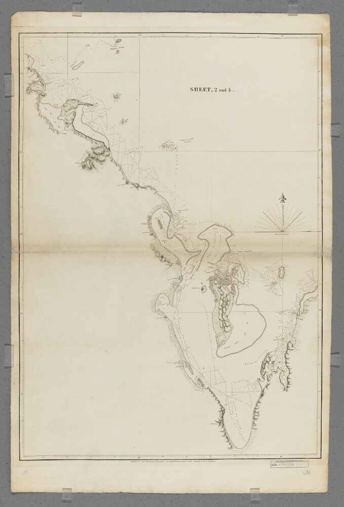
Abstract: Sheet 1 (Eastern) bears the shelfmark IOR/X/3635/1Sheet 2 (Western) bears the shelfmark IOR/X/3635/2Covers the Persian Gulf, Strait of Hormuz and the coastlines of Persia [Iran], Mesopotamia and the north-eastern Arabian Peninsula eastwards to the Musandam Peninsula. Includes a hinterland of approximately twelve miles. Portrays hydrology, including depths by soundings, and rocks, relief by hachures and rock drawing, vegetation, settlements and place names in English and Arabic, and includes topographical and hydrographic notes. The coastlines are highlighted in watercolour.'Constructed from the Trigonometrical Surveys. Made by Order of the Hon[ourab]le the Court of Directors of the United English East India Company; and to whom it is Respectfully Dedicated by their most obedient Servant George Barnes Brucks, Commander HC [Honourable Company] Marine. 1830.'Original surveys by Lieutenants John Michael Guy, George Barnes Brucks, Robert Cogan, William Eales Rogers and Stafford Bettesworth Haines, 1821-29. Engraved by Richard Bateman. Published by James Horsburgh, Hydrographer to the Honourable East India Company, 1832.Physical description: Materials: Printed, with manuscript additions in watercolour, on paper (backed with linen)Dimensions: Sheet 1 (Eastern) 725 x 580mm, on sheet 803 x 644mm; Sheet 2 (Western) 731 x 580mm, on sheet 820 x 648mm
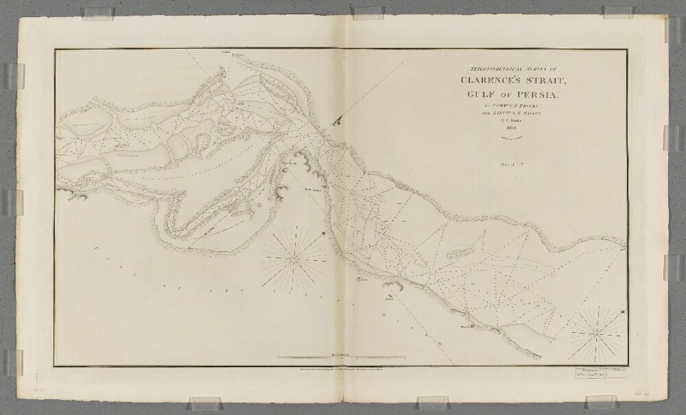
Abstract: Covers a thirty-five-mile length of the central portion of Clarence's Strait [Toreh-ye Khuran and Toreh-ye Khvoran] and the adjacent coastlines of southern Persia [Iran] and Kishm Island [Qeshm Island, Iran], together with a hinterland of approximately half a mile. Portrays hydrology, including depths by soundings, sands and rocks, relief by hachures, vegetation, settlements and place names, and includes topographical and hydrographic notes.Surveyed by Commander George Barnes Brucks and Lieutenant Stafford Bettesworth Haines, 1828. Engraved by Richard Bateman. Published by James Horsburgh, Hydrographer to the Honourable East India Company.An accompanying sheet (Sheet 2nd) is filed at IOR/X/3630/28/2.Physical description: Materials: Printed on paperDimensions: 496 x 898mm, on sheet 610 x 1020mm