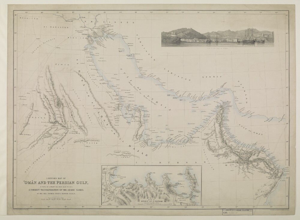
Abstract: Imprint:London, Printed for the Hakluyt Society. Stanford’s Geographical Establishment,Distinctive Features:Relief shown by hachures.Includes two insets: ‘View of the town of Máskat’ in the top right-hand corner, and ‘Plan of Máskat and El- Mátrah’ in the bottom centre.Physical description: Dimensions:520 x 710 mm
Abstract: This file consists of a memorandum by George Percy Badger (scholar and missionary) concerning Persian claims in Beloochistan [Baluchistan] and Mekran [Makran], particularly Gwadel or Gwadur [Gwādar] and Charbar [Chābahār]. It contains the following: a history of Persian encroachments in Beloochistan; a table outlining the political divisions of the maritime provinces of Mekran, and their respective governments; an assessment of Persia's jurisdiction on the Mekran Coast; details of the sovereignty of Gwadur; a discussion of hostilities between Persia and the Sultan of Muscat over Bunder Abbas [Bandar-e ʻAbbās] and other dependencies; a summary of the 1856 treaty between Persia and Muscat. A map depicting the political geography of Mekran is included on folio 5.The appendices include:a translation of the treaty between His late Highness Seyyed Saeed [Āl Bū Sa‘īd, Sayyid Thuwaynī bin Sa‘īd] and the Persian Government, relating to Bunder Abbas, etc., dated 1856;a report by Lieutenant-Colonel Frederic John Goldsmid on the claims of Persia, Khelat [Kalat], and Muscat, to sovereign rights on the Mekran Coast;extracts from Lieutenant-Colonel Goldsmid's diaries on defining boundaries and districts;a memorandum on Western Mekran by Lieutenant-Colonel Goldsmid.Physical description: Foliation: the foliation sequence commences at the first folio with 1, and terminates at the last folio with 10; these numbers are written in pencil, are circled, and are located in the top right corner of the recto side of each folio.Pagination: the file also contains an original printed pagination sequence.