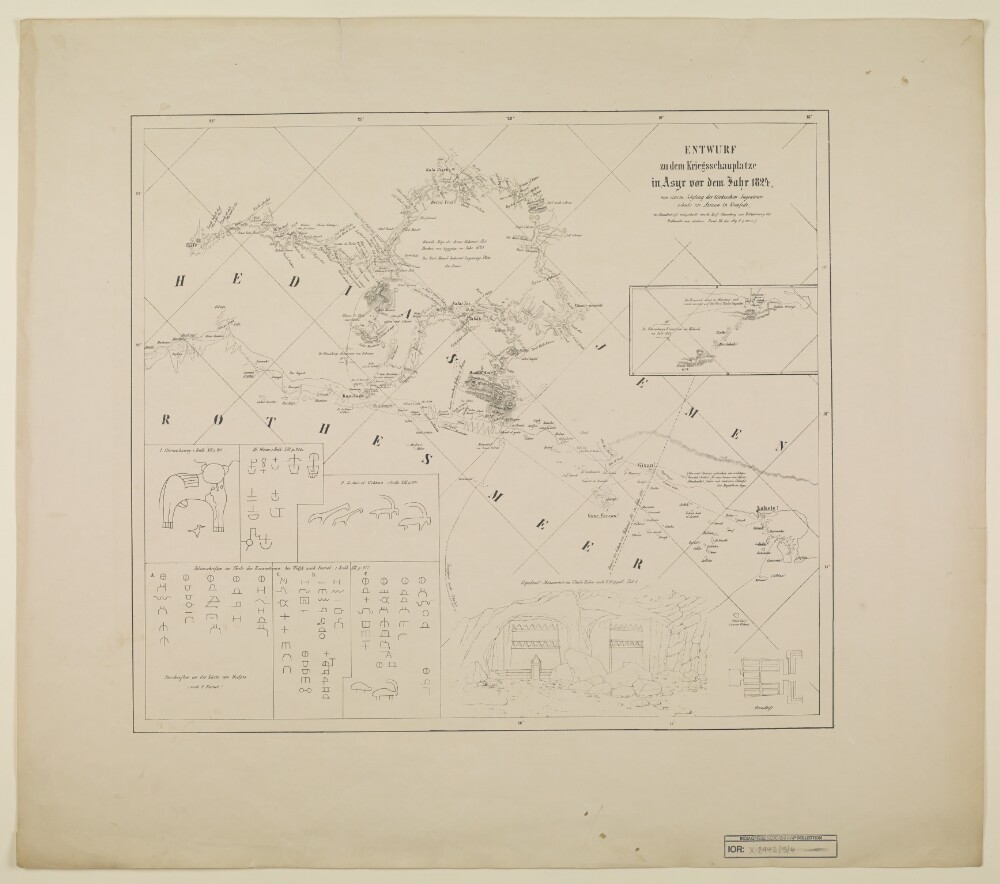
Abstract: Distinctive Features:Title continues: ‘von einem Zögling der türkischen Ingenieurschule in Assuan in Romfode, in Handschrift mitgetheilt durch Prof. Ehrenberg zur Erläuterung der Erdkunde von Arabien. Band XII der Allg. E. p. 1027 u. f.’Relief shown by hachures.Includes inset with illustrations of rock inscriptions found on the coast of Hedjas with references to C. Ritter's ‘Erdkunde’.Physical description: Dimensions:420 x 475 mm, on sheet 600 x 690 mm
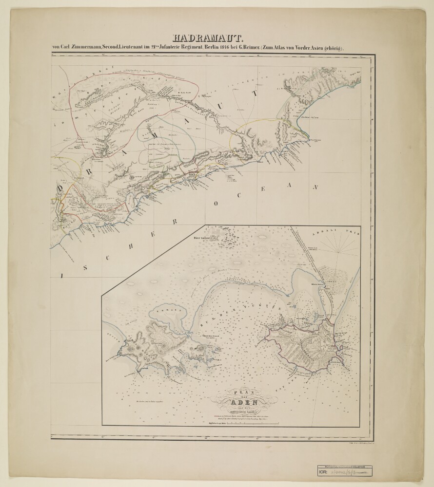
Abstract: Distinctive Features:Relief shown by hachures.Shows routes of various expeditions with a table of explorers and dates of their journeys listed at left centre of sheet at IOR/X/2942/5/2.Includes inset: ‘Plan von Aden und des umliegenden Landes’ with soundings recorded and note: ‘nach den Parlaments Reports Indian Papers respecting Aden 1837 & 1838 & Foster Sketch of Cap Aden in Bombay Geographical Society Proceedings May 1839’.Physical description: Dimensions:525 x 500 mm, on sheet 690 x 604 mm
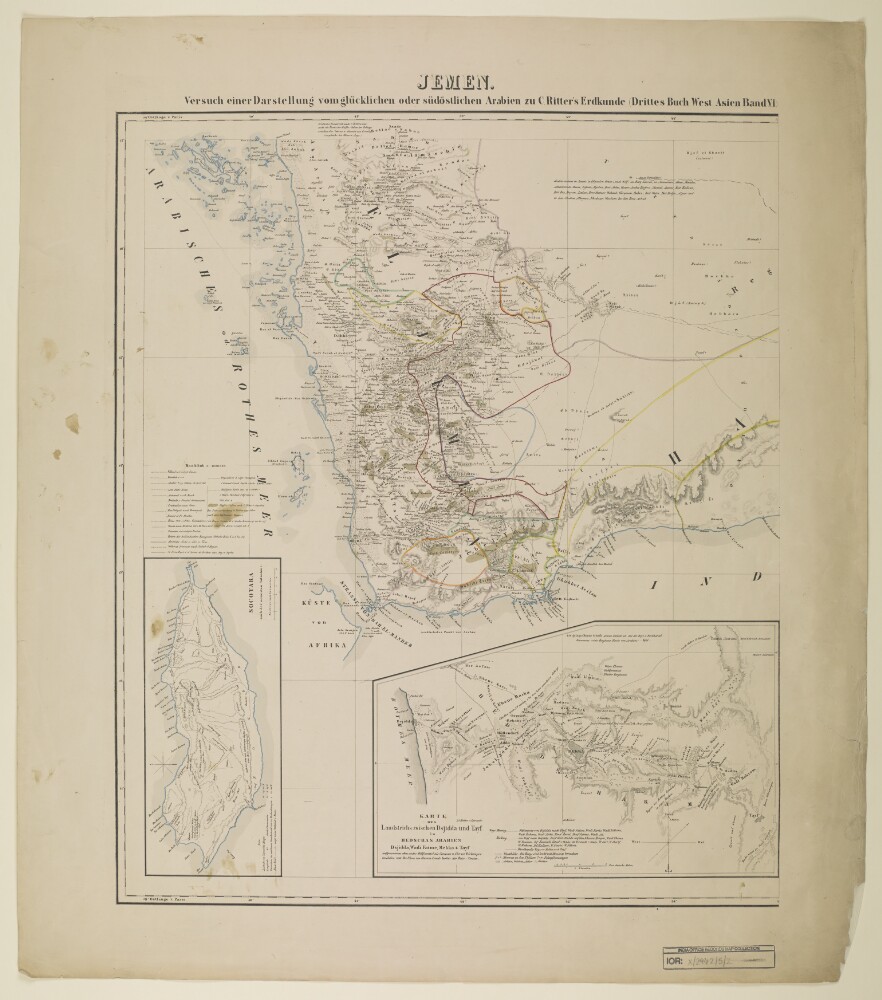
Abstract: Distinctive Features:Relief shown by hachures.Shows routes of various expeditions with a list of explorers and dates of their journeys at left centre.Includes two insets: ‘Socotara’ and ‘KARTE DES Landstrichs zwischen Dsjidda und Tayf in HEDSCHAS ARABIEN’.Physical description: Dimensions:550 x 465 mm, on sheet 690 x 604 mm
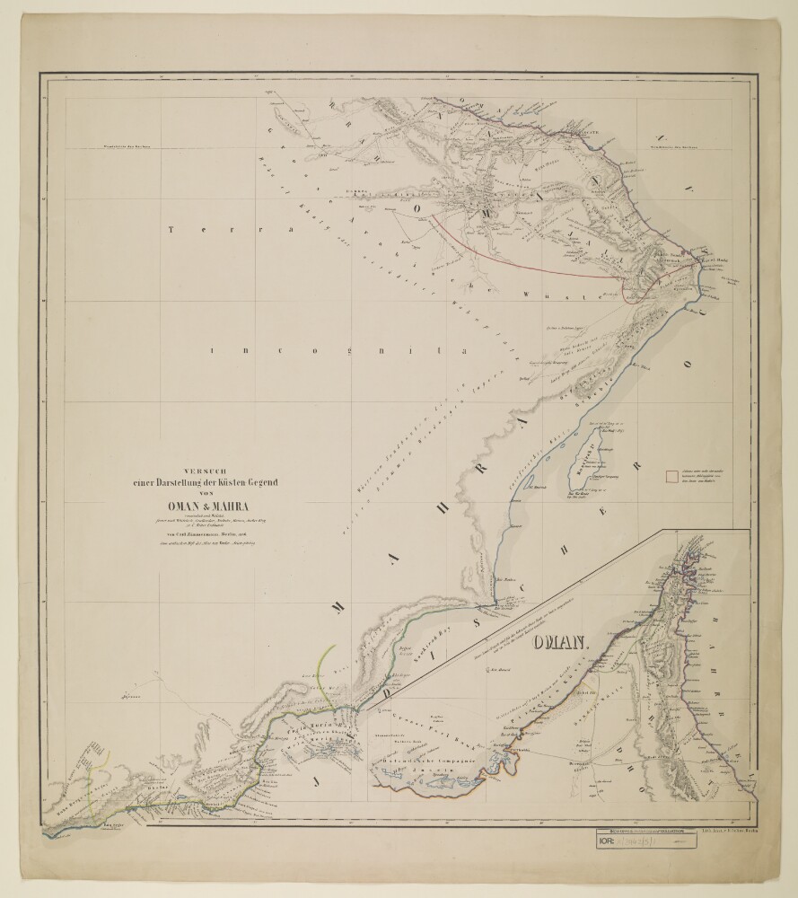
Abstract: Distinctive Features:Title continues: 'vornämlich nach Wellsted, ferner nach Whitelock, Cruttendon, Niebuhr, Haines Aucher Eloy, zu C. Ritters Erdkunde von Carl Zimmermann. Berlin 1846. Zum Arabischen Heft des Atlas von Vorder-Asien gehörig'.Coloured for reference.Includes inset map of Oman.The coast between Abu Dhabi and Dubai is labelled ‘Piraten Küste’; shows pearl banks to the west of Abu Dhabi bay.Physical description: Dimensions:600 x 570 mm, on sheet 687 x 604 mm
Abstract: Imprint:Berlin, Published by Dietrich Reimer and lithographed by Hermann Delius.Distinctive Features:Original title: 'Fünf Karten zu C. Ritter's Erdkunde von Arabien. Bearbeitet von Carl Zimmermann'.Physical description: 5 map sheets
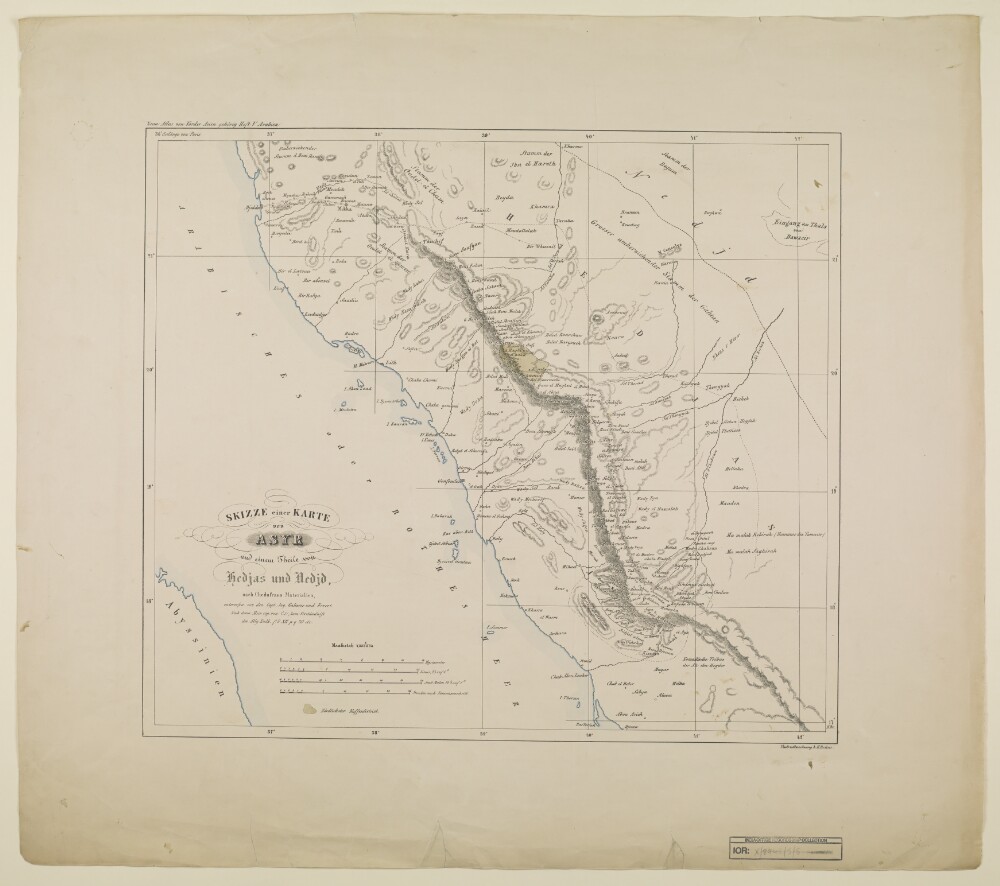
Abstract: Distinctive Features:Above map at top left: ‘Zum Atlas von Vorder-Asien gehörig, Heft V, Arabien’.Relief shown by hachures.Shows the approximate location of the major nomadic tribes across the region.Physical description: Dimensions:405 x 475 mm, on sheet 604 x 690 mm