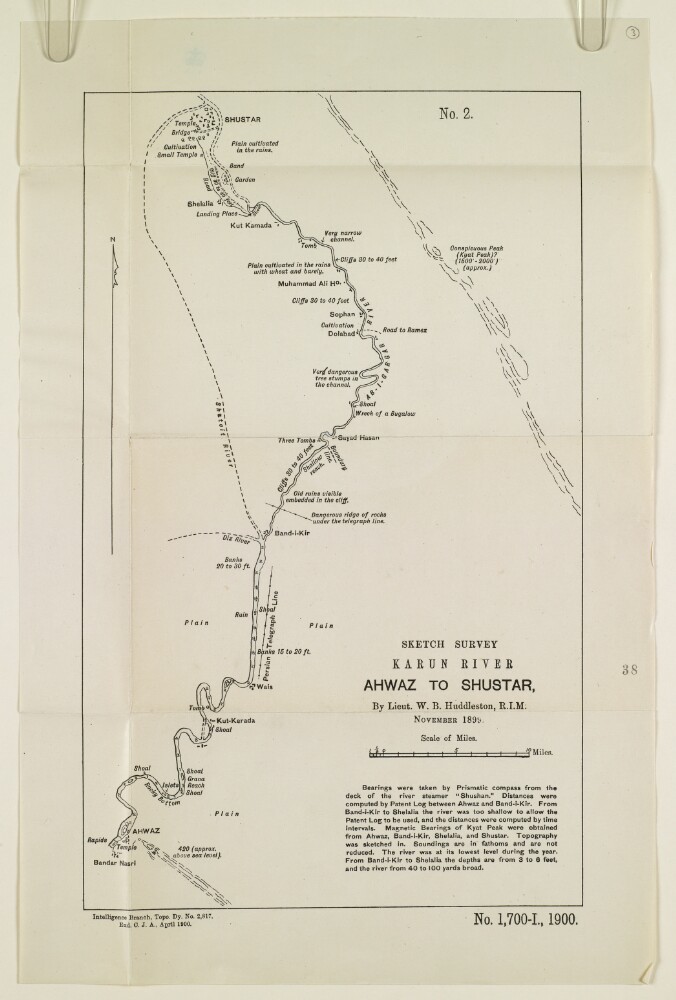
Abstract: The sketch map shows the course of the river Karun from Ahwaz [Ahvāz] to Shushtar, based on a survey undertaken by Lieutenant Willoughby Baynes Huddleston of the Royal Indian Marine in November 1899. The map indicates: the course and nature of the river; soundings, measured in fathoms; the height of banks, shoals; channel hazards; plains; notable landmarks; roads; and river tributaries. A note below the map title states that the bearings were taken by prismatic compass from the deck of the river steamer
Shushtan, at a time of year when the river was at its lowest annual point. The note gives further information on the methods used to record river measurements and bearings.Other labels on the map: at the top, ‘No. 2’; at the bottom: ‘Exd C.J.A.’Physical description: Dimensions: 354 x 217 mm, on sheet 419 x 275 mm.Materials: Printed on paper.
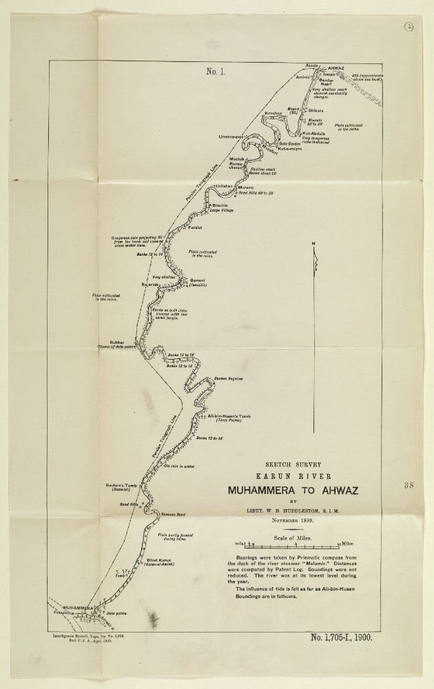
Abstract: Sketch map showing the course of the river Karun from Muhammera [Khorramshahr] to Ahwaz [Ahvāz], based on a survey undertaken by Lieutenant Willoughby Baynes Huddleston of the Royal Indian Marine in November 1899. The map indicates: the nature and course of the river; soundings, measured in fathoms; the height of banks, given in feet; plains; villages; and other features, such as tombs and mounds. A note below the title of the map states that bearings were taken with a prismatic compass from the deck of the river steamer
Malamir, at a time of year when the river was at its lowest annual point.Other labels on the map: at the top, ‘No. 1’; at the bottom: ‘Exd C.J.A.’Physical description: Dimensions: 406 x 244 mm, on sheet 486 x 302 mm.Materials: Printed on paper.