1 - 2 of 2
Number of results to display per page
Search Results
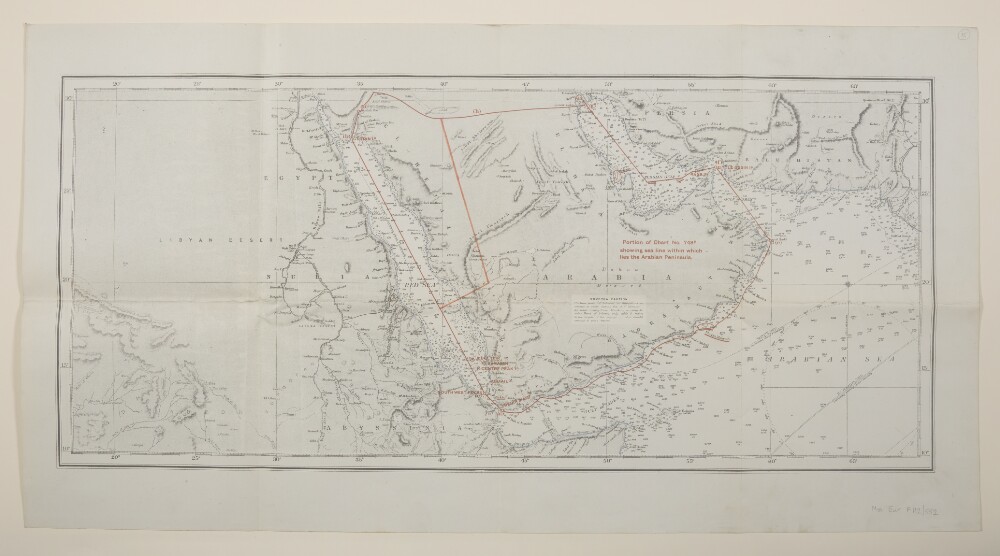
1. 'Portion of Chart No. 748B showing sea line within which lies the Arabian Peninsula.'
- Description:
- Abstract: Covers the Persian Gulf, Gulf of Aden and Red Sea, including hinterlands to a width of approximately 150 miles beyond which detail diminishes. Comprises a base map, overprint and manuscript additions.The base map is produced from British Admiralty Chart No. 748B titled 'Indian Ocean - Northern Portion' dated 15 November 1918 and filed at Maps B.A.C. (748B.). Portrays marine hydrology, including sands, rocks and depths by soundings, inland hydrology, relief by hachures and spot heights, railways, roads and tracks, settlements and place names. Bears the notes 'Drawn for engraving by E J Powell' and 'Engraved by Davies Bryer & Co.'A red overprint portrays the sea line including geographical reference points, some of which possess reference letters although no key is present.Manuscript additions relate to the sea line and also accentuate the coastline.The verso bears the annotation 'Arabia'.Physical description: Materials: Printed in colour, with manuscript additions in crayonDimensions: 290 x 676mm, on sheet 405 x 763mm
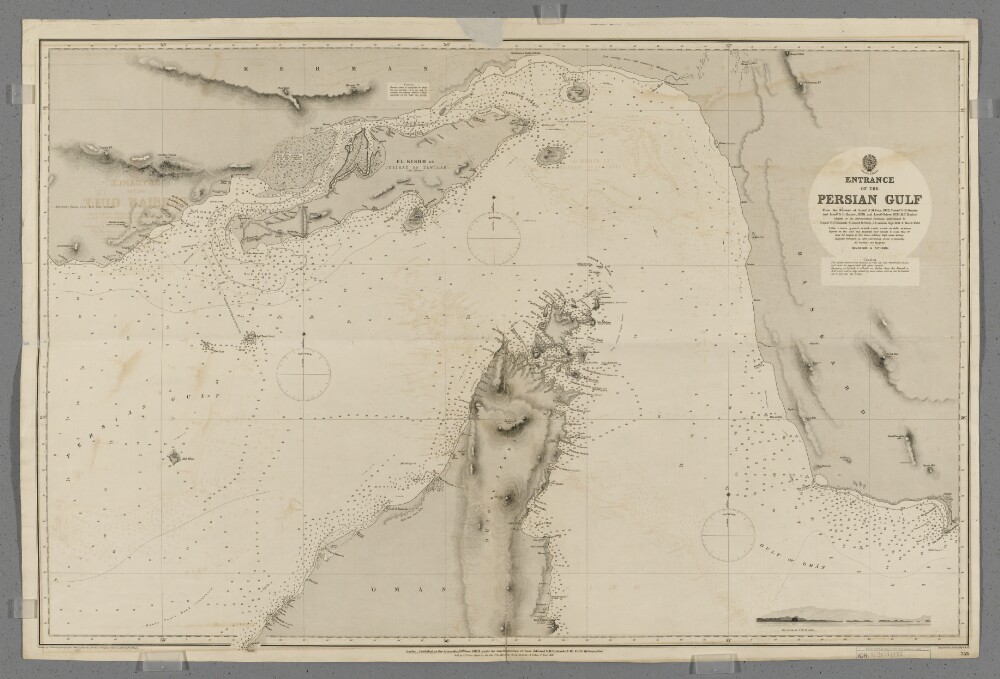
2. 'Entrance to the Persian Gulf'
- Description:
- Abstract: Chart 753.Hydrographic chart covering the Strait of Hormuz and the adjoining sections of the Persian Gulf and Gulf of Oman. Also includes the adjacent coastal areas of Persia and the Musandam Peninsula. Portrays hydrology, including depths by soundings and contours, anchorages, sands and rocks, relief by spot heights and hachures, vegetation, settlements, forts and place names, and includes topographical notes and navigational aids, including buoys, beacons and prominent buildings.Includes an annotated sketch view, at unspecified scale, of Koh Mubarak, Persia [Kuh Mobarak, Iran] from the west by south at twelve miles distant.Chart produced from the surveys of Lieutenant John M Guy (1822), Commander George Barnes Brucks and Lieutenant Stafford Bettesworth Haines (1828) and Lieutenant Albany Moore Grieve (1839), Honourable Marine. Astronomical positions determined by Commander Charles Golding Constable and Lieutenant Arthur William Stiffe, Indian Navy (1857-60). Engraved by Davies, Bryer & Company. Drawn by Edward James Powell, Hydrographic Office. Published at the Admiralty, 1872.Physical description: Materials: Printed on paperDimensions: 640 x 968mm, on sheet 682 x 1017mm