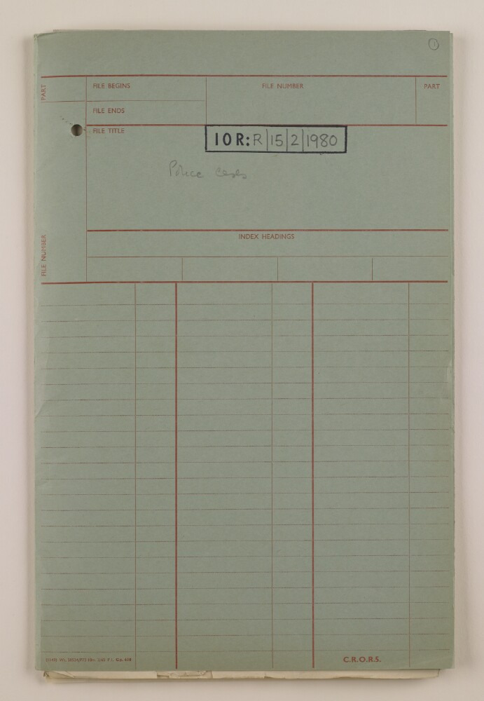
Abstract: The file contains correspondence in the form of petitions, reports and statements, related to police cases in Bahrain. Cases of note include the renewal of driving licences, and the distribution of ice by the Baladyia (Municipality).The main correspondence is between the Bahrain Political Agency, and the Adviser to the Bahrain Government (Charles Dalrymple Belgrave).Physical description: Foliation: the main foliation sequence (used for referencing) commences at the front cover with 1, and terminates at the inside back cover with 36; these numbers are written in pencil, are circled, and are located in the top right corner of the recto side of each folio. An additional foliation sequence is present in parallel between ff 2-35; these numbers are also written in pencil, but are not circled.
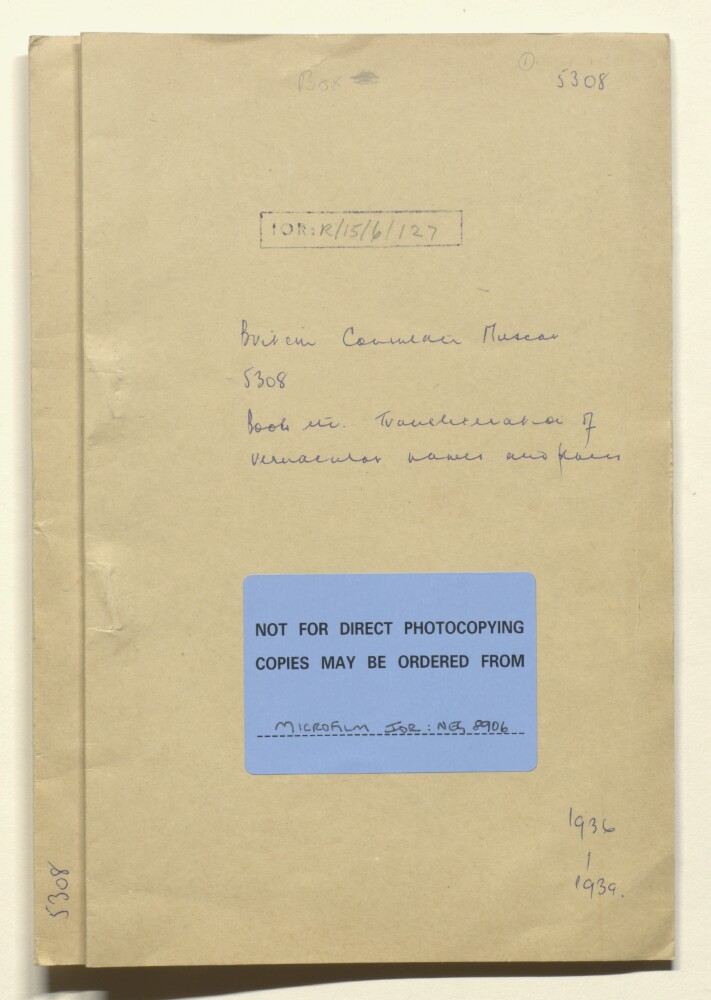
Abstract: Unnumbered file: the file is numbered 5308, but clearly belongs in this series.The file concerns a request from the India Office for revisions to the
Second List of Names in Arabia (N.E. and S.E.), by the Permanent Committee on Geographical Names for British Official Use (Royal Geographical Society, December 1935). The correspondence, dated 1936-37, includes a memorandum of corrections in accordance with local custom prepared by Major Ralph Ponsonby Watts, Political Agent and HBM's Consul, Muscat, and copies of the list dated 1935 and (corrected) 1937.The papers also include transcripts of three articles from the Arab press dated 1939 concerning German military aims in the Middle East, and related topics.The Arabic language content of the file consists of lists of place names (with transliterations into English) and press agency letterheads.Physical description: Foliation: the main foliation sequence (used for referencing) commences at the front cover with 1, and terminates at the inside back cover with 28; these numbers are written in pencil, are circled, and are located in the top right corner of the recto side of each folio. An additional foliation sequence is present in parallel between ff 2-5 and between ff 14-27; these numbers are also written in pencil, but are not circled.
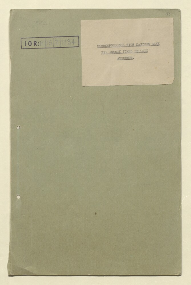
Abstract: The file contains nine letters between the Manager, The Eastern Bank Limited, and the Political Agent, Bahrain concerning the Political Agency's fixed deposit accounts (covering renewal, receipts, and interest).The date range gives the covering dates of the correspondence; the last dated addition to the file is an entry in the notes on folio 12v dated 26 June 1950.Physical description: Foliation: the foliation sequence (used for referencing) commences at the front cover with 1 and terminates at the inside back cover with 12; these numbers are written in pencil, are circled, and are located in the top right corner of the recto side of each folio.
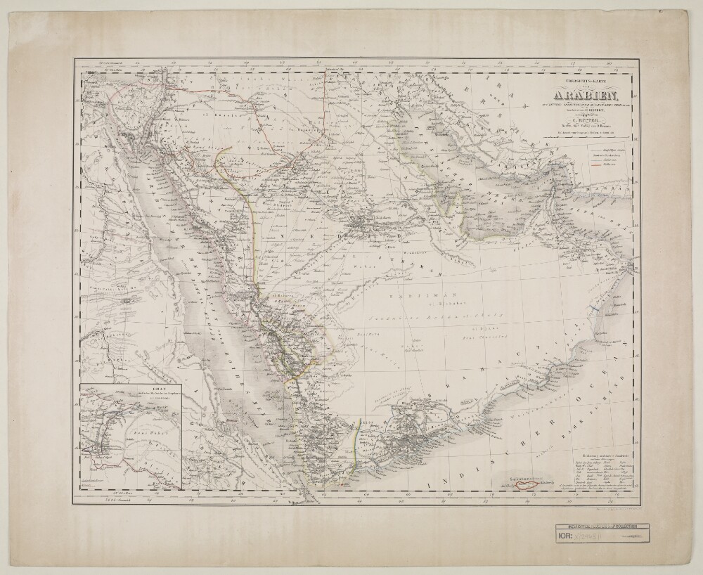
Abstract: Distinctive Features:Relief shown by hachures.Title continues: ‘Zu C. Ritter’s Erdkunde, Buch III, West-Asien, Theil XII, XIII; bearbeitet von H. Kiepert, herausgegeben von C. Ritter. Berlin, 1852 Verlag von D. Reimer’.General map of Arabian Peninsula based on Carl Ritter’s ‘Die Erdkunde im Verhältnis zur Natur und zur Geschichte des Menschen’ [Geography in relationship to nature and to the history of humanity] showing various routes across the region including the Hajj pilgrimage, Captain George Forster Sadlier’s expedition of 1819 and George August Wallin‘s journey of 1848. Provinces and regions labelled with boundary coloured for reference.Includes inset map entitled ‘Oman’ showing Maskat [Muscat] with routes traversed by Pierre-Martin-Rémi Aucher-Eloy and James Raymond Wellsted marked. In the bottom right-hand corner there is a table of reference listing Arabic geographic terms with German equivalents and abbreviations.Physical description: Dimensions:353 x 475 mm, on sheet 742 x 580 mm
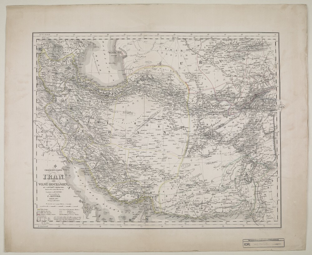
Abstract: Distinctive Features:Relief shown by hachures.Title continues: ‘Zu C. Ritter’s Erdkunde, Buch III, West-Asien, Theil VIII, IX. Bearbeitet von H. Kiepert, herausgegeben von C. Ritter. Berlin, 1852 Verlag von D. Reimer’.Map of Iran showing territorial extent of the Ottoman, the Russian and the British sphere of influence in the region with borders outlined in colour and explained in a key in the bottom left-hand corner below title. Also shows the boundaries between provinces and various routes across the region.Physical description: Dimensions:462 x 490 mm, on sheet 478 x 584 mm
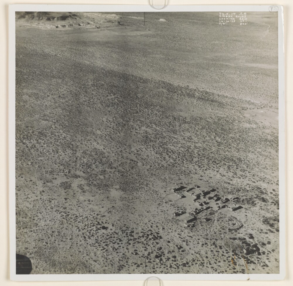
Abstract: Aerial photograph of a ruined settlement at Ambak [Nibāk], situated in a desert landscape on the frontier between Saudi Arabia and Qatar. The photograph was taken during a Royal Air Force reconnaissance flight on 14 October 1935. On the rear of the photograph is a red date stamp, marked ‘for official use only’, ‘Royal Air Force official, Crown Copyright Reserved’, and dated 16 October 1935.Physical description: Dimensions:183 x 183 mm.
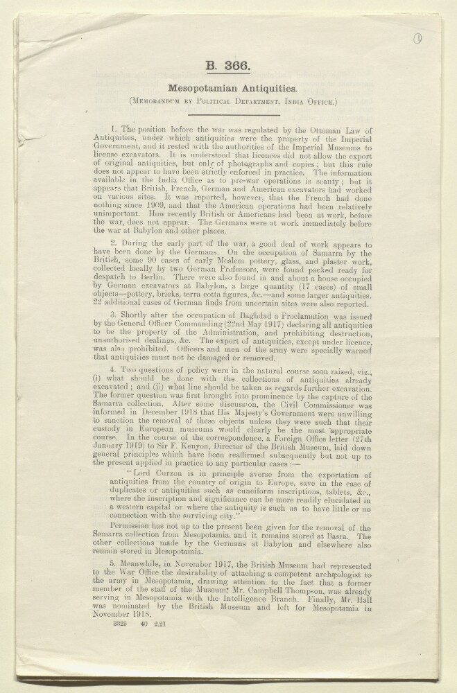
Abstract: This printed memorandum by Sir Leonard Day Wakely (signed L D W), Political Department, India Office, dated 3 February 1921, provides an overview of antiquities in Mesopotamia [Iraq].The memorandum detail:the Ottoman administration of archaeology;German archaeological expeditions during the First World War;the declaration of a proclamation by the General Officer Commanding, dated 22 May 1917, declaring all antiquities are property of the Administration and questions;a request from the British Museum in November 1917 to the War Office to attach an archaeologist to the army in Mesopotamia, with Dr Henry Reginald Holland Hall dispatched in November 1918;preservation of certain important monuments, such as the ruins of Ctesiphon;Dr Hall and Reginald Campbell Thompson undertaking their own excavations and shipping the resulting collections to the British Museum, and a resulting ban on removing archaeological artefacts from Mesopotamia on 23 May 1919;general questions arising from this concerning requests for expeditions from the University of Philadelphia, Professor Stephen Herbert Langdon of the University of Oxford, and Professor James Henry Breasted of the University of Chicago;the question of establishing an Archaeological Department and Professor Albert Tobias Clay's suggestion of establishing a School of Archaeological Research in 1920;the Archaeological Joint Committee formed in 1918 and chaired by Sir Frederic George Kenyon; and the disposal of Samarra [Sāmarrā’];and other German collections stored in Mesopotamia and antiquities (the Lisbon Collection) seized by Portuguese authorities during the War.Physical description: Foliation: The foliation sequence commences at the front cover, and terminates at the inside back cover; these numbers are written in pencil, are circled, and are located in the top right corner of the recto side of each folio.Pagination: The volume also contains an original printed pagination sequence.
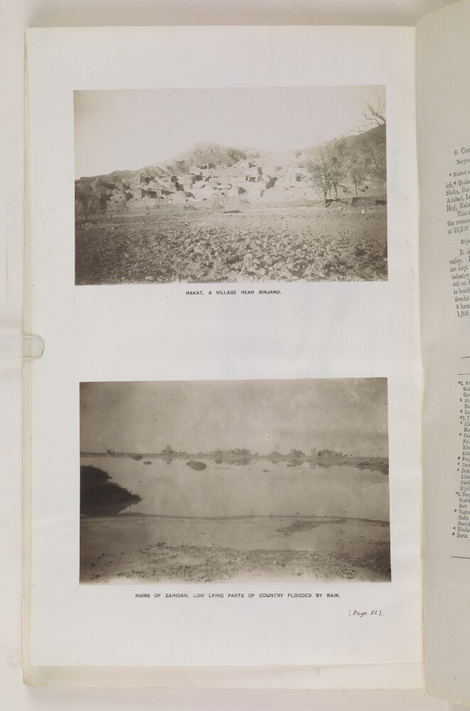
Abstract: A black and white photograph some ruined buildings. In front of the buildings is an expanse of floodwater. The photographer is unknown.Physical description: Dimensions: 102 x 156mm
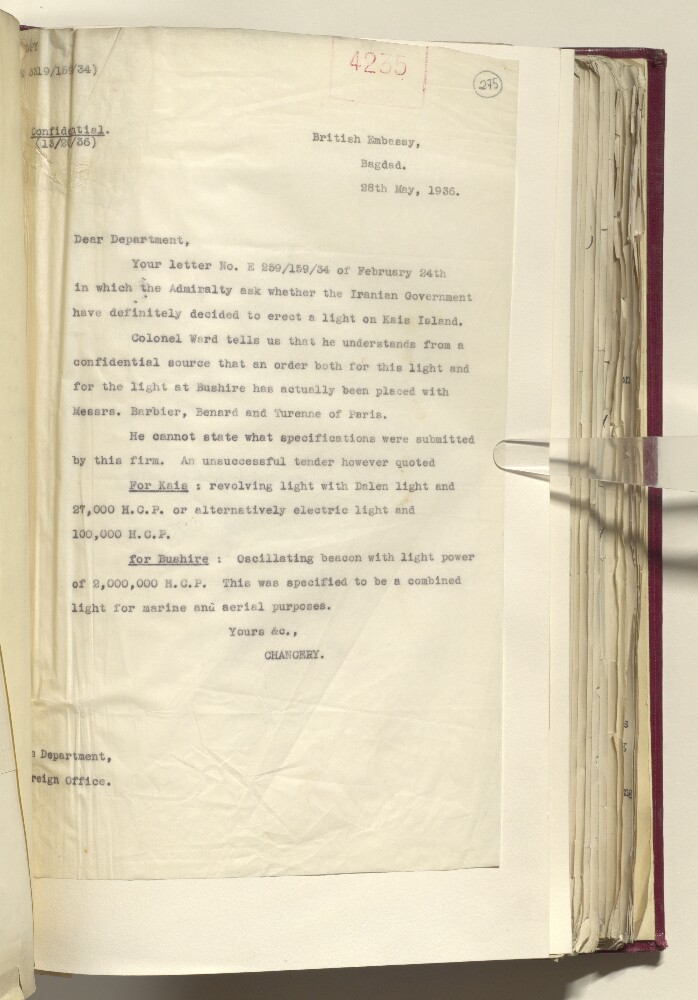
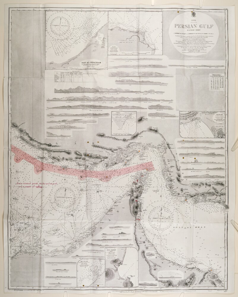
Abstract: A map of the Eastern Persian Gulf that was compiled by Commander C G Constable and Lieutenant Arthur William Stiffe in 1860. Corrections made by Commander Frederic H Walter, HMS Odin and Lieutenant H T Bowen, HMS Alert in 1910. This version was printed by the Admiralty in 1934. Engraved by J & C Walker.The maps has major settlements and relief marked, with water depth shown by soundings. An area of a proposed Royal Navy survey is marked in pink on the map.The map has detailed inserts showing the shore lines of Charak, Kais, Ras al-Khaimah, Hor [Khor] Fakkan, Abu Dhabi and Chiru.Physical description: Materials: Printed on paperDimensions: 1,100mm x 820mm
Abstract: A map of the Eastern Persian Gulf that was compiled by Commander C G Constable and Lieutenant A W Stiffe in 1860. Corrections made by Commander F H Walter, HMS
Odinand Lieutenant H T Bowen, HMS
Alertin 1910. This version was printed by the Admiralty in 1929. Engraved by J & C Walker.The map has major settlements and relief marked, with water depth shown by soundings. An area of a proposed Royal Navy survey is marked in pink on the map.The map has detailed inserts showing the shore lines of Charak, Kais, Ras al-Khaimah, Hor [Khor] Fakkan, Abu Dhabi and Chiru.Physical description: Materials: Printed on paperDimensions: 1,100mm x 820mm
Abstract: The Portugues Asia: or, The history of the discovery and conquest of India by the Portugues; containing all their discoveries from the coast of Africk, to the farthest parts of China and Japan; all their battels by sea and land, sieges and other memorable actions; a description of those countries, and many particulars of the religion, government and customs of the natives, &c. In three tomes. Written in Spanish by Manuel de Faria y Sousa, of the Order of Christ. Translated into English by Cap. John Stevens. Tome the First.Publication Details: London, Printed for C. Brome, at the Sign the Gun, at the West-End of St. Pauls, 1694.Physical Description: Octavo.Physical description: Dimensions: 185mm x 105mm
Abstract: The Portugues Asia: or, The history of the discovery and conquest of India by the Portugues; containing all their discoveries from the coast of Africk, to the farthest parts of China and Japan; all their battels by sea and land, sieges and other memorable actions; a description of those countries, and many particulars of the religion, government and customs of the natives, &c. In three tomes. Written in Spanish by Manuel de Faria y Sousa, of the Order of Christ. Translated into English by Cap. John Stevens. Tome the Third.Publication Details: London, Printed for C. Brome, at the Sign the Gun, at the West-End of St. Pauls, 1694.Physical Description: Octavo.Physical description: Dimensions: 185mm x 105mm