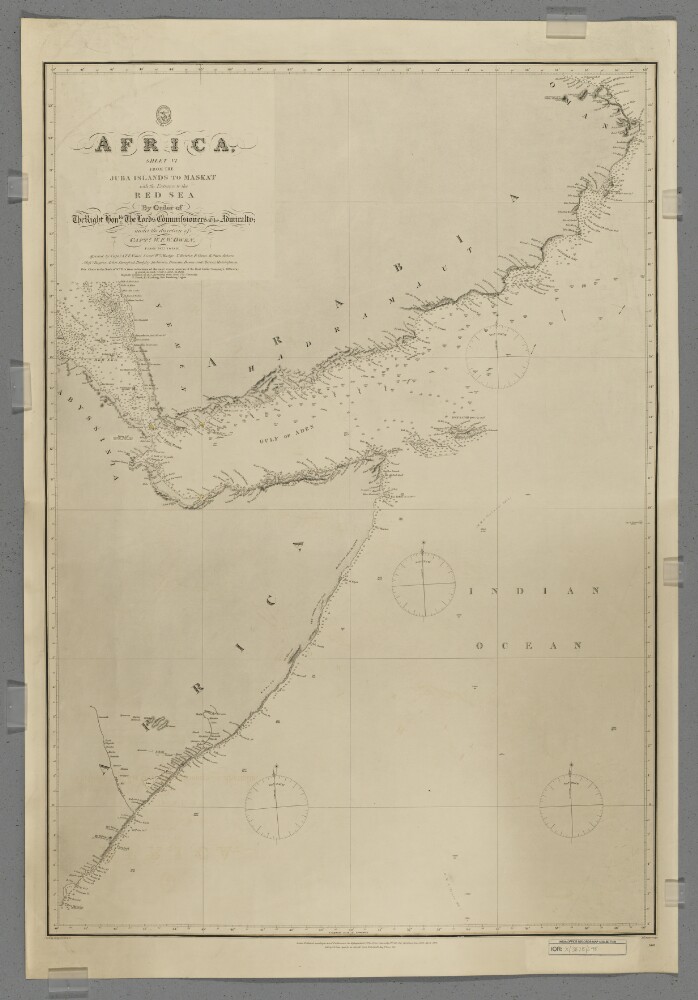
1. 'Africa, Sheet VI from the Juba Islands to Maskat with the Entrance to the Red Sea' Creator: Cartographer: J & C Walker Date: 1877/1877 Language: English Geographic region: Juba Islands
2. 'Papers relating to Seas, Rivers and Countries connected with Steam Navigation in Asia' Date: 1811/1834 Language: English Geographic region: Indus RiverBurrampooter RiverPersian Gulf
3. 'Proceedings of Captain Chiefalla, of the Greek Privateer "Hellas" – Proclamation issued, forbidding British subjects from serving under any foreign flag against the Turks in India or the Red Sea' Date: 1829/1830 Language: English Geographic region: MochaMahéGoaRed Sea
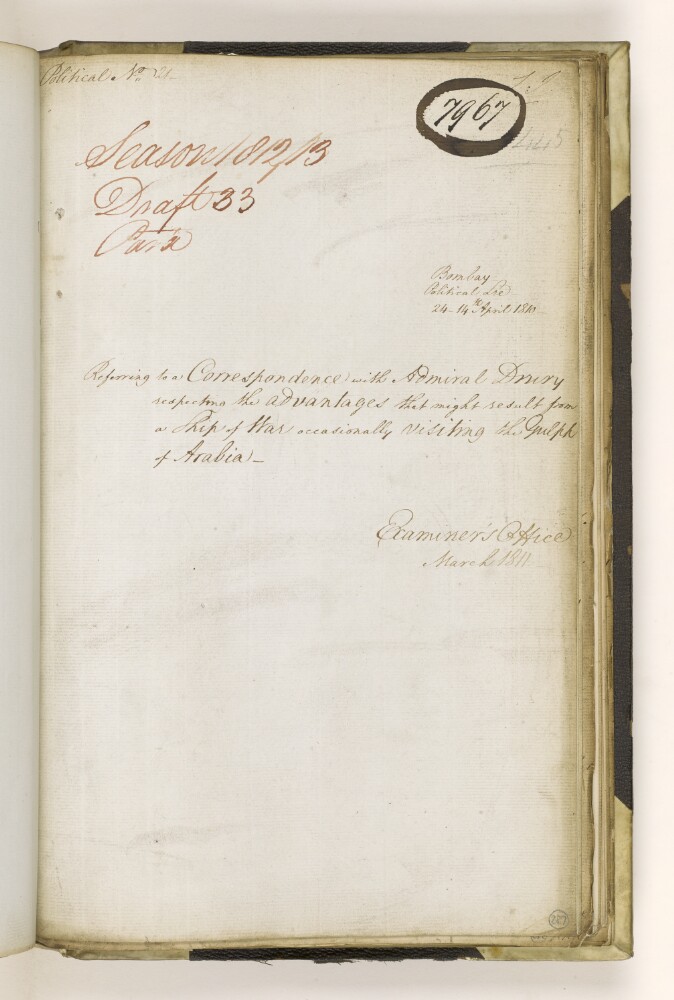
4. 'Referring to a Correspondence with Admiral Drury respecting the advantages that might result from a Ship of War occasionally visiting the Gulph of Arabia' Date: 1810/1810 Language: English Geographic region: Red Sea
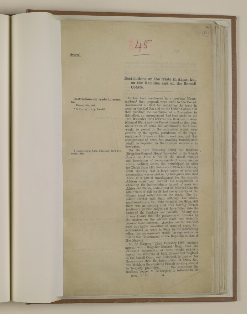
5. 'Restrictions on the trade in arms, &c., on the Red Sea and on the Somali Coasts' Date: 1887/1887 Language: English Geographic region: AdenRed SeaSomali Coast
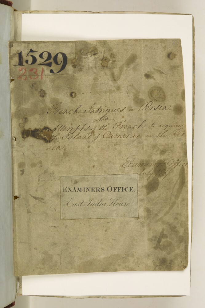
6. 'French intrigues in Persia and Attempts of the French to acquire the Island of Cameran in the Red Sea' Date: 1804/1807 Language: English Geographic region: MochaRed SeaCameran
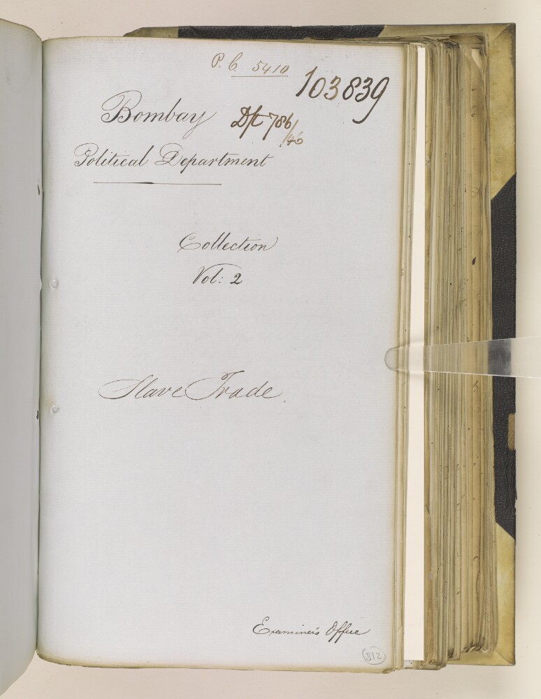
7. ‘Slave Trade – Carried on between Abyssinia & the different Ports in the Red Sea.’ Date: 1837/1841 Language: English Geographic region: Massowah HarbourBurbarraRed SeaAbyssinia
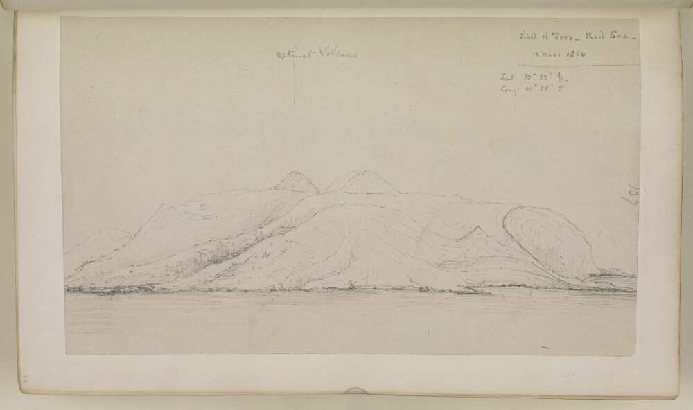
9. ‘Jibel el Teer – Red Sea. 13 Novr 1850’ Date: 1850/1850 Language: English Geographic region: Red SeaSouth Africa
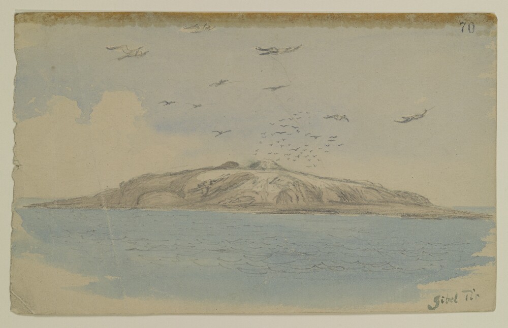
10. 'Gibel Tir', by Sir Henry Yule (1820-1899) Date: 1844/1844 Language: English Geographic region: Red Sea
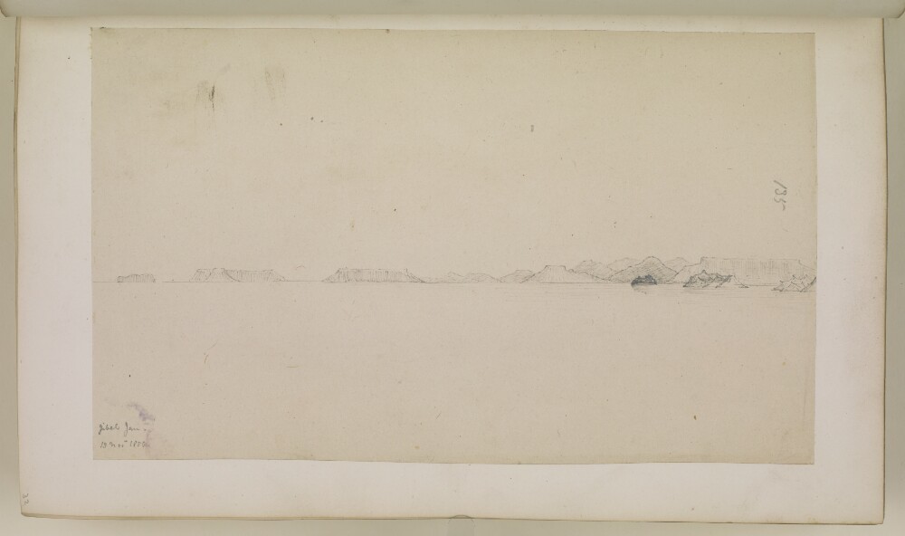
11. ‘Jibel Jan – 13 Novr 1850.’ Date: 1850/1850 Language: English Geographic region: Red SeaSouth Africa
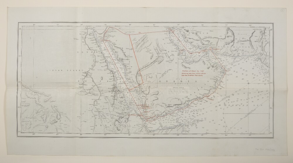
12. 'Portion of Chart No. 748B showing sea line within which lies the Arabian Peninsula.' Creator: Cartographer: Edward James PowellCartographer: Davies, Bryer & Co Date: 1917/1919 Language: English Geographic region: Arabian PeninsulaPersian GulfGulf of AdenRed Sea