Abstract: The file is concerned with the supply of food – in the form of cereals and dried fruit – to the Persian Gulf States (Bahrain, Kuwait, Muscat, and the Trucial Coast) and eastern Saudi Arabia, during the Second World War (1939-1945) and its aftermath. This involves correspondence discussing the minimum requirements of these states, sources of supply, and the availability of shipping.Specific policy questions included in the file are: the search for alternative sources of cereals as a result of the ban on exports from India following the Bengal Famine of 1943-1944; the question of whether the British Government should subsidise Iraqi cereals supplied to the Persian Gulf to match the price of cereals previously imported from India; the question of using oil tankers to ship wheat to Bahrain; and proposals for increases in the tea and sugar quotas for the Persian Gulf States in order to facilitate barter trade with Persia [Iran].The problem of global rice shortages also receives attention in the file; rice supplies to the Persian Gulf were completely cut off following the Indian export ban. This includes attempts to try to restore the supply of rice, such as an effort by the Gulf States to purchase rice from Persia in 1945. A note prepared by Colonel Harold Richard Patrick Dickson on the dietary problems of the Bedouin of Kuwait and north-east Arabia resulting from the cessation of rice imports can be found on folios 136-140.The main correspondents are as follows: the Political Resident in the Persian Gulf (Percy Gordon Loch, Charles Geoffrey Prior, and Arnold Crawshaw Galloway), officials of the Foreign Office, officials of the India Office (from August 1947 the Commonwealth Relations Office), officials of the Middle East Supply Centre, officials of the Ministry of Food, officials of the Ministry of War Transport, officials of the Treasury, and representatives of the Government of India – in the Commercial, External, and Food departments respectively.The file includes a divider which gives a list of correspondence references contained in the file by year. This is placed at the back of the correspondence.Physical description: Foliation: the foliation sequence (used for referencing) commences at the inside front cover with 1, and terminates at the last folio with 406; these numbers are written in pencil, are circled, and are located in the top right corner of the recto side of each folio.
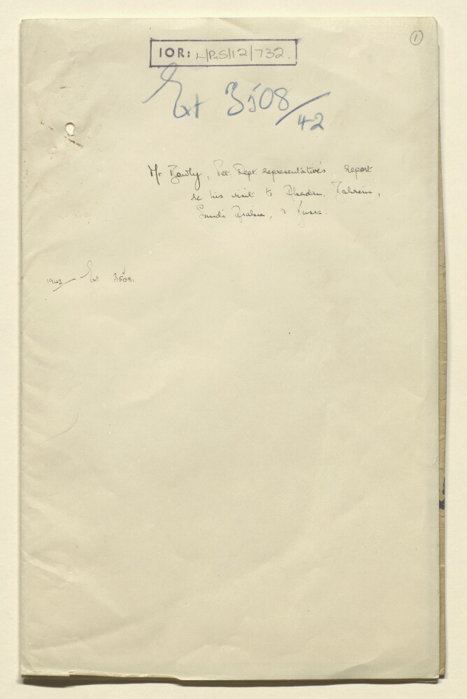
Abstract: The file contains a report by Hugo Salvin Bowlby, Petroleum Department representative in Baghdad, on his visit to Abadan, Bahrain, Saudi Arabia and Basra, forwarded by Petroleum Department to the India Office. The report describes visits to oil fields in Bahrain and Saudi Arabia, in June 1942.Physical description: Foliation: the foliation sequence commences at the front cover with 1 and terminates at the inside back cover with 7; these numbers are written in pencil, are circled, and are located in the top right corner of the recto side of each folio.
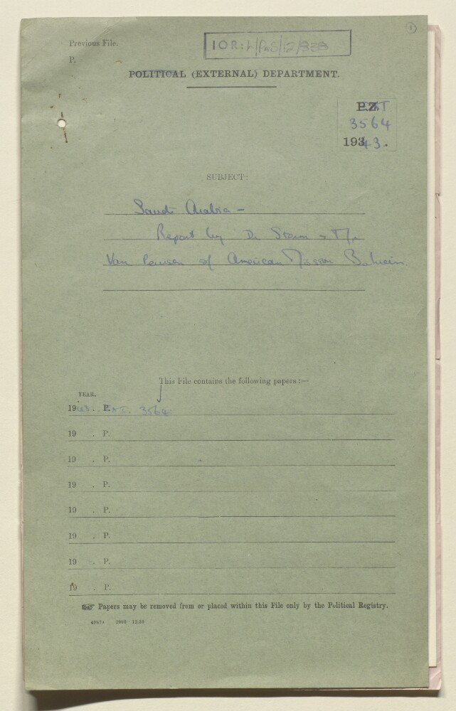
Abstract: This file contains a report about the American Mission Hospital in Bahrain.The report is divided into six parts. Its contents include:• A summary of the medical tour in Saudi Arabia.• An account of the conditions of the city, food and people.• Public sentiment towards news of the war.• A discussion on the King• The fee for medical services.Physical description: Foliation: the foliation sequence (used for referencing) commences at the front cover with 1, and terminates at the inside back cover with 5; these numbers are written in pencil, are circled, and are located in the top right corner of the recto side of each folio.
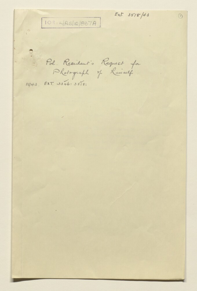
Abstract: This file consists of letters between Graves Law, Ministry of Information, Roland Tennyson Peel and E W R Lumby, and the India Office which discuss photographing Lieutenant-Colonel Sir Geoffrey Prior, the Public Relations Officer in the Persian Gulf.Physical description: Foliation: the foliation sequence (used for referencing) commences at the front cover with 1, and terminates at the inside back cover with 10; these numbers are written in pencil, are circled, and are located in the top right corner of the recto side of each folio.
Abstract: This file contains papers that discuss to find suitable school teachers to work in Saudi Arabia at the request of the Saudi Government. The papers indicate that these efforts were conducted with the help of the British Council, which looked into finding possible candidates in both Sudan and India. The denomination of the teachers appears a matter of concern in the papers.Physical description: Foliation: the foliation sequence (used for referencing) commences at the front cover with 1, and terminates at the inside back cover with 28; these numbers are written in pencil, are circled, and are located in the top right corner of the recto side of each folio.
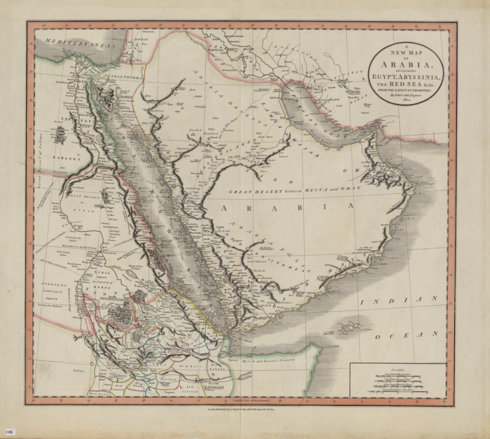
Abstract: John Cary (circa 1754−1835) was a leading London engraver, map-, chart- and print-seller, and globe maker, active between 1787 and 1834. This map of 1804 shows the Arabian Peninsula and neighboring parts of Africa and the Middle East. Important caravan routes are marked, including the “route of the grand caravan of Sudan from the Niger to Cairo,” “route of the caravan from Batsora [Basra] to Aleppo,” “caravan of Darfowar [Darfur] to Mecca by Dongola,” “caravan of Sudan directly to Mecca by Suakem,” and several other caravan routes to Mecca. Many African kingdoms are shown, their borders marked with colored lines, as is a speculative source of the Nile. The northern coast of Somalia is called “Myrrh and Incense Country.” The zigzag line in the Red Sea indicates the course of La Venus, a French frigate that sailed on a voyage of discovery in the Red Sea, Persian Gulf, and Indian Ocean in 1785−88. The map includes many other notes that reflect the state of European geographic understanding of this region at the beginning of the 19th century. Four distance scales are given: great Arabian miles, Persian parasangs, British statute miles, and common French leagues.Physical description: 1 map : hand colored ; 44 x 50 centimeters
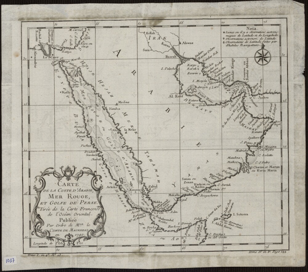
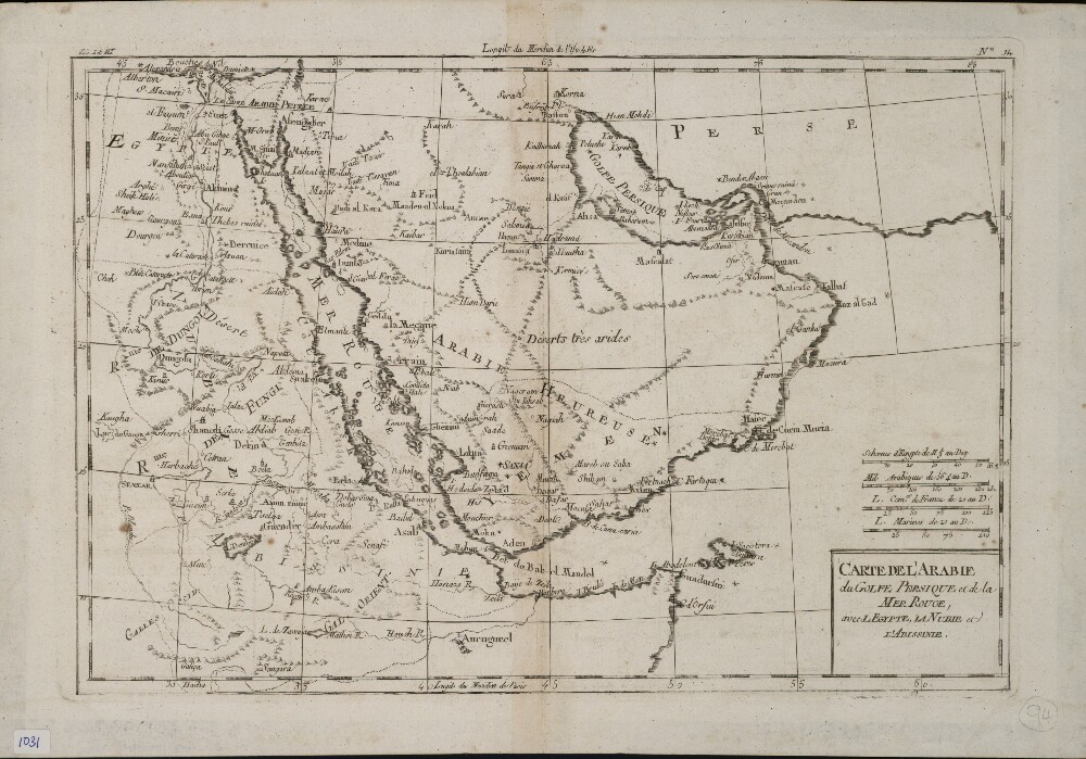
Abstract: This 1740 map is by the French cartographer and hydrographer Jacques-Nicolas Bellin (1703-72). It was published by order of Jean-Frédéric Phélypeaux, Count de Maurepas (1701-81), secretary of state under King Louis XV. The map focuses exclusively on the coastlines, and provides no detail about the interior of the Arabian Peninsula. It shows pearl banks along the coast from Bahrain to Julfar. Qatar is noted (“Katara”), but the peninsula that it occupies is not accurately drawn. Kuwait is not shown, but the island of “Peleche” is indicated. The Red Sea is indicated as Mer Rouge ou Golfe d’Arabie (the Red Sea or the Gulf of Arabia). The note at upper right explains the use of three different symbols: a star to indicate places whose locations had been determined by astronomical observations of latitude and longitude; a cross to indicate places whose locations had been determined by astronomical observations of (only) latitude; and a modified cross to indicate places whose locations had been determined by latitudinal observations made by skilled navigators.Physical description: 1 map; black and white; 20.50 x 23.50 centimeters
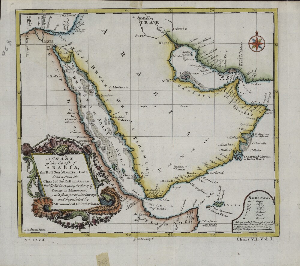
Abstract: This English map is a reprinting, with slight changes, of an earlier French map published in 1740 by order of Jean-Frédéric Phélypeaux, Count de Maurepas (1701-81), secretary of state under King Louis XV. The map was drawn from an earlier chart of the Eastern Ocean, “improv’d from particular surveys and regulated by astronomical observations.” This English edition of the de Maurepas map has a different title cartouche. The “Remarks” section at the lower right gives abbreviations for physical features on the map, and notes: “ A Stroke under ye Name of a Place denotes ye Latitude having been Observed by Astronomers, and a Prict [sic] Line by skilful Navigators.” Longitude is measured in degrees east of the “Isle de Fer” (Ferro, in the Canary Islands). Town names are as they appeared on the earlier French map. The Red Sea is listed as the “Red Sea or Arabic Gulf.”Physical description: 1 map; color; 22 x 24 centimeters
Abstract: This map of the Arabian Peninsula, published in 1720, shows Arabia Felix, Arabia Deserta, and Arabia Petraea. Other regions included are Palestine, Mesopotamia, Chaldea, Persia, Aegyptus, and Aethiopia. A large number of towns are shown. The title cartouche includes nine vignette coins. The tribal and town names on the map are those used by Ptolemy. Some are used more than once, with variations. Thus “Indicara,” “Iacara,” “Ichara,” and “Aphana” all could indicate the same place: the spot where Alexander the Great intended to build a capital on an island in the Arabian Gulf, enabling him to control the trade of the region and extend his empire (a scheme that he was unable to accomplish before he died). Archeological research suggests that this place was Failakah Island in present-day Kuwait, although some historians place it at Abu Ali Island. The map shows a peninsula near present-day Bahrain. The islands of “Arathos” and “Thylaso” indicate Muharraq and Bahrain islands, respectively, which are actually located north of Qatar. On this map, they are placed on the Persian coast side, probably because the cartographer confused them with “Hormuz” and “Qishm.” Qatar is mentioned on the map as “Catara,” but its shape and location are not accurate. The map is by Christoph Weigel, a German engraver, art dealer, and publisher.Physical description: 1 map; color; 35.90 x 29.30 centimeters
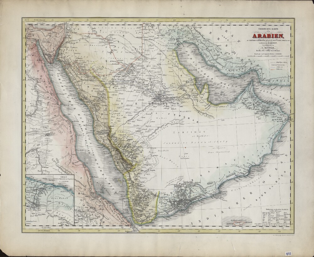
Abstract: German geographer and cartographer Heinrich Kiepert (1818–99) is generally regarded as one of the most important scholarly cartographers of the second half of the 19th century. He was head of the Geographical Institute in Weimar between 1845 and 1852 and professor at the University of Berlin from 1852 until his death. Shown here is Kiepert’s 1852 map of Arabia. As indicated in the title, it is based on “C. Ritter’s geography book.” The latter refers to Die Erdkunde im Verhältnis zur Natur und zur Geschichte des Menschen (Geography in relationship to nature and to the history of humanity), the pioneering 23-volume work of scientific geography published between 1822 and 1859 by the German geographer Carl Georg Ritter (1779−1859). The map contains a wealth of geographic and historical information, including pilgrimage (hajj) routes, the routes in northern Arabia of the explorers George Forster Sadlier (1819) and Georg August Wallin (1848), and explanations in German of Arabic geographic expressions, with abbreviations. At the lower left is an inset map of Oman, which provides much detail, including the routes taken by French naturalist Pierre-Martin-Rémi Aucher-Eloy and East India Company naval officer James Raymond Wellsted. The map was lithographed by the firm of Heinrich Mahlmann (1812−48) and published by Dietrich Reimer, with whom Kiepert had a long association.Physical description: 1 map : lithograph ; 47 x 36 centimeters
Abstract: This map of the Arabian Peninsula and surrounding areas was most likely created by the French cartographer and hydrologist Rigobert Bonne (1727−94). It is probably a proof copy of the map of the same title published in his Atlas des toutes les parties connues du globe terrestre (Atlas of all known land surfaces of the globe). The Arabian Peninsula is the main focus of the map, but it also covers much of the Nile Valley on the western shore of the Red Sea. The atlas was created to serve the global commercial and political interests of European traders and officials. Rigobert Bonne was one of many outstanding French cartographers of the 18th century. Self-taught in mathematics, he rose in the French administration to become chief hydrologist of the state Maritime Department. As a theoretician, he published a revision of global cartographic projection entitled Principes sur les mesures en longueur et en capacité (Principles of measurement of length and volume), a copy of which he sent to Thomas Jefferson in 1790 for discussion at the American Philosophical Society.Physical description: 1 map ; 21 x 31 centimeters
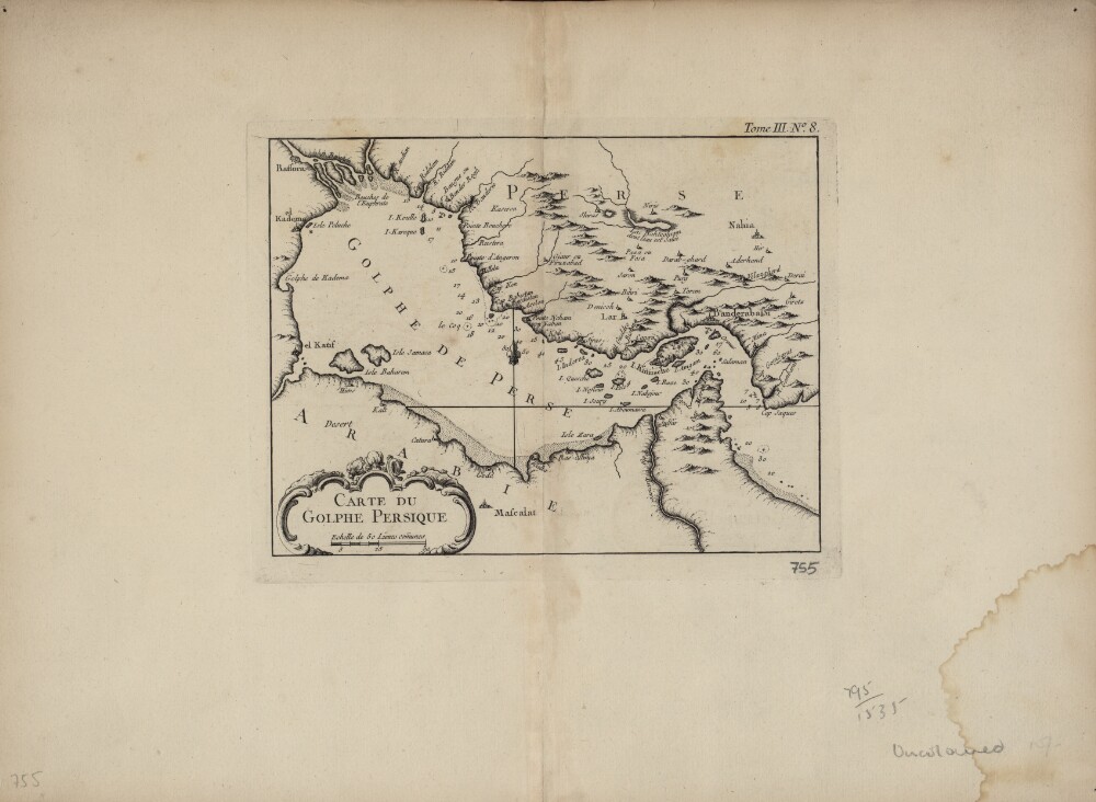
Abstract: This map of the Persian Gulf is by the French cartographer Jacques-Nicolas Bellin (1703−72). Qatar is shown as Catura. Cities on both the Arabian and Persian sides of the gulf are indicated, and the map shows a river emptying into the gulf at the port of Julfar (present-day Ra's al-Khaymah, United Arab Emirates). The scale is in common leagues, and there are no latitudinal or longitudinal lines. Trained as a hydrographer, Bellin was attached to the French Marine Office and specialized in producing maritime maps showing coastlines. His maps were in the tradition of Nicolas Sanson (1600–1667), the royal geographer to Kings Louis XIII and Louis XIV commonly known as the father of French cartography, and of Guillaume de l'Isle (1675−1726), one of a group of French cartographers that wrested mapmaking preeminence from the Dutch in the late 17th century. Like Sanson and de l’Isle, Bellin placed great emphasis on scientific accuracy rather than on artistic beauty for its own sake. In 1764, he published Le Petit Atlas Maritime: Recueil de Cartes et de Plans des Quatre Parties du Monde (Small maritime atlas: collection of maps and charts of the four parts of the world), a work in five volumes containing 581 maps. This map appeared as plate 8 in volume 3 of this work, containing maps of Asia (part I) and Africa (part II).Physical description: 1 map : copper engraving ; 22 x 17 centimeters