Skip to search
Skip to main content
Skip to first result
Digital Library of the Middle East
Show facets
Hide facets
English
العربية
Contact us
Contact us
To contact us about any matter related to DLME, please use the form below.
Message
Your name
Ignore this text box. It is used to detect spammers. If you enter anything into this text box, your message will not be sent.
Your email
Cancel
Digital Library of the Middle East
Preserve. Access. Inspire.
Home
Explore
Contributors
About
Search in
Everything
Title
Creator / Contributor
Identifier
search for
Search
Home
Search results
Search
Search Constraints
Start Over
You searched for:
Spatial
بحر العرب
✖
Remove constraint Spatial: بحر العرب
1
-
10
of
10
Sort
by Relevance
Relevance
Title
Creator
Date (old to new)
Date (new to old)
Number of results to display per page
12
per page
per page
12
per page
24
per page
48
per page
96
per page
View results as:
List
Gallery
Slideshow
Search Results
×
‘Persian Gulf. Abolition of the Slave Trade in the Principal ports of-’
1 of 10
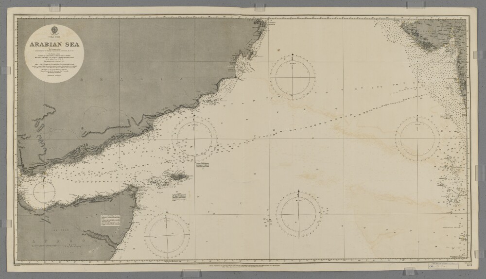
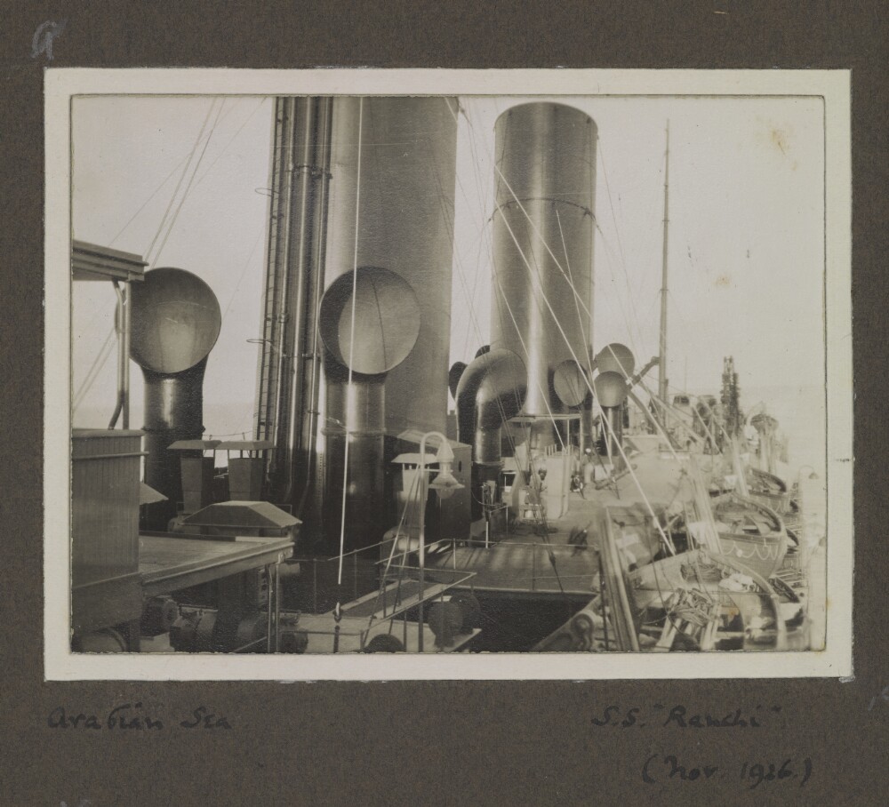
'Arabian Sea'
2 of 10
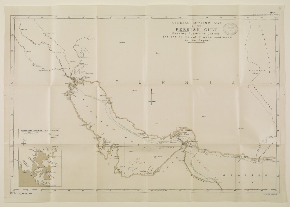
'GENERAL OUTLINE MAP OF THE PERSIAN GULF Showing Submarine Cables and the Principal Places mentioned in the Report.'
3 of 10
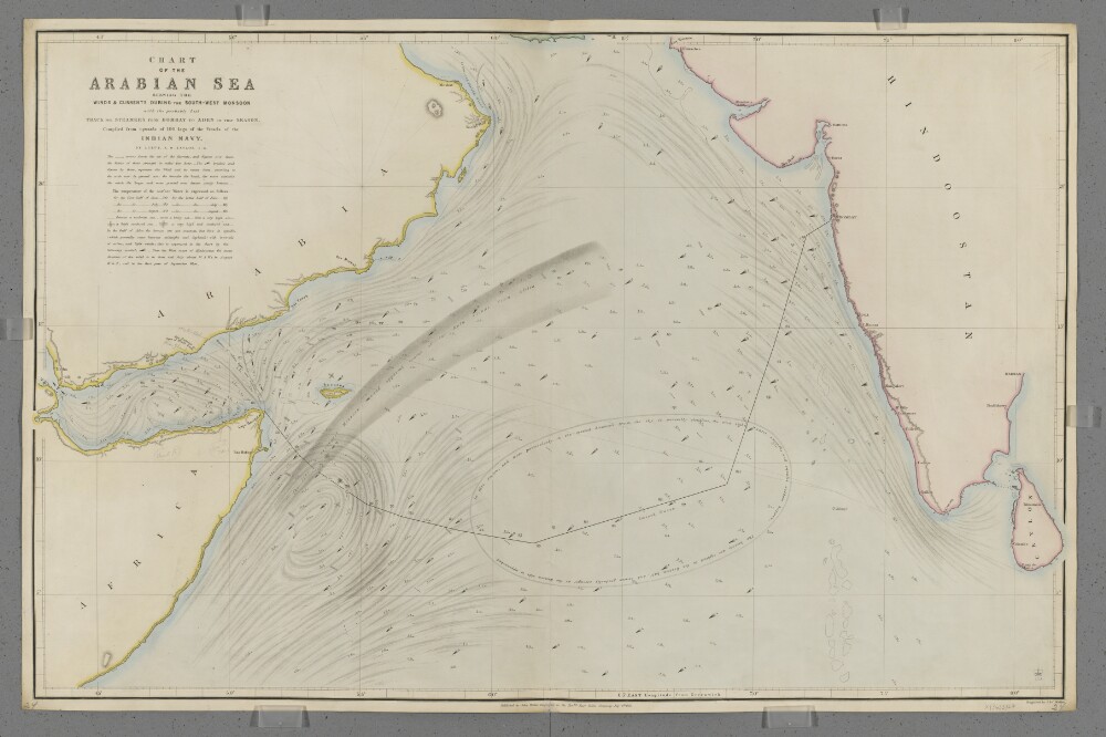
'Chart of the Arabian Sea Shewing the Winds & Currents during the South-West Monsoon with the probably best Track for Steamers from Bombay to Aden in that Season.'
4 of 10
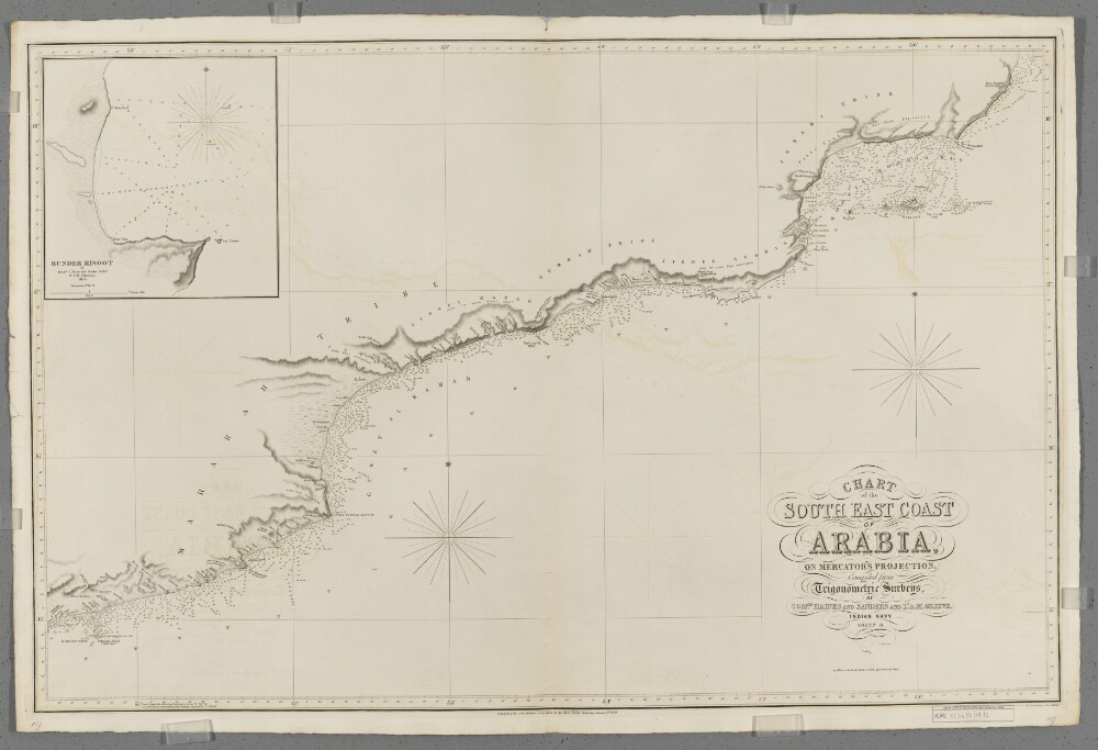
'Chart of the South East Coast of Arabia'. Sheet II
5 of 10
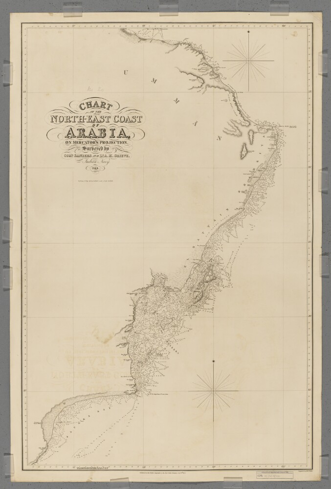
'Chart of the North-East Coast of Arabia'
6 of 10
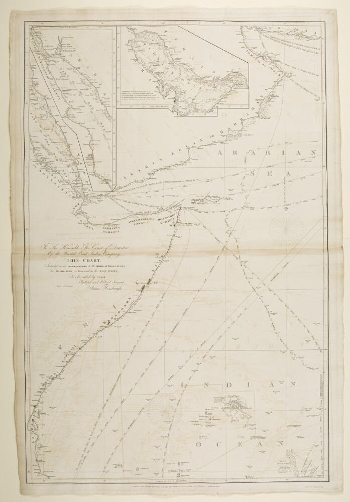
‘Chart Intended as an Accompaniment to the Book of Directions for Navigating to, from, and in the East Indies. Engraved by John Bateman’
7 of 10
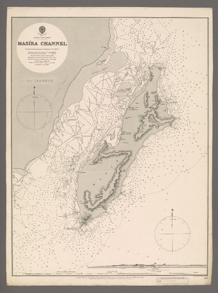
'Masira Channel'
8 of 10
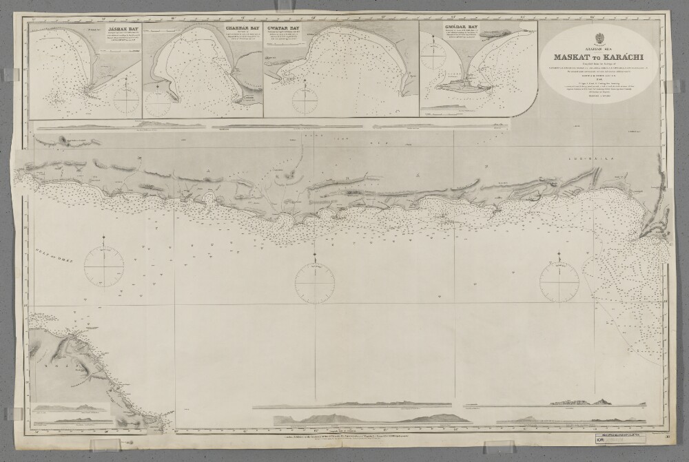
'Maskat to Karachi'
9 of 10
Album of views in India, the Middle East and Europe. Photographer: Rev. Edwin Aubrey Storrs-Fox
10 of 10