1 entry found
Number of results to display per page
Search Results
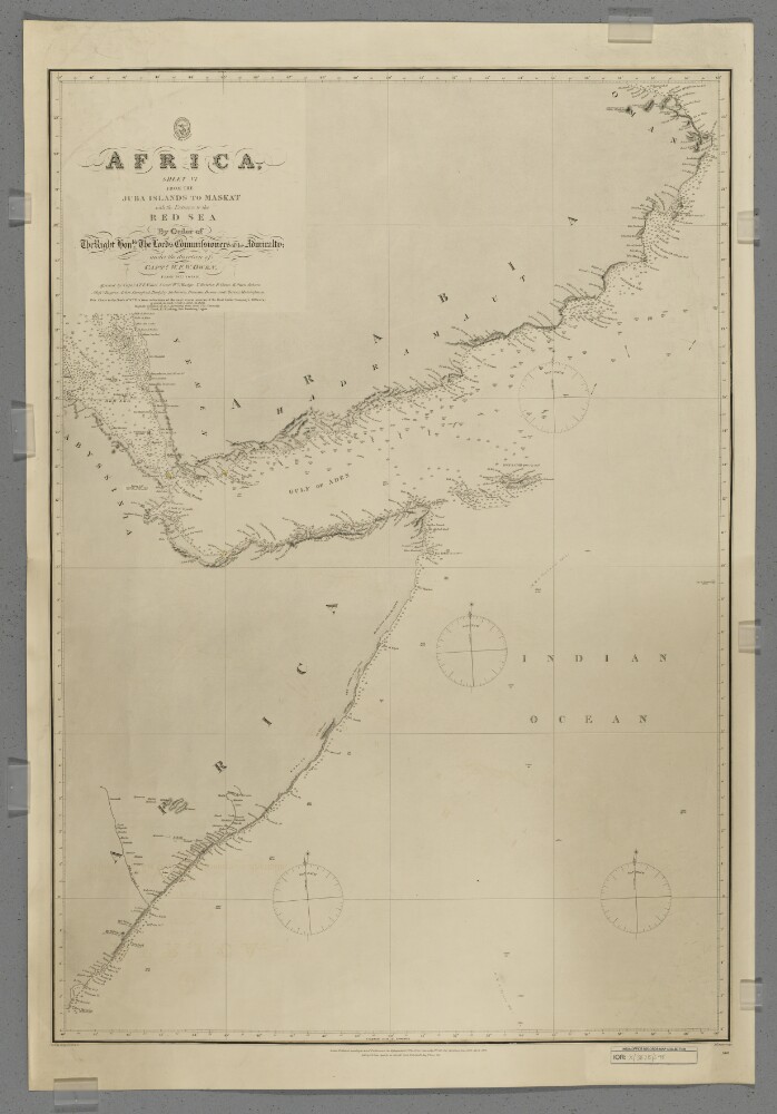
1. 'Africa, Sheet VI from the Juba Islands to Maskat with the Entrance to the Red Sea'
- Description:
- Abstract: Chart 598.Hydrographic chart covering the Horn of Africa north of the Juba [Bajun] Islands, the southern coast of the Arabian Peninsula to Maskat [Muscat], the western Indian Ocean, the Gulf of Aden and the southern Red Sea. Portrays hydrology, including depths by soundings and some contours, sands and rocks, relief by hachures and occasional spot heights, settlements and place names, and includes topographical notes and navigational aids, including lights highlighted in watercolour.Chart compiled under the direction of Captain William Fitzwilliam Owen from 1822 to 1826, assisted by Captain Alexander Thomas Emeric Vidal and lieutenants William Mudge, Thomas Boteler, Richard Owen, Edward Owen Johnes and Messrs Rogier, Arlett, Durnford, Badgley, Robinson, Bowen and Mercer, Midshipmen. North of 10°N the chart is compiled from reductions of more recent surveys by 'the East India Company's Officers'. Engraved by J & C Walker. Published by the Admiralty 1827, with corrections 1868, 1873, 1875, November 1876, December 1876, May 1877 and September 1877.Physical description: Materials: Printed, with watercolour additions, on paperDimensions: 870 x 600mm, on sheet 982 x 669mm