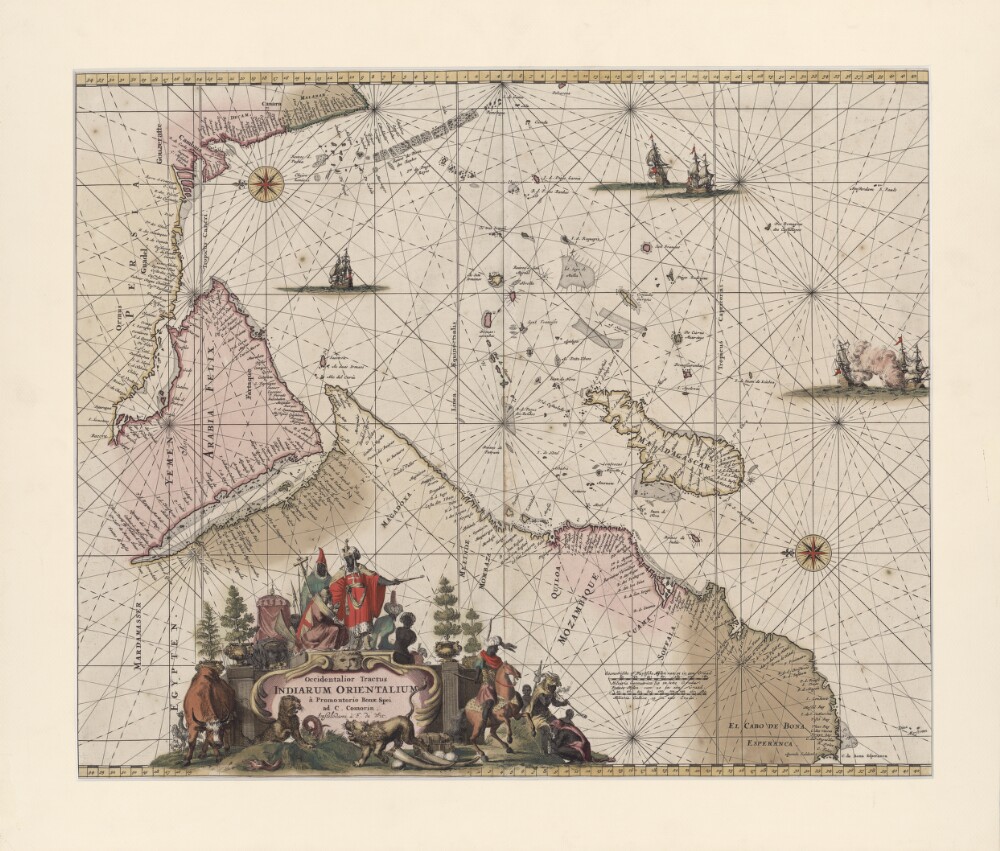
Abstract: This portolan map by the Dutch engraver, publisher, and map seller Frederick de Wit (1629 or 1630-1706) shows the Indian Ocean from the Cape of Good Hope to the west coast of India (Malabar). The map was first published in 1675 and was reprinted in 1715. It is oriented with east at the top. Kishm is placed in the present-day United Arab Emirates (UAE) and repeated as “Quaro” and “Quiximi.” The shape of the Arabian or Persian Gulf differs from that shown on other maps. There is a big island north of Bahrain Island named “Quezimi,” most likely another version of Qishm. Khorfan is shown twice: at one location in the present-day UAE in the Gulf of Corsca and the second on the Omani side, where it is called “Orfacan.” Mascalat, the region, is located at the center of the Arabian Peninsula, while the town of the same name is found south of Tablan, not far from the Arabian coast. “Ormuz,” a territorial name, is found around Oman and the present-day UAE. The Arabian Gulf is called “Mare Elcatif ol Sinus Persicus” (Al Qatif, Persian Gulf), while the Red Sea is marked “Mare Rubrum turcis Mare de Mecca olim Sinus Arabicus” (Red Sea, named Sea of Mecca by Turks and formerly known as the Arabian Gulf).Physical description: 1 map; color; 42 x 53.5 centimeters