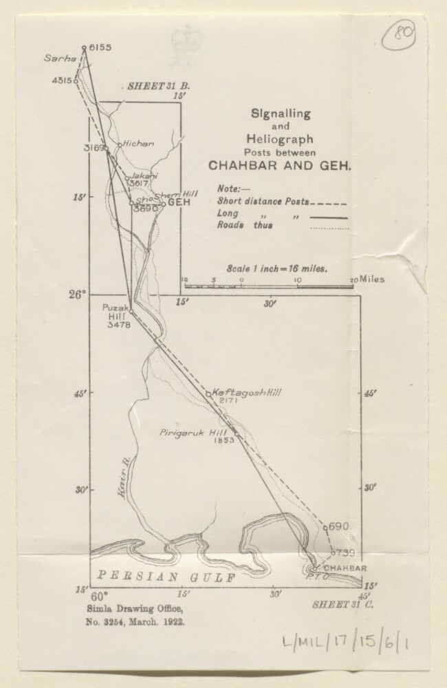
Abstract: The map accompanies
MILITARY REPORT on PERSIA Vol. IV Part I. and shows a region of southern and eastern Persia, indicating short and long distance signalling and heliograph posts between Chahbar [Chahabar] and Geh [Nīkshahr] and points further north. Also shows roads and hydrology.The map bears a printing statement which reads 'Simla Drawing Office. No. 3254, March. 1922.'.Physical description: Materials: Printed on paperDimensions: 153 x 80mm, on sheet 185 x 116mm