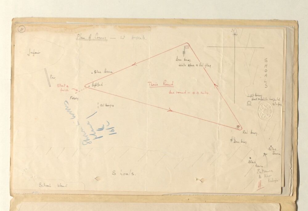
Abstract: Distinctive Features:Hand drawn rough sketch map produced for sailing race which took place off the coast of Sitrah Island, Bahrein, on the 6th February 1936. The race course shown in red line with location of beacons and buoys marked and shoals labelled. Details of the race provided on folio 3.Physical description: Materials:Pen and ink with additions in pencil on paperDimensions:203 x 330 mm
Abstract: Imprint:Reduced and lithographed in the Chief Engineer’s Office by Kumbroodeen E. & F.D. Jesus, Bombay 3d Oct.r 1855.Distinctive Features:Plan originally produced to accompany a report on Bassadore prepared by Captain Thomas Remon, Bombay Engineers.Depth shown by soundings in fathoms with areas partly dry at low water indicated.Along the top a birds-eye view of the settlement with landmarks labelled.Physical description: Dimensions:313 x 248 mm, on sheet 350 x 286 mm
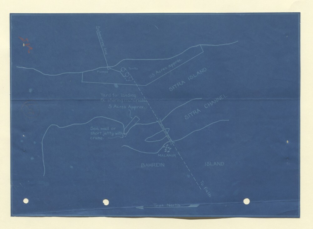
Abstract: Distinctive Features:Blueprint sketch map compiled from a rough survey carried out by the Bahrain Petroleum Company, attached to a copy of a letter dated 7 December 1933 (folios 215-216).Shows land on Sitrah Island intended for the installation of the Bahrain Petroleum Company’s equipment including pumping plants, submarine line and oil tanks.Physical description: Dimensions:200 x 285 mm