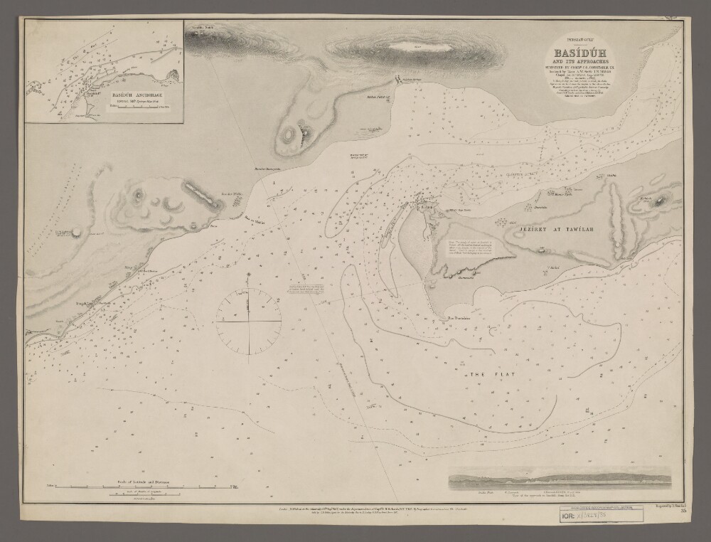
13. 'Basiduh and its Approaches' Creator: Cartographer: Edward Stanford Date: 1869/1869 Language: English Geographic region: QeshmClarence StraitPersian GulfBasiduh
14. ‘Relative to the Occupation of the Island of Kishm vol 1’ Date: 1819/1823 Language: English Geographic region: BahreinKishm
15. ‘Relative to the Occupation of the Island of Kishm vol 2’ Date: 1821/1822 Language: English Geographic region: Kishm
16. 'Persia: Railway Construction; Negotiations between the Persian Govt. and the Anglo-Persian Oil Co; Acquisition of Gulf Islands' Date: 1919/1921 Language: English Geographic region: BagdadQeshmAbadan
17. ‘Slave Trade in the Red Sea & Persian Gulf. Vol: 2’ Date: 1844/1844 Language: English Geographic region: MuscatKishm
18. ‘Cession by the King of Persia to the French of the Port of Gombroon.’ Date: 1807/1808 Language: English Geographic region: OrmusKharickKishmGombroon
19. Jonasand Lion: Journal on Jonasand Lion, Richard Swanley Date: 1621/1623 Language: English Geographic region: KishmeCombromMocha
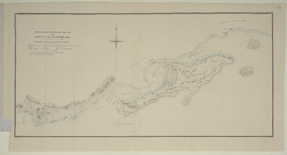
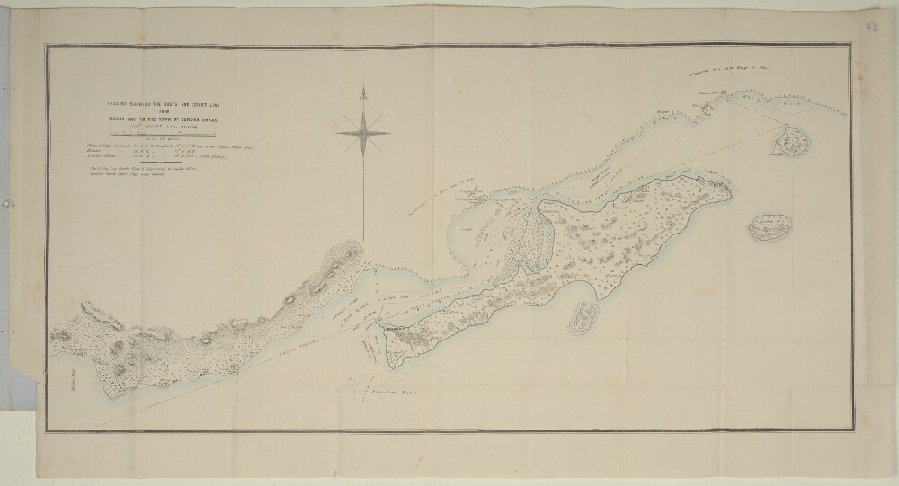
20. ‘TRACING SHOWING THE ROUTE AND COAST LINE FROM MOGOO BAY TO THE TOWN OF BUNDER ABBAS’ Date: 1864/1864 Language: English Geographic region: Bunder AbbasKishm
21. ‘TRACING SHOWING THE ROUTE AND COAST LINE FROM MOGOO BAY TO THE TOWN OF BUNDER ABBAS’ Date: 1864/1864 Language: English Geographic region: Bunder AbbasKishm
22. ‘FACTORY RECORDS: EARLY PAPERS ON PERSIA’, Pt 1 Date: 1621/1625 Language: English Geographic region: Keshm
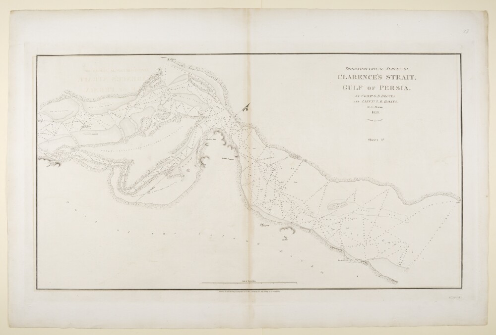
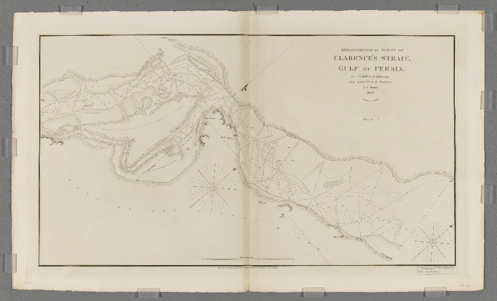
23. ‘Trigonometrical Survey of Clarence’s Strait, Gulf of Persia. By Commr. G.B. Brucks and Lieutt. S.B. Haines. H.C. Marine 1828. Engraved by R. Bateman. Sheet 1st’ Date: 1831/1831 Language: English Geographic region: KishmClarence Strait
24. 'Trigonometrical Survey of Clarence's Strait, Gulf of Persia. Sheet 1st.' Creator: Cartographer: Richard Bateman Date: 1831/1831 Language: English Geographic region: PersiaPersian GulfClarence StraitKishm