1 entry found
Number of results to display per page
Search Results
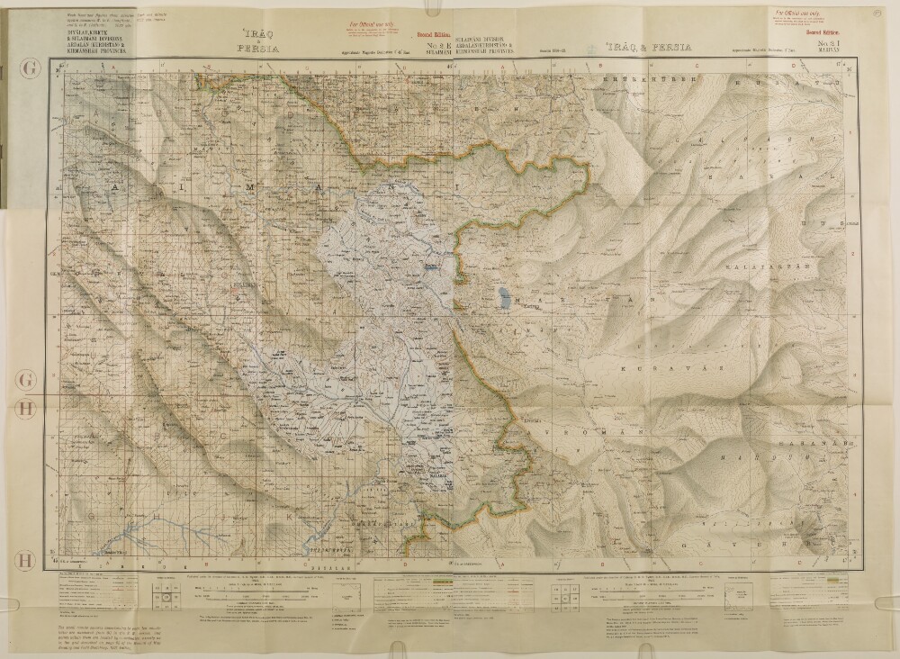
1. 'IRĀQ & PERSIA'
- Description:
- Abstract: The map is found in the Report of the Operations connected with the Occupation of Penjwin between April 18th and May 7th, 1927, promulgated by Command of the Air Council. It shows Diyālah [Ustān Diyālá], Kirkuk, and Sulaimāni [As Sulaymānīyah] divisions in Iraq; and Ardalān (Kurdistān) and Kirmānshah [Kermānshāhān] provinces in Persia. It indicates cities, towns and settlements, railways, telegraph lines, roads, tracks, paths, hydrology, relief with contours, and spot heights.Notes in the bottom margin describe the map compilation methodology, and contain an index to sheets, and two keys to symbols.The map consists of two sheets pasted together. A portion of a third sheet is pasted over the western half.Published under the direction of Colonel C H D Ryder, Surveyor General of India. Originally published in 1923, this 2nd edition with slight alterations was published in 1925. Heliozincographed at the Survey of India Offices, Calcutta.Physical description: Materials: Printed in colour on paperDimensions: 435 x 711mm, on sheet 583 x 801mm