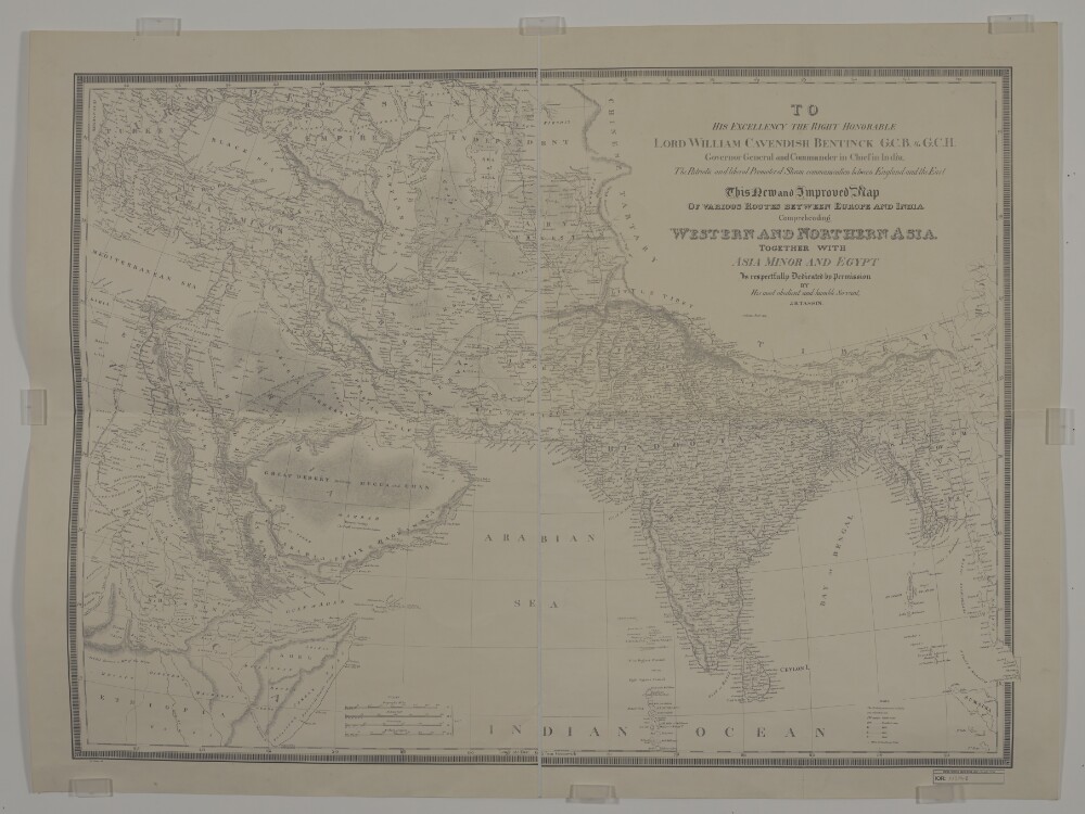
Abstract: Imprint:Calcutta, Jan.y 1834. J.B. Tassin lith.Distinctive Features:Relief shown by hachures.Map shows various routes between places of interest including caravan and pilgrim routes, with estimated journey times and location of wells reported. Notations concerning regions and their topography cover the face of the map. Includes a key to symbols and dedication from J.B. Tassin to Lord William Cavendish Bentinck Governor General and Commander in Chief in India.Physical description: Dimensions:743 x 1047 mm, on sheet 868 x 1158 mm
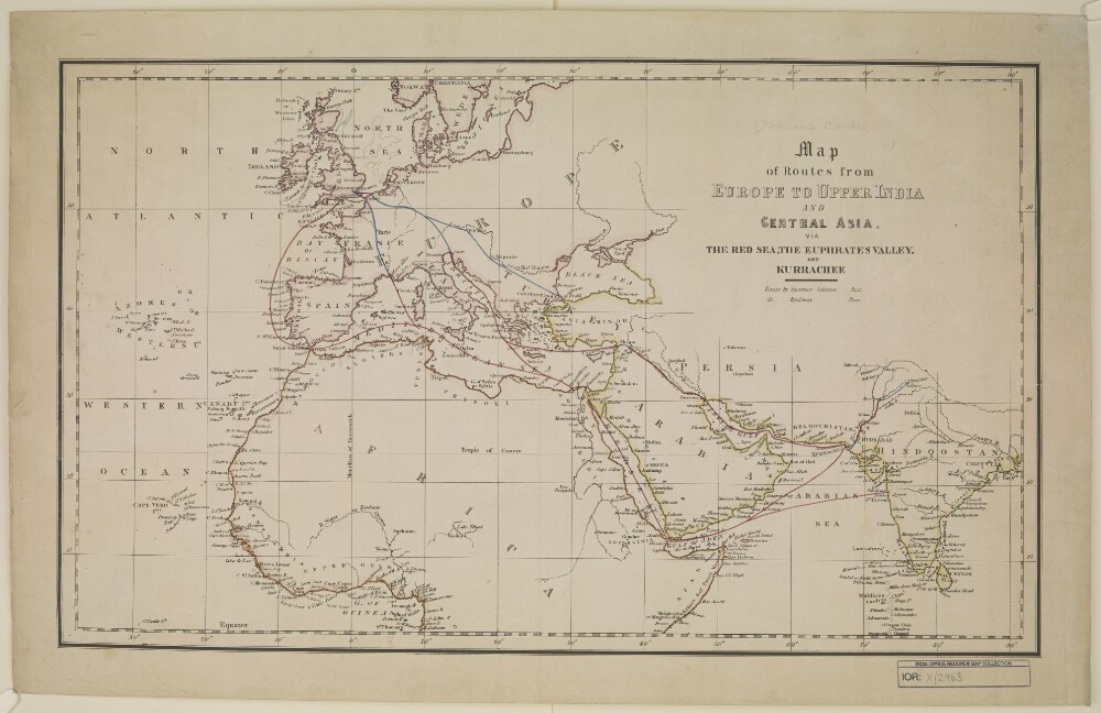
Abstract: Distinctive Features:Unsigned and undated.Land routes shown in blue with sea routes and waterways coloured red.Physical description: Dimensions:327 x 562 mm, on sheet 407 x 646 mm
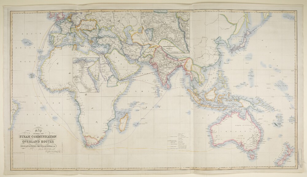
Abstract: Imprint:London, Wm. H. Allen & Co., 13 Waterloo Place, S.W.Distinctive Features:Includes two insets: ‘ROUTES between MEDITERRANEAN and RED SEA on an Enlarged Scale’ and ‘ROUTES between MEDITERRANEAN, BLACK SEA and PERSIAN GULF on an Enlarged Scale’.Routes shown in colour with a list of shipping companies and a key at bottom centre.Physical description: Dimensions:677 x 1237 m, on sheet 732 x 1296 mm
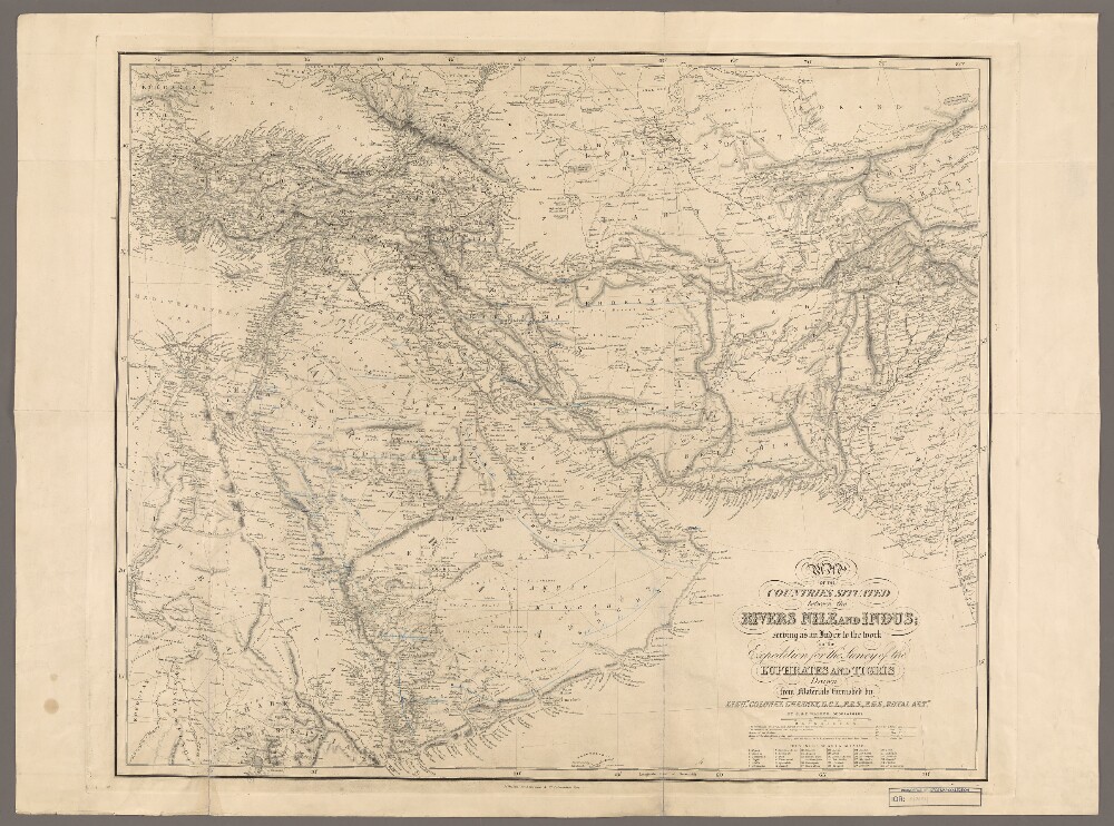
Abstract: Covers south-west Asia. Portrays hydrology, relief by hachures and some spot heights, roads and tracks, expedition and other historical routes, settlements, place names and administrative boundaries. A legend refers to the expedition and other historical routes as depicted in colour, although the colour is absent from this copy. Manuscript additions in coloured ink and crayon relate to place names.Drawn from materials furnished by Lieutenant-Colonel Francis Rawdon Chesney, Royal Artillery by J & C Walker, Geographers. Published by Longman & Co, London.Physical description: Materials: Printed, with additions in coloured ink and crayonDimensions: 598 x 730mm, on sheet 686 x 928mm
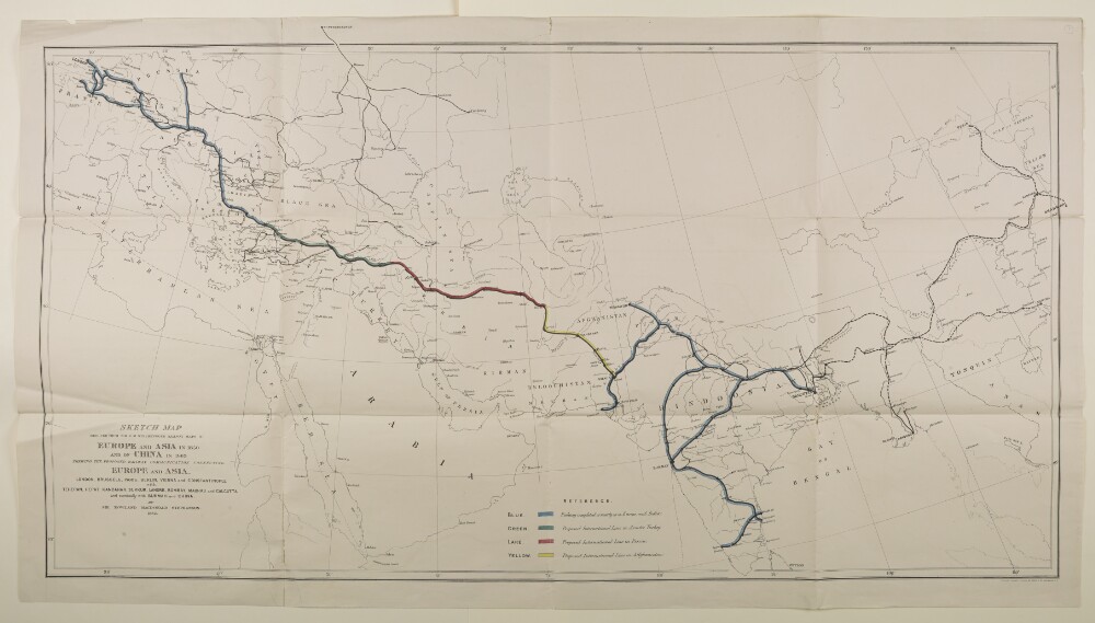
Abstract: Imprint:London, Connell Litho. 37 Castle St. Holborn E.C.Distinctive Features:Outline map showing the completed and proposed railway scheme in Europe and Asia, with lines coloured for reference and explained in a key provided in the lower centre of sheet.Below title the note: London, Brussels, Paris, Berlin Vienna and Constantinople with Teheran, Herat, Kandahar, Sukkur, Lahore, Bombay, Madras and Calcutta and eventually with Burmah and China.Physical description: Dimensions:630 x 1147 mm; on sheet 676 x 1220 mmFoliation:The map sheet has been foliated in the front top right hand corner of the folio with a pencil number enclosed in a circle.
ampliss viri D. N. Witsen pro majori parte aliis auctoribus excerpta et dita per F. de Witt.Covers Northeastern Russia, China, Korea, Japan, Turkestan, Kazakhstan, Tajikistan, Kyrgyzstan, Mongolia, Uzbekistan, Afghanistan, Pakistan and portions of Iran, India, China.Relief shown pictorially.Colored in outline.Appears in: Atlas nouveau contenant toutes les parties du monde, où sont exactement marqués les empires, monarchies, royaumes, états républiques &c; le tout recueilli par les meilleurs géographes. 1683-1761. Vol. 8, map no.108.In Latin with place names in Russian, Turkish, Persian and Arabic in Latin script.
ex variis observationibus in lucem edita a Reinero et Josua Ottens.Covers the Middle East, Southern Caucasus, Central Asia and portions of Egypt, the Arabian Peninsula and Southeastern Europe.Relief shown pictorially.
Abstract: The file contains copies of Ministry of Civil Aviation Eastern Intelligence Summaries – Numbers 1 to 2 – which have been supplied to the India Office. The summaries cover independent countries (China including Manchuria, Thailand, and the Philippine Commonwealth), countries under the influence of independent sovereignties (French Indo-China including the Republics of Vietnam and Cochin-China, and the Netherlands East Indies including the Republic of Indonesia), Countries within the British Commonwealth (India and Burma), British Colonies (Ceylon, Singapore, The Malayan Union, North Borneo, Sarawak, Brunei, and Hong Kong), and occupied territories under Allied administration (Japan, Korea, Formosa Island, Sakhalin, and the Kurile Islands).The subject matter is developments, and proposals for developments, in civil aviation in the Middle East and surrounding regions. This includes the attitude of local governments to civil aviation, and the position of Britain's international competitors in civil aviation. Details related to the formation of airlines, and frequency of operating services are included.The file includes a divider which gives a list of correspondence references contained in the file by year. This is placed at the back of the correspondence.Physical description: Foliation: the foliation sequence (used for referencing) commences at the front cover with 1, and terminates at the last folio with 22; these numbers are written in pencil, are circled, and are located in the top right corner of the recto side of each folio.