1 entry found
Number of results to display per page
Search Results
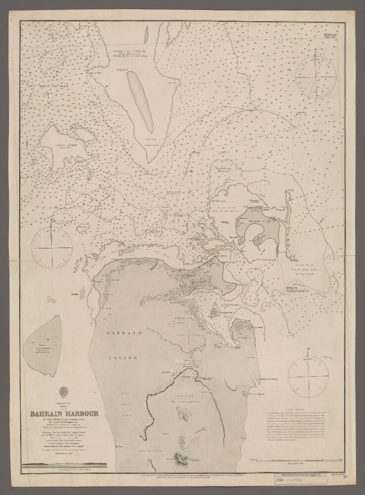
1. 'Bahrain Harbour'
- Description:
- Abstract: Chart 20.Hydrographic chart covering the northern half of Bahrain Island and Maharak [Muharraq] Island in the western part of the Persian Gulf. Portrays hydrology, including depths by soundings and contours, sands, rocks, reefs and anchorages, relief by hachures, vegetation, settlements, forts and place names, and includes topographical notes and navigational aids, including buoys and prominent buildings. There is a view of the Portuguese Fort and textual sailing directions into Bahrain Harbour.By Commander Charles Golding Constable and Lieutenant Richard William Whish, Indian Navy, 1860. Re-surveyed by M Chapman, Indian Navy, Messrs A P Thompson & C J Cuthbert, Her Majesty's Indian Surveying Schooner Constance, 1872-74. Upright soundings in hair line by Lieutenant George Barnes Brucks, Indian Navy, 1825. Engraved by J & C Walker. Published by the Admiralty, 1862, with corrections 1873 and 1875.Physical description: Materials: Printed on paperDimensions: 668 x 481mm, on sheet 707 x 514mm