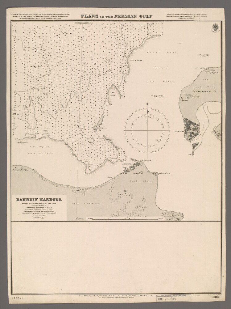
Abstract: Chart 3380. (The chart also bears the number '2362'.)Hydrographic chart covering the north-eastern tip of Bahrein [Bahrain] Island and a small portion of western Muharrak [Muharraq] Island in the western part of the Persian Gulf. Portrays hydrology, including depths by soundings and contours, sands, rocks, reefs and anchorages, vegetation, cultivation, settlements and street layouts, significant buildings, forts, water sources and place names, and includes topographical notes and navigational aids, including lights, buoys, beacons and prominent buildings.Surveyed by the officers of the Royal Indian Marine ship
Investigatorunder the direction of Commander Thomas Henry Heming, Royal Navy, 1901-02. Engraved by Malby & Sons. Published at the Admiralty, 1903.Physical description: Materials: Printed on paperDimensions: 457 x 480mm, on sheet 678 x 503mm