1 entry found
Number of results to display per page
Search Results
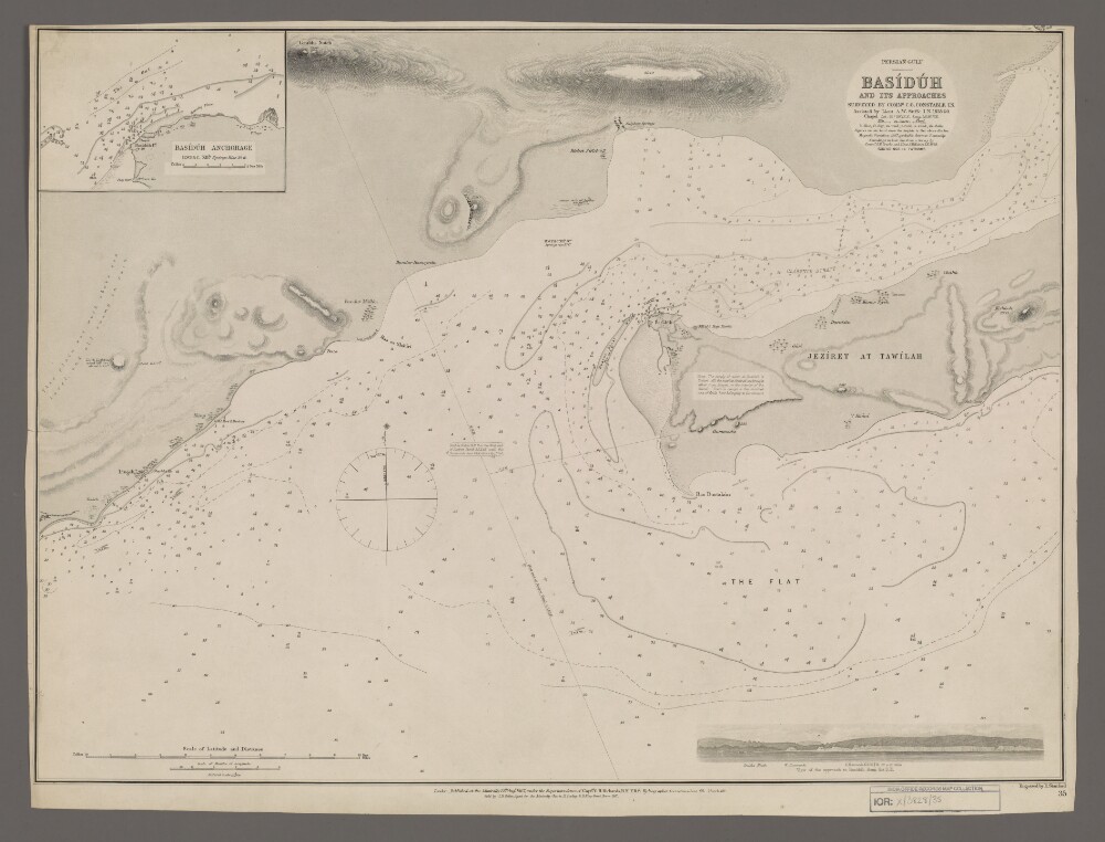
1. 'Basiduh and its Approaches'
- Description:
- Abstract: Chart 35.Hydrographic chart covering the port of Basiduh [Basaidu] on Qeshm Island, Persia [Iran]. Also depicts the western part of Clarence [Khuran] Strait, the Persian Gulf and a fifty-mile length of the Persian mainland coast. Portrays hydrology, including depths by soundings and contours, sands, mud, rocks and anchorages, relief by spot heights, hachures and rock drawings, vegetation, cultivation, settlements, public buildings and place names, and includes topographical notes and navigational aids, including beacons and prominent buildings. The sheet also includes an inset of Basiduh Anchorage at scale 1:60,500 and an annotated sketch view, at an unspecified scale, of the approach to Basiduh from the south-east.The margins have been trimmed, with some information lost.Chart surveyed by Commander Charles Golding. Constable, Indian Navy, and assisted by Lieutenant Arthur William Stiffe, Indian Navy, 1858-60. Soundings in 'hair line' from a survey by Commander George Barnes Brucks and Lieutenant Stafford Bettesworth Haines, Indian Navy, 1828. Engraved by Edward Stanford. Published at the Admiralty 1867, with corrections 1868 and 1869.Physical description: Materials: Printed on paperDimensions: 457 x 625mm, on sheet 484 x 643mm