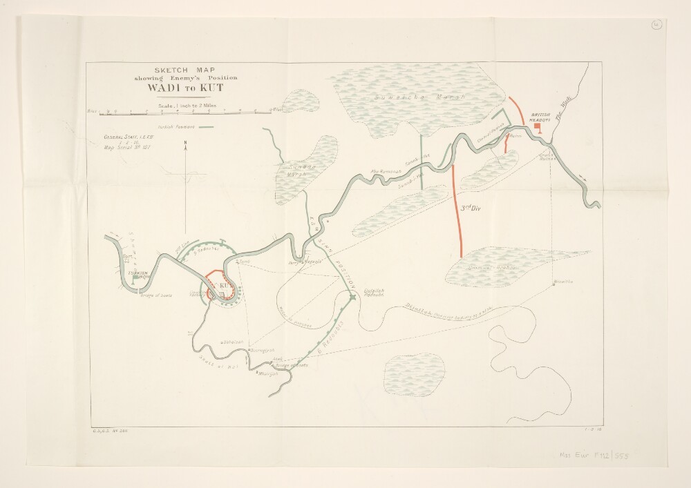
Abstract: Created by the War Office. Covers a twenty-five mile length of the River Tigris, to a width of approximately ten miles, from Kut [Al-Kut] to Wadi [Nahr Wadi] in present-day eastern Iraq. Created to support the Allied relief of Kut and associated Battle of Dujailah against Turkish forces. Portrays hydrology, roads and tracks, river crossings, settlements, ruins, place names, military installations and British and Turkish positions. The margin bears the series designation 'G[eographical].S[ection].,G[eneral].S[taff]. No. 2811' and date '1.3.16'. The map face bears the printed note 'General Staff, I[ndian]. E[xpeditionary].F[orce]."D." 1.2.16. Map Serial No. 107'.Verso bears the annotation 'Kut'.Other copies are filed at 48080.(7.) and 48505.(7.).Physical description: Materials: Printed in colourDimensions: 300 x 420mm, on sheet 371 x 528mm