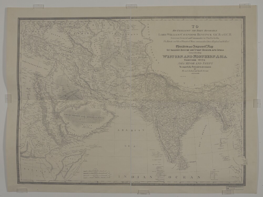
Abstract: Imprint:Calcutta, Jan.y 1834. J.B. Tassin lith.Distinctive Features:Relief shown by hachures.Map shows various routes between places of interest including caravan and pilgrim routes, with estimated journey times and location of wells reported. Notations concerning regions and their topography cover the face of the map. Includes a key to symbols and dedication from J.B. Tassin to Lord William Cavendish Bentinck Governor General and Commander in Chief in India.Physical description: Dimensions:743 x 1047 mm, on sheet 868 x 1158 mm
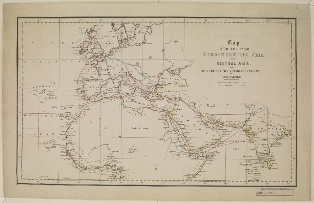
Abstract: Distinctive Features:Unsigned and undated.Land routes shown in blue with sea routes and waterways coloured red.Physical description: Dimensions:327 x 562 mm, on sheet 407 x 646 mm
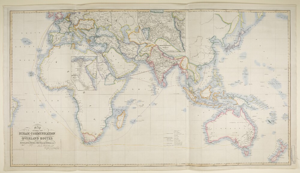
Abstract: Imprint:London, Wm. H. Allen & Co., 13 Waterloo Place, S.W.Distinctive Features:Includes two insets: ‘ROUTES between MEDITERRANEAN and RED SEA on an Enlarged Scale’ and ‘ROUTES between MEDITERRANEAN, BLACK SEA and PERSIAN GULF on an Enlarged Scale’.Routes shown in colour with a list of shipping companies and a key at bottom centre.Physical description: Dimensions:677 x 1237 m, on sheet 732 x 1296 mm
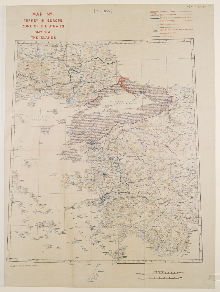
Abstract: This map shows Turkey where it is included in Europe and features the Straits, Smyrna [Izmir], and islands. The map indicates boundaries and relief with contours.The map includes a printing statement which reads '(B 16478) WT 18378-212.5050.10/20.H&S,LTD.'Physical description: Materials: Printed in colour on paper with manuscript additions in coloured inkDimensions: 495 x 430mm, on sheet 630 x 475mm
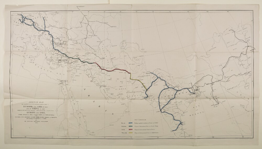
Abstract: Imprint:London, Connell Litho. 37 Castle St. Holborn E.C.Distinctive Features:Outline map showing the completed and proposed railway scheme in Europe and Asia, with lines coloured for reference and explained in a key provided in the lower centre of sheet.Below title the note: London, Brussels, Paris, Berlin Vienna and Constantinople with Teheran, Herat, Kandahar, Sukkur, Lahore, Bombay, Madras and Calcutta and eventually with Burmah and China.Physical description: Dimensions:630 x 1147 mm; on sheet 676 x 1220 mmFoliation:The map sheet has been foliated in the front top right hand corner of the folio with a pencil number enclosed in a circle.