Abstract: Distinctive Features:Relief shown by hachures and spot heights.Title continues: ‘Zu C. Ritter’s Erdkunde, Buch III, West-Asien, Theil XII. Bearbeitet von H. Kiepert, herausgegeben von C. Ritter. Berlin, 1852 Verlag von Dietrich Reimer’.Map of Hedjaz [Hejaz] province showing various routes including the Hajj pilgrimage, Carsten Niebuhr exploration journey, and J.G. Hulton and Charles J. Cruttenden expedition of 1836.In the bottom right-hand corner there is a table of reference listing Arabic geographic terms with German equivalents and abbreviations.Includes two insets:• plan of Mecca entitled ‘Mekka nach Burckhardt’ drawn to scale 1:30,000 with districts numbered and listed in a table of reference; • map of peninsula and the port of Aden entitled ‘Halbinsel und Hafen von Aden’ drawn to scale 1:200,000 with depths shown by contours.Physical description: Dimensions:491 x 349 mm, on sheet 584 x 476 mm
Abstract: This file contains correspondence regarding relations between Bahrain and Saudi Arabia.The topics discussed in the file include the signing of a Treaty of Extradition between the Government of Bahrain and the Government of Hejaz-Nejd, a visit made by Amir Saud to Bahrain, visits made by Ibn Saud to Kuwait and Bahrain and territorial issues between Bahrain and Saudi Arabia related to a number of islands between their coasts. The activities of the Bahrain Petroleum Company and the Californian Arabian Standard Oil Company are also discussed.Two maps of Bahrain and its vicinity are contained on folio 156b and folio 157b. The maps contain information related to oil deposits and facilities.A bi-lingual (Arabic and English) copy of the Treaty of Extradition between the Government of Bahrain and the Government of Hejaz-Nejd is contained on folios 6-9.Physical description: A bound correspondence volume. The main foliation sequence commences at the titlepage and terminates at the 5th sheet from the back of the volume; these numbers are written in pencil, are circled, and can be found in the top right corner of the recto side of each folio.A second foliation sequence runs between f 3 and f 193; these numbers are also written in pencil, but are not circled and are located in the same position as the main sequence.A set of index numbers corresponding with the index at the back run through the volume; these numbers are written in red crayon and are circled. Foliation errors: 2A and 2B; 156A and 156B; 157A and 157B; 164A and 164B.
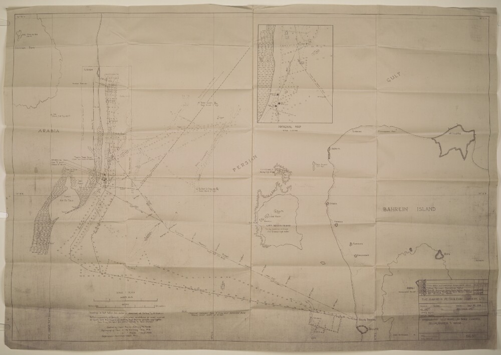
Abstract: Distinctive Features:Depths shown by soundings recorded in feet below low water as observed at Zellaq and Al Khobar.Contains information related to oil deposits and facilities, including Zellaq Terminal and barge routes which are indicated by pecked line and lettered for reference. Additions listed in the revisions table in bottom right-hand corner.Includes inset map in the upper left.Physical description: Materials:BlueprintDimensions:677 x 981 mm, on sheet 712 x 1020 mm
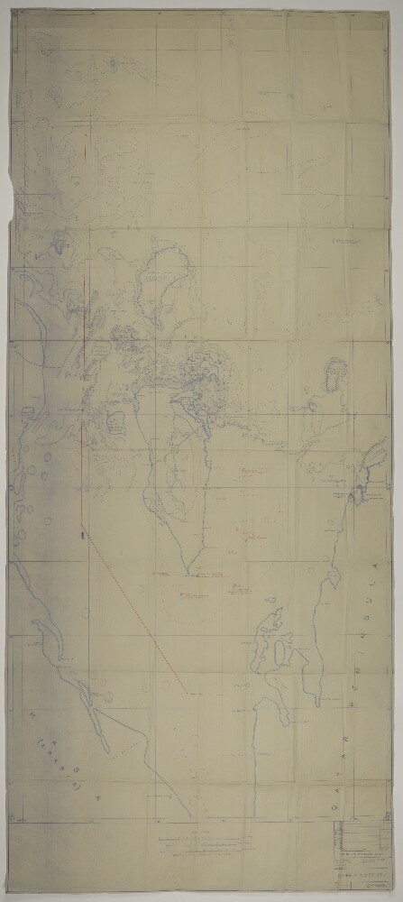
Abstract: Distinctive Features:Depths shown by contours.Attached to letter dated 29th May 1939 regarding Saudi claim to certain islands.Sketch map prepared by the Bahrain Petroleum Company from Admiralty charts and other information on record showing Bahrain, the Saudi Arabia and Qatar coasts and the waters to the north, with shoals and reefs mapped in detail.New information obtained during the reconnaissance survey between 25th and 27th May 1939, added in red ink including the proposed boundaries line to determine territorial waters of Saudi Arabia and Bahrain.Physical description: Materials:Blueprint on tracing paper with additions in wash and red inkDimensions:2207 x 914 mm, on sheet 2232 x 978 mm