Abstract: Distinctive Features:Relief shown by hachures and spot heights.Title continues: ‘Zu C. Ritter’s Erdkunde, Buch III, West-Asien, Theil XII. Bearbeitet von H. Kiepert, herausgegeben von C. Ritter. Berlin, 1852 Verlag von Dietrich Reimer’.Map of Hedjaz [Hejaz] province showing various routes including the Hajj pilgrimage, Carsten Niebuhr exploration journey, and J.G. Hulton and Charles J. Cruttenden expedition of 1836.In the bottom right-hand corner there is a table of reference listing Arabic geographic terms with German equivalents and abbreviations.Includes two insets:• plan of Mecca entitled ‘Mekka nach Burckhardt’ drawn to scale 1:30,000 with districts numbered and listed in a table of reference; • map of peninsula and the port of Aden entitled ‘Halbinsel und Hafen von Aden’ drawn to scale 1:200,000 with depths shown by contours.Physical description: Dimensions:491 x 349 mm, on sheet 584 x 476 mm
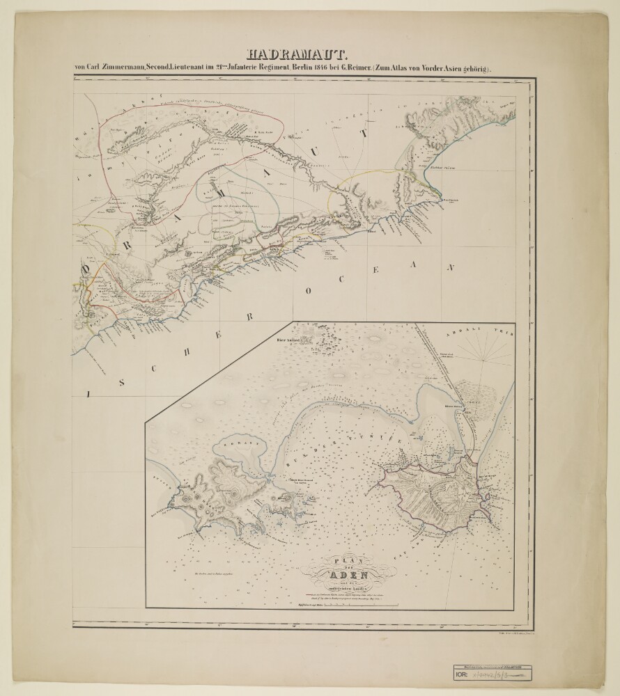
Abstract: Distinctive Features:Relief shown by hachures.Shows routes of various expeditions with a table of explorers and dates of their journeys listed at left centre of sheet at IOR/X/2942/5/2.Includes inset: ‘Plan von Aden und des umliegenden Landes’ with soundings recorded and note: ‘nach den Parlaments Reports Indian Papers respecting Aden 1837 & 1838 & Foster Sketch of Cap Aden in Bombay Geographical Society Proceedings May 1839’.Physical description: Dimensions:525 x 500 mm, on sheet 690 x 604 mm
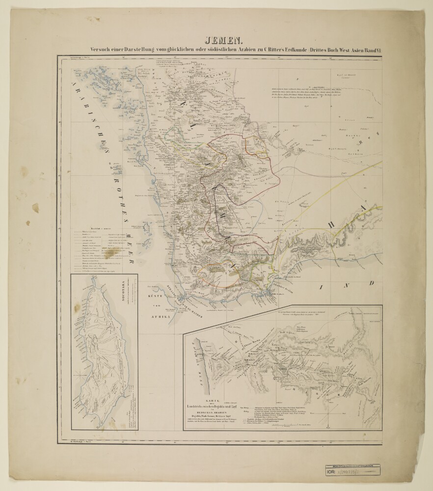
Abstract: Distinctive Features:Relief shown by hachures.Shows routes of various expeditions with a list of explorers and dates of their journeys at left centre.Includes two insets: ‘Socotara’ and ‘KARTE DES Landstrichs zwischen Dsjidda und Tayf in HEDSCHAS ARABIEN’.Physical description: Dimensions:550 x 465 mm, on sheet 690 x 604 mm