1 entry found
Number of results to display per page
Search Results
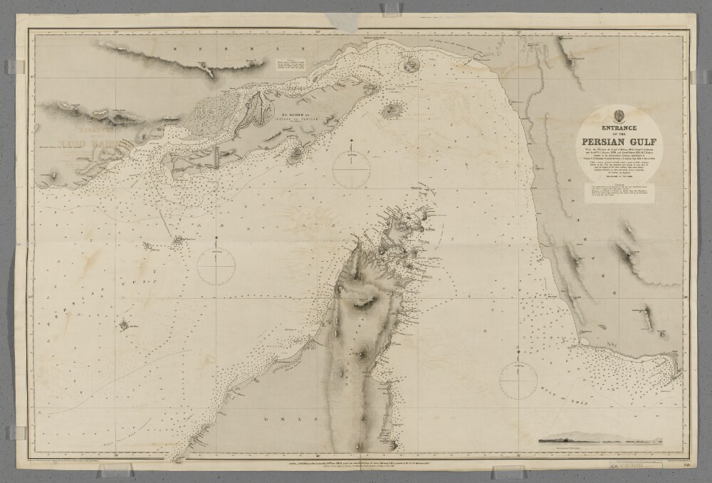
1. 'Entrance to the Persian Gulf'
- Description:
- Abstract: Chart 753.Hydrographic chart covering the Strait of Hormuz and the adjoining sections of the Persian Gulf and Gulf of Oman. Also includes the adjacent coastal areas of Persia and the Musandam Peninsula. Portrays hydrology, including depths by soundings and contours, anchorages, sands and rocks, relief by spot heights and hachures, vegetation, settlements, forts and place names, and includes topographical notes and navigational aids, including buoys, beacons and prominent buildings.Includes an annotated sketch view, at unspecified scale, of Koh Mubarak, Persia [Kuh Mobarak, Iran] from the west by south at twelve miles distant.Chart produced from the surveys of Lieutenant John M Guy (1822), Commander George Barnes Brucks and Lieutenant Stafford Bettesworth Haines (1828) and Lieutenant Albany Moore Grieve (1839), Honourable Marine. Astronomical positions determined by Commander Charles Golding Constable and Lieutenant Arthur William Stiffe, Indian Navy (1857-60). Engraved by Davies, Bryer & Company. Drawn by Edward James Powell, Hydrographic Office. Published at the Admiralty, 1872.Physical description: Materials: Printed on paperDimensions: 640 x 968mm, on sheet 682 x 1017mm