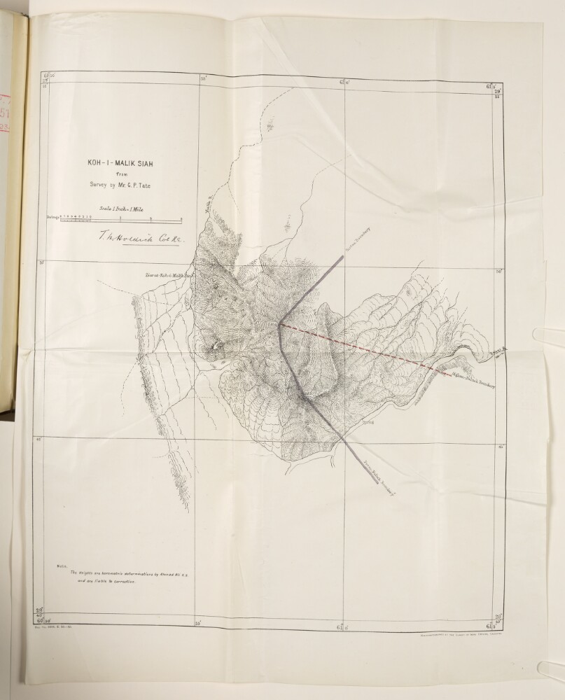
Abstract: Map of the mountain Koh-i-Malik Siah (also referred to as Malik Siah Koh in file) [Malek Sīāh Kōh] and surrounding area, around the frontiers of Afghanistan, Persia [Iran] and Baluchistan [in present-day Pakistan], produced from a survey made by George Passman Tate. The map is signed by Colonel Thomas Hungerford Holdich, Royal Engineers. The map indicates: topography, with an indication of relief; heights for two summits, expressed in feet; the Afghan-Baluch boundary, marked as a red dashed line; the Perso-Baluch and Sistan boundaries, marked as solid mauve lines.A note on the map states that heights indicated on the map are barometric determinations by Ahmad Kali, and are liable to correction. A printing statement in the bottom right of the map states: ‘Heliozincographed at the Survey of India Offices, Calcutta [Kolkata].’Physical description: Dimensions:455 x 390 mm, on sheet 550 x 430 mm.Materials:printed on paper.