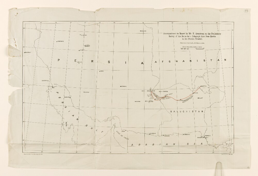
Abstract: The map shows parts of countries including Iraq, Persia [Iran], and Afghanistan, the region of Baluchistan [Balochistan], the Persian Gulf, and the Northern coastline of the Arabian Sea. The route of a proposed telegraph line from Quetta to Ladis and Koh-i-Malik Seah is indicated with a red line.The map includes some indication of relief, in the form of hachures for volcanoes and mountains.Physical description: Materials: Printed on paperDimensions: 316 x 506mm, on sheet 387 x 579mm
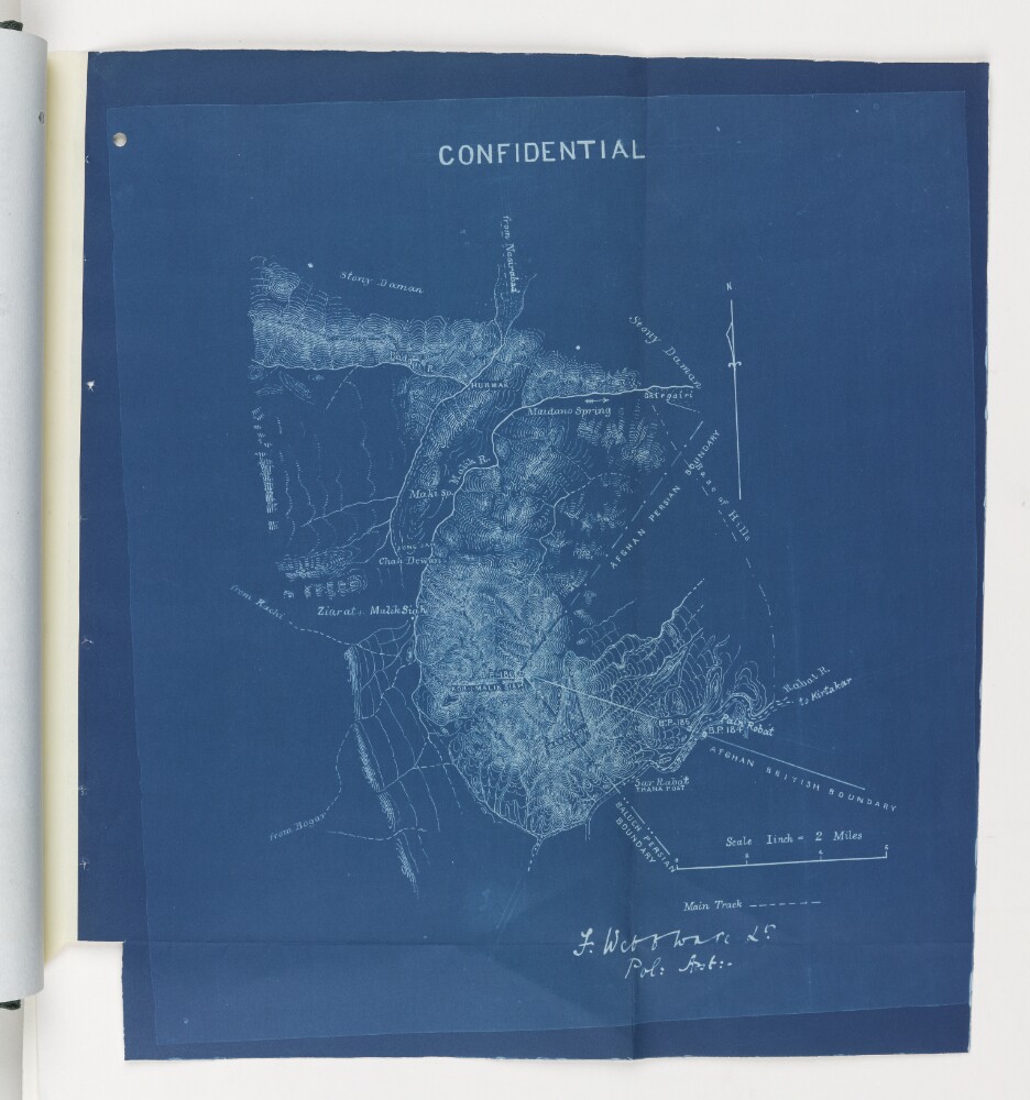
Abstract: The blueprint map shows the point at which the Afghan Persian Boundary, the Afghan British Boundary, and the Baluch Persian Boundary meet at Koh-I-Malik Seah [Malik Siah Koh or Malek Sīāh Kōh] mountain. Relief is indicated by contours.It is headed ‘Confidential’ and is signed by Lieutenant Frank Webb Ware, Political Assistant, Chagai. It forms part of a ‘Report on the Baluch-Persian Caravan Route and Nushki, Chagai and Western Sinjerani Districts, by Webb Ware, dated 1897 (folios 22-54 of Mss Eur F111/350).Physical description: Materials: Blueprint paperDimensions: 355 x 320mm