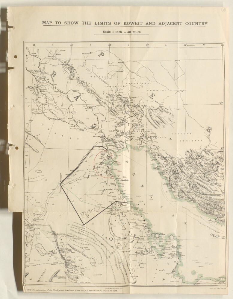
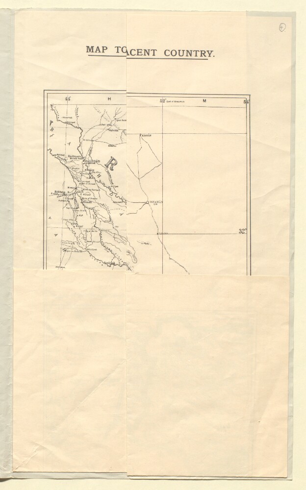
13. ‘MAP TO SHOW THE LIMITS OF KOWEIT AND ADJACENT COUNTRY’ Date: 1913/1913 Language: English Geographic region: Koweit
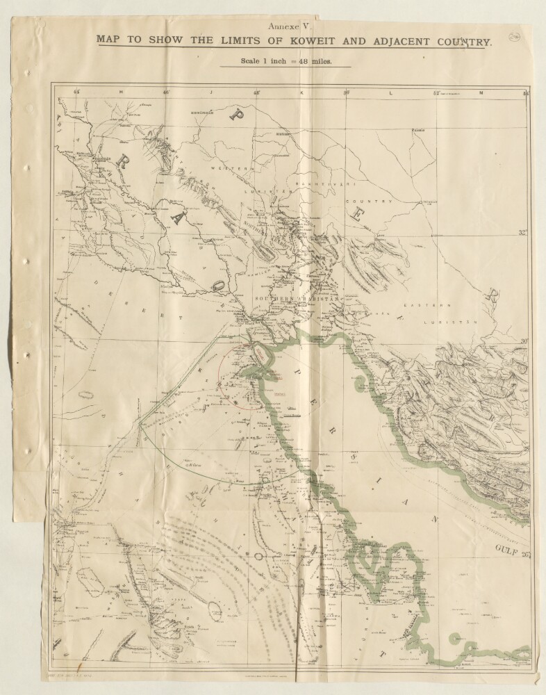
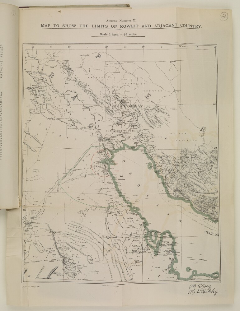
14. ‘MAP TO SHOW THE LIMITS OF KOWEIT AND ADJACENT COUNTRY. Annexe V’ Date: 1913/1913 Language: English Geographic region: Koweit
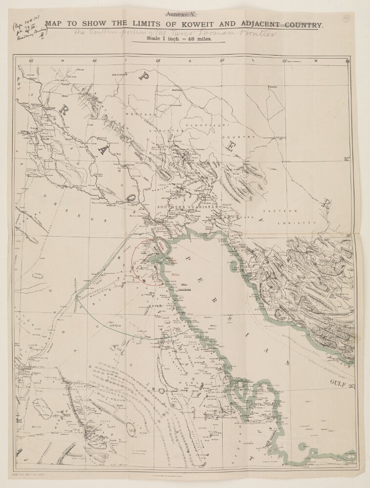
15. ‘MAP TO SHOW THE LIMITS OF KOWEIT AND ADJACENT COUNTRY. Annexe V’ Date: 1913/1913 Language: English Geographic region: Koweit
16. 'ROUGH MAP OF THE COUNTRY AROUND KOWEIT. (PERSIAN GULF) (Not drawn to Scale) by Captain E.A Simons R N.(1902).' Date: 1903/1903 Language: English Geographic region: Koweit
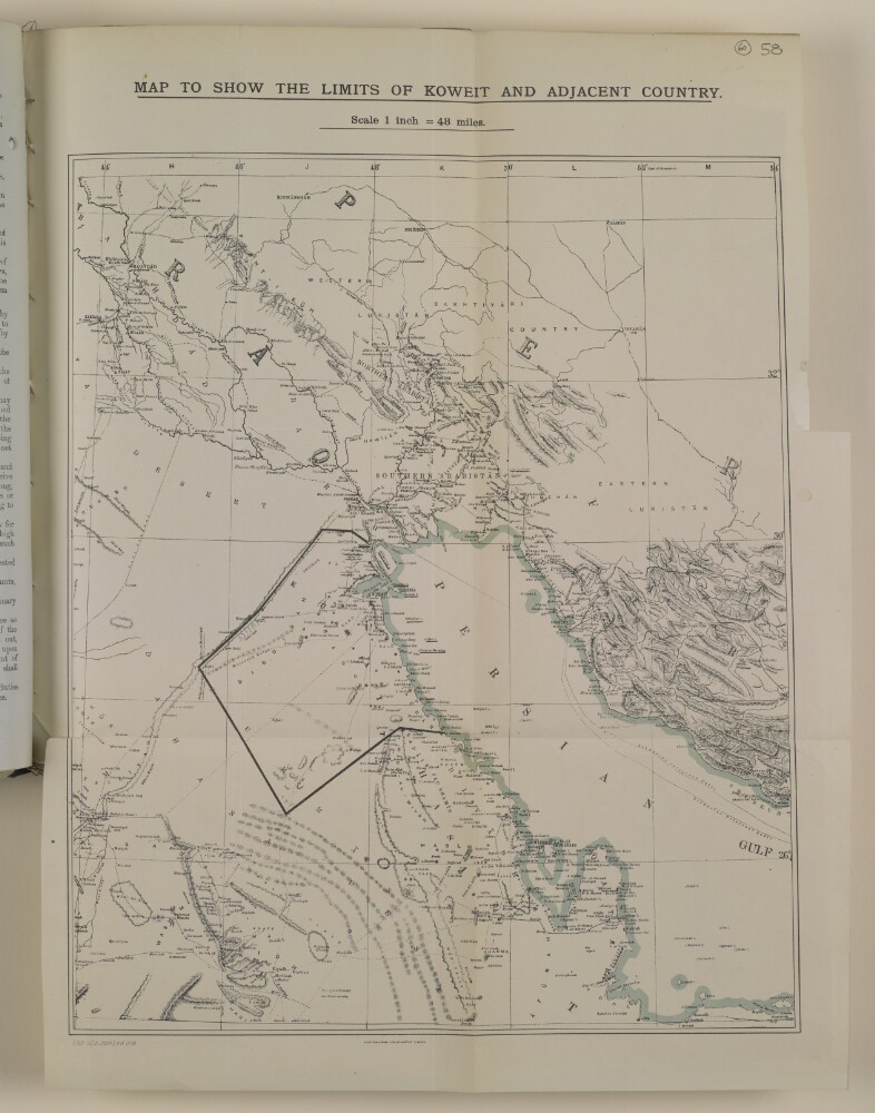
17. 'MAP TO SHOW THE LIMITS OF KOWEIT AND ADJACENT COUNTRY' Date: 1907/1917 Language: English Geographic region: Koweit
18. 'MAP TO SHOW THE LIMITS OF KOWEIT AND ADJACENT COUNTRY. Scale 1 inch = 48 miles.' Date: 1912/1914 Language: English Geographic region: Koweit
19. ‘Map to show the Limits of Koweit and Adjacent Country’ Date: 1913/1913 Language: English Geographic region: Koweit
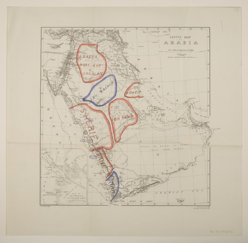
20. 'Sketch map of Arabia'. With manuscript additions showing 'Friendly' and 'Hostile' Confederations Date: 1906/1917 Language: English Geographic region: Arabian PeninsulaKoweit
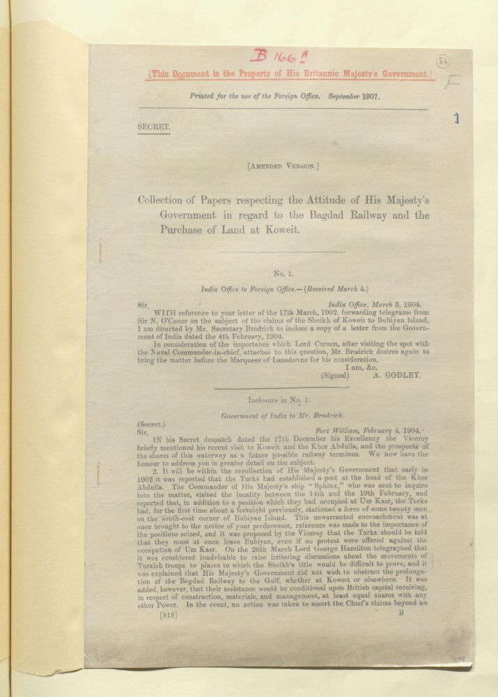
22. 'Collection of papers respecting the attitude of His Majesty's Government in regard to the Bagdad Railway and the Purchase of Land at Koweit (amended version)' Creator: Author: Government of India Date: 1907/1907 Language: English Geographic region: Koweit
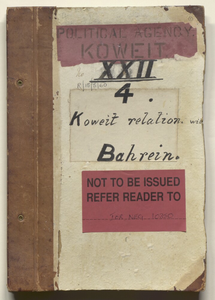
23. 'File XXII 4 Koweit relations with Bahrain.' Date: 1906/1920 Language: English Geographic region: KoweitZubaraBahrain
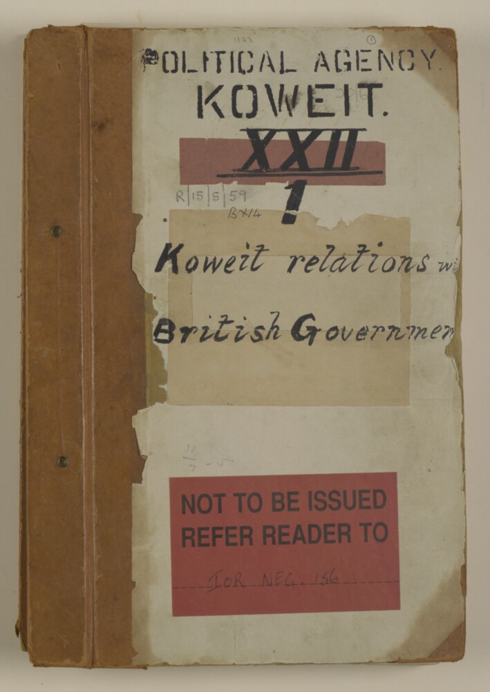
24. 'File XXII/1 Koweit relations with British Government' Date: 1904/1916 Language: English Geographic region: BussorahKoweit