1 entry found
Number of results to display per page
Search Results
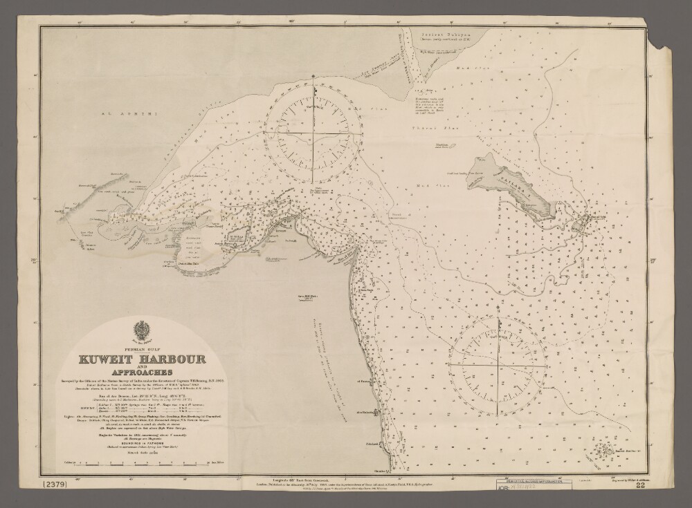
1. 'Kuweit Harbour and Approaches'
- Description:
- Abstract: Chart 22. (The chart also bears the number '2379'.)Hydrographic chart covering the central and northern coast of Kuweit [Kuwait], including Kuweit Harbour, and the north-western part of the head of the Persian Gulf. Portrays hydrology, including depths by soundings and contours, sands, mud and rocks, relief by form lines and spot heights, vegetation, settlements, forts and place names, and includes topographical notes and navigational aids, including buoys, beacons and prominent buildings.Chart surveyed under the direction of Captain Thomas Henry Heming, Royal Navy, 1905; also lieutenants John Michael Guy, Indian Navy, and George Barnes Brucks, Indian Navy, 1825. Engraved by Weller & Addison. Published at the Admiralty, 1907.Physical description: Materials: Printed on paperDimensions: 468 x 632mm, on sheet 494 x 684mmTop right corner of margin not present on transfer