1 entry found
Number of results to display per page
Search Results
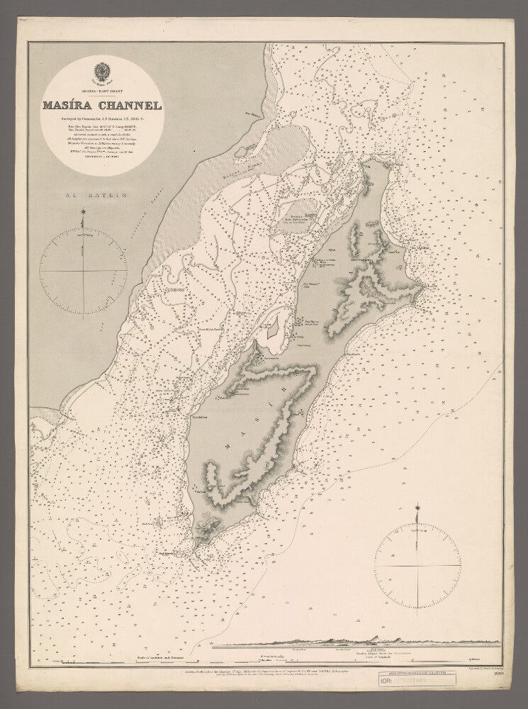
1. 'Masira Channel'
- Description:
- Abstract: Chart 1089.Hydrographic chart covering Masira Channel [Turʻat Masirah], the Arabian Sea, Masira Island [Jazirat Masirah] and a thirty-five-mile length of the eastern Oman coast. The Masira Channel, twelve miles wide and sixty miles long, separates Masira Island from the Omani mainland. Portrays hydrology, including depths by soundings and contours, sands, rocks, anchorages, relief by spot heights and hachures, vegetation, settlements, watering places and place names, and includes topographical notes and navigational aids, including prominent landscape features and buildings.Includes an annotated view, at an unspecified scale, of Masira Island from the south.Chart surveyed by Commander John Parke Sanders, Indian Navy 1845-1846. Engraved by Davies & Company. Published at the Admiralty, 1888.Physical description: Materials: Printed on paperDimensions: 633 x 481mm, on sheet 685 x 508mm