1 entry found
Number of results to display per page
Search Results
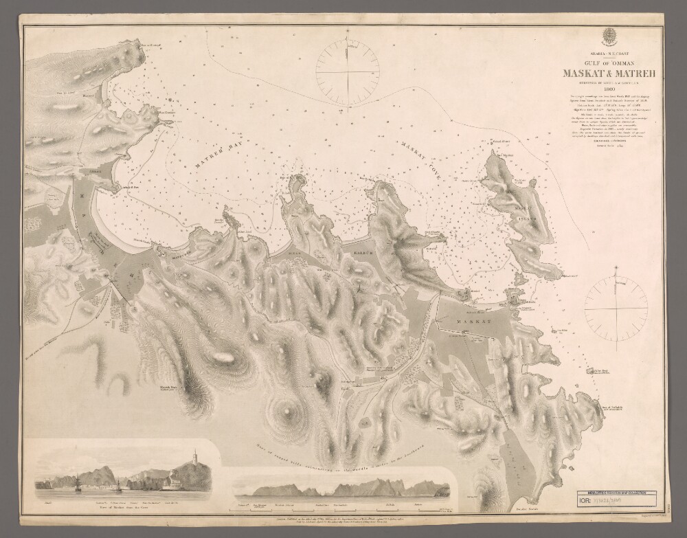
1. 'Maskat & Matreh'
- Description:
- Abstract: Chart 2869.Hydrographic chart covering a four-mile length of the Omani coast from Maskat [Muscat] north-eastwards to Matreh [Mutrah] on the Gulf of Oman. Portrays hydrology, including depths by soundings and contours, sands, mud and rocks, anchorages, relief by spot heights and hachures, vegetation, cultivation, roads, paths, walls, settlements and public buildings, military buildings, wells and place names, and includes topographical notes and navigational aids, including prominent buildings.Includes annotated sketch views, at unspecified scales, of Maskat from the north-north-east and the approach to Maskat Cove [Khawr Masqat] from the north-north-west.Surveyed by Lieutenant Arthur William Stiffe, Indian Navy, 1860, with upright soundings from Lieutenant Ward, 1849, and the sloping soundings from Lieutenant George Barnes Brucks and Lieutenant Stafford Bettesworth Haines, 1828. Engraved by J & C Walker. Published at the Admiralty, 1862.Physical description: Materials: Printed on paperDimensions: 481 x 624mm, on sheet 508 x 643mm