1 entry found
Number of results to display per page
Search Results
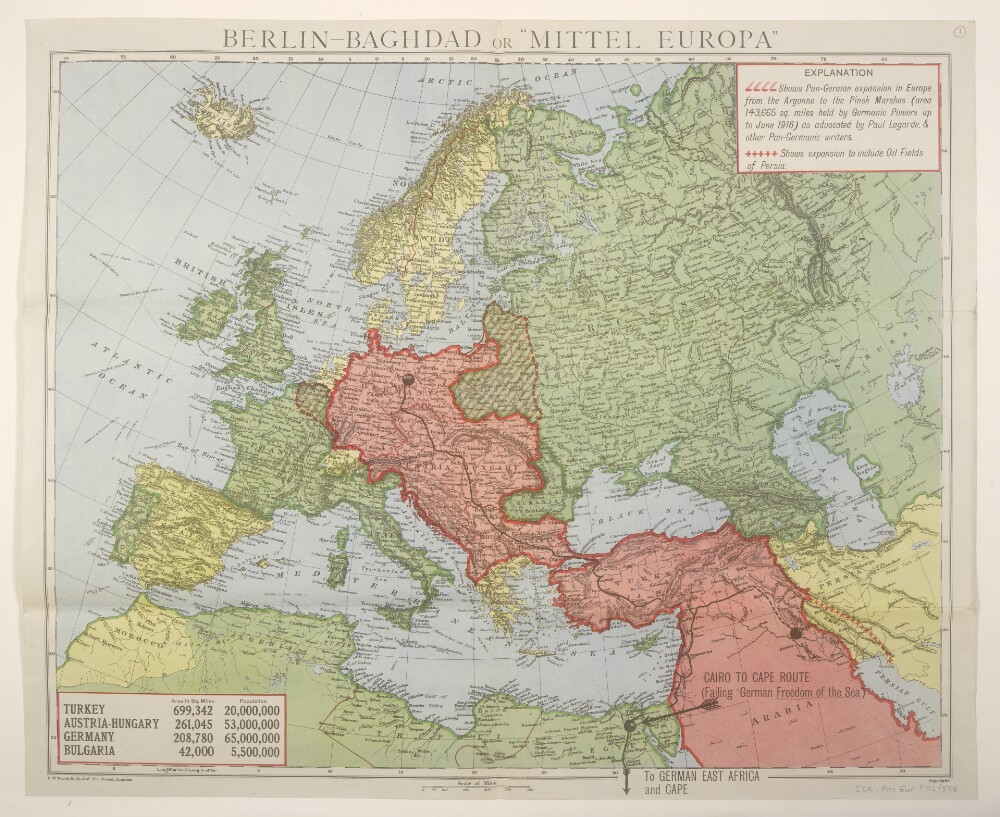
1. Maps 'Berlin-Baghdad or "Mittel Europa"'
- Description:
- Abstract: These maps represent a British impression of the expansionist ambitions of the German State during the First World War derived from the writings of Pan-Germanic authors of the period, in particular Paul Anton de Lagarde. The map represents the route of the railway project that links the Central Powers of the First World War, or the 'Berlin-Baghdad' Railway.The maps bear the imprint 'G.W. Bacon & Co. Ltd., 127, Strand, London' and depict the route of the approximately 2,000 mile railway line (partly built, partly proposed) from Berlin to Baghdad. The sheets portray hydrology, relief by hachures and spot heights, settlements, place names and international boundaries. Shading distinguishes Allied, Central Powers and neutral countries. Areas of Pan-German expansion are also indicated, and a table shows the areas and populations of Central Powers countries. Part of the title is in German.Dates derived from neutral countries' later allegiances.Two editions of the map are held:f 1 Lithograph depicting Rumania [Romania] as neutral, with later watercolour wash to show her subsequent Allied allegiance. 1916-17f 2 Lithograph depicting Rumania's Allied allegiance. 1916-17.Physical description: 2 map sheets