1 - 2 of 2
Number of results to display per page
Search Results
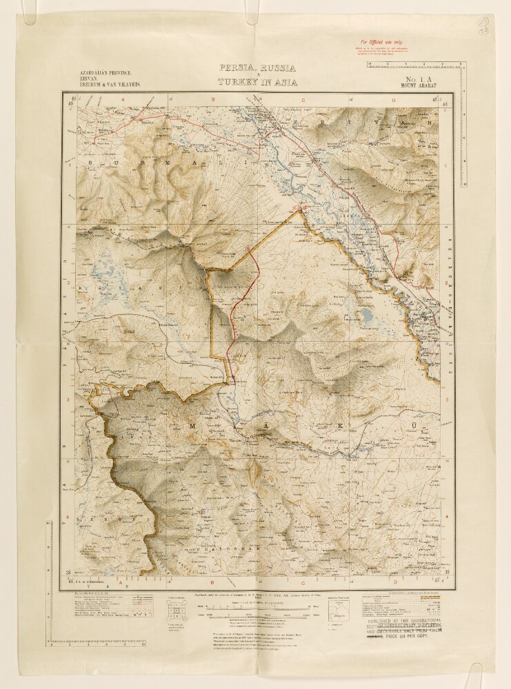
1. ‘Persia, Russia & Turkey in Asia’
- Description:
- Abstract: Map numbered 1.A (Mount Ararat), and subtitled ‘Azarbāījān [Azerbaijan] Province. Erivan [Yerevan]. Erzerum [Erzurum] & Van Vilayets.’ An index to the geographical location of the provinces is provided below the map. A caption under the map states that it was published under the direction of Colonel Charles Henry Dudley Ryder, Surveyor General of India, 1922. A stamp in the bottom right corner of the map states that it was published by the Geographical Section General Staff, War Office.The map indicates: relief, shown by contours and shading, with elevations given in feet; rivers, lakes, marshes; province and country boundaries; settlements, with place names in English; railways, roads and other transport routes; the Indo-European Telegraph Line. A new boundary line, drawn in red ink with annotations, has been added to the map.The map is mentioned in a copy of a letter sent by HM’s Envoy Extraordinary and Minister Plenipotentiary at Tehran (Reginald Hervey Hoare) to the Secretary of State for Foreign Affairs (John Allsebrook Simon), dated 1 July 1932, which states that the ‘Turkish military attaché has been so good as to draw upon sheets 1 A, 1 B, and 1 C [...] the line of the new frontier’ (f 48).Physical description: Materials:1 paper folio.Dimensions:462 x 367 mm, on sheet 615 x 444 mm.
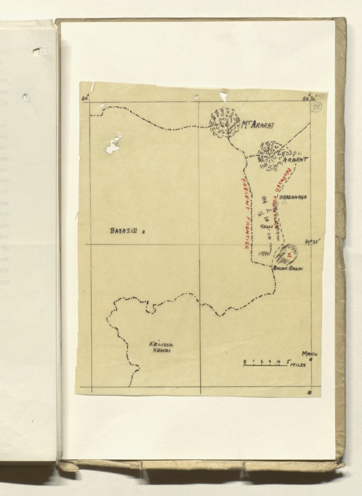
2. Sketch Map of the Perso-Turkish Frontier
- Description:
- Abstract: Map indicating the present and proposed frontier line (drawn as dot-dashed and dashed lines respectively) between Turkey and Persia [Iran], south of Mount Ararat. Also indicated on the map are: Mount Ararat, Lesser Ararat, the towns of Bayazid [Doğubayazıt] in Turkey, and Mākū and Kelissa Kendi [Kalīsā Kandī] in Persia.Reference to the map is made in a note preceding the map in the file, entitled ‘Information obtained from Major Nishet, Turkish Military Attaché’, prepared by the Military Attaché at the British Legation in Tehran in October 1931 (ff 88-89).Physical description: Materials:Ink on tracing paper.Dimensions:240 x 190 mm.