« Previous |
1 - 12 of 352
|
Next »
Number of results to display per page
Search Results
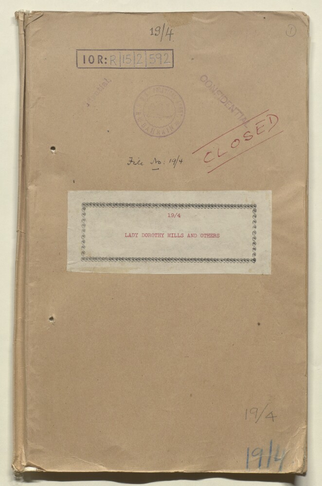
1. ‘19/4 LADY DOROTHY MILLS AND OTHERS’
- Description:
- Abstract: This file concerns a proposed and actual visits to the Persian Gulf by the writer Lady Dorothy Mills to countries in the Middle East in 1932 for the purpose of collecting suitable material for her literary work, with permission granted to her to travel to Muscat, Bahrain and Kuwait, but not the Trucial Coast (ff 7-11); and Lady Stokes, widow of Sir Wilfred Stokes, and Miss Hastings, daughter of Colonel Sir George Hastings, to Bahrain in 1937 (ff 12-14).Correspondents in this file include: Lieutenant-Colonel Trenchard Craven Fowle, Political Resident in the Persian Gulf at Bushire; Lieutenant-Colonel Percy Gordon Loch, Political Agent at Bahrain; and Sir Courtenay Latimer, the British Resident at Rajkot.Physical description: Foliation: the main foliation sequence (used for referencing) commences at the front cover, and terminates at the inside back cover; these numbers are written in pencil, are circled, and are located in the top right corner of the recto side of each folio. An additional foliation sequence is also present in parallel between ff 7-13; these numbers are also written in pencil, but are not circled, and can be found in the same position as the main sequence.
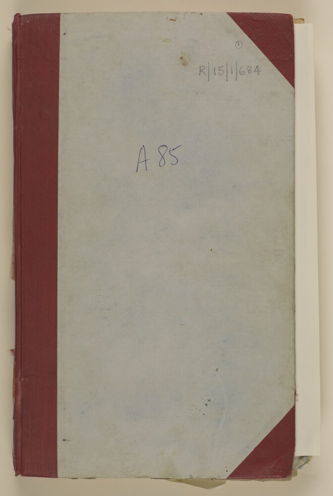
2. '86/12-III CONFIDENTIAL A. 85 P.C.L. MUSCAT'
- Description:
- Abstract: The volume comprises correspondence between the Political Resident in the Persian Gulf , the Political Agent at Muscat, the Political Agent at Bahrain, the India Office (Roland Tennyson Peel, John Percival Gibson, Francis Anthony Kitchener Harrison) , the Secretary to the Government of India (Sir Aubrey Metcalfe), the Sultan of Muscat and Oman (Sayyid Sa‘īd bin Taymūr Āl Bū Sa‘īd) and Petroleum Development (Oman and Dhofar) Limited (Ernest Vincent Packer, John Skliros, H H Wheatley) regarding the oil concession agreements concluded with the Sultan of Muscat for Dhofar [Zufār] and Muscat territory. Copies of the two concessions can be found at folios 17-47.Included in the volume is correspondence relating to the political agreement between His Majesty’s Government and Petroleum Development (Oman and Dhofar) Limited including its presentation to the Sultan of Muscat; the Sultan’s concerns about the document and negotiation with the India Office in order to agree a suitably amended version that satisfied all parties, including the decision by the India Office to have a separate pre-emption agreement. Copies of the Political Agreement and Pre-Emption Clause agreement can be found at folios 93-98 and 132-135.Also discussed is the decision by Petroleum Development (Oman and Dhofar) Limited to take up in 1942 the option of an extension on their exploration agreement for two years owing to wartime conditions and further discussion regarding possible methods of extending the exploration agreement to the end of the war and a period beyond. The conclusion of the discussion being the decision by the Company to take up their concession rather than attempt to negotiate any further extension. Also discussed are concerns by the Sultan of Muscat that the Company did not really intend to explore and develop a concession in his territory and were only really interested in preventing other companies operating there. The concession with the Shaikh of Ajman [‘Ajmān] (Rāshid Bin Ḥumaid Al-Nu`aimī) is also discussed in this context as the exploration of that territory had also not commenced on the outbreak of World War II and extensions to the exploration agreement were therefore also required.Further correspondence relates to the Oil Undertaking made in 1923 by Sultan Taimur bin Faisal [Sayyid Taymūr bin Fayṣal bin Turkī Āl Bū Sa‘īd], formerly Sultan of Muscat and father of Sayyid Said bin Taimur. The correspondence centres around the assertion made by Sultan Said bin Taimur that the undertaking was not binding on him as his father had written a letter to the political authorities in 1923 stating that any such undertaking would not be binding on his successors unless specifically stated in the contractual agreement. Further correspondence concludes that the letter written by Sayyid Taimur bin Faisal in 1923 was received by the Political Resident in the Persian Gulf but was never responded to by him or forwarded on to the India Office or Government of India and that they were therefore unaware of any such opinion or response and that as a result were prepared to consider a re-negotiation of the Sultan’s treaties and undertakings.Also of interest within the volume are:discussions about the Muscat Arms Subsidy which was originally granted to Sayyid Faisal bin Turki [Fayṣal bin Turkī Āl Bū Sa‘īd] including the conditions under which it was granted and the lack of clarity in the terms and conditions of the subsidy’s contract;discussions regarding the Oman hinterland which the Company were interested in exploring but which was under the authority of the Imam of Muscat and the decision to wait until the following year to raise the question again as the Imam’s authority in that area was considered to be dwindling and the Sultan hoped then to be able to make arrangements with either the Imam of the tribes living there;a memorandum prepared in the Petroleum Department, June 1938, looking at areas where petroleum concessions were mostly likely to be, or had been already been obtained, on the Arabian Peninsula (Koweit [Kuwait], Koweit Neutral Zone, Bahrein [Bahrain], Qatar, Trucial Sheikhdom’s, Aden Protectorate, Saudi Arabia, The Yemen, Muscat, and Oman) and looking at Petroleum Concessions Limited's refinery agreement and pre-emption clause.The agreements and correspondence with the Sultan of Muscat are in Arabic and English.A series of file notes which were maintained as a record of the correspondence in the volume can be found at folios 264-276.Physical description: Foliation: the main foliation sequence (used for referencing) commences at the front cover with folio 1 and terminates at the back cover with folio 280; these numbers are written in pencil, are circled, and are located in the top right corner of the recto side of each folio. An additional mixed foliation/pagination sequence is also present between ff 2-267; these numbers are also written in pencil, but are not circled. These are located in the same position as the main sequence, except for some instances which are located on the verso. Pagination: a short pagination sequence is present at the back of the volume between ff 264-276; these numbers are written in pencil, and are located in the top outermost corners of each page.
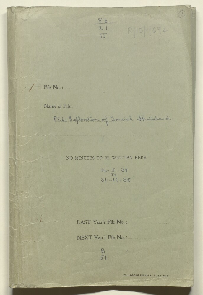
3. '86/21 - II P.C.L. Exploration of Trucial Hinterland. B 51'
- Description:
- Abstract: The file comprises correspondence between the Political Resident in the Persian Gulf (Trenchard Craven Fowle), the Political Agent at Bahrain (Hugh Weightman), the Political Agent at Muscat (Ralph Ponsonby Watts) and Petroleum Concessions Limited (Stephen Hemsley Longrigg) regarding arrangements for geologists from Petroleum Concessions Limited to undertake geological exploration at Jebel Faiyah [Jabal al Fāyah], Baraimi [Al Buraymī] and Jebel Hafit [Jabal Ḩafīt].Possible routes of entry to the Baraimi Oasis through Sharjah, Muscat and Abu Dhabi are discussed along with the proposal to use two exploration parties which could meet up at the Oasis. One exploration party was sent from Muscat to Jebel Hafit and Baraimi with the assistance of the Sultan of Muscat (Sayyid Sa‘īd bin Taymūr Āl Bū Sa‘īd) and escorted by the Wali of Sohar (Mudhaffar Suliman). The other, escorted by a political officer John Baron Howes, hoped to travel through Beni Kitab [Beni Qitab] territory and visit Jebel Faiyah before going on to Baraimi, but ultimately had to travel there directly from Abu Dhabi with the assistance of the Wali of Al Ain (Ibrāhīm bin ʻUthmān).The remainder of the volume discusses the various intrigues and difficulties encountered by the exploration parties in attempting to negotiate with the principal tribes at the Baraimi Oasis in order to gain access to their territory for exploration. The tribes involved include the Na’im [Na‘īm] (Shaikh Saqr bin Sulṭān), Al Bu Shamis [Āl Bū Shāmis] (Shaikh Muḥammad bin Raḥmāh bin Salmin), Beni Ka’ab [Banū Ka‘ab] and Abu Dhabi.Contained within the volume are detailed letters and reports submitted by John Baron Howes, Assistant Political Agent at Bahrain, who had accompanied one of the exploration parties to Baraimi. The correspondence details the various negotiations to enable the parties to travel, incidents on route and day by day accounts of the exploration party’s work and their interactions with the various tribes there. Folios 131-141 comprise Howe’s official report of his special duty in connection with the PCL exploration party and includes two sketch maps, one of the geographical layout of the Baraimi Oasis and the other of the distribution of the various tribes around the Oasis. A detailed appendix lists every tribe residing at the Oasis and includes details of their leaders, strength of arms, where their main settlement was, and whether they were Ghafiri or Hinawari [Hinawi].Also discussed are the lack of attempts made by the Shaikh of Sharjah to permit the geologists to visit Jebel Faiyah and subsequent attempts by Shaikh Khalid [Shaikh Khalid bin Aḥmad bin Sulṭān Āl Qasimī], Regent of Kalba to negotiate with Shaikh Muhammad bin Ali [Muḥammad bin ‘Īsá], Chief of the Beni Kitab to arrange for the PCL geologists to travel there. The negotiations were unsuccessful owing to the intrigues of various individuals on the Trucial coast, which the British believed to be orchestrated by the Shaikh of Sharjah (Shaikh Sulṭān bin Saqr Āl Qasimī).Other matters discussed in the volume include:PCL’s wish to establish an aerodrome at Baraimi, and their subsequent decision to establish it nearer to the coast owing to the difficulties encountered at Baraimi and the likely cost of acquiring permission from the Shaikh of Abu Dhabi (Shaikh Shakhbūt bin Sulṭān bin Zāyid Āl Nahyān);memorandum and reports from the Residency Agent at Sharjah (‘Abd al Razzaq) on visits made by Shaikh Saqr bin Sultan, Ruler of Baraimi and Shaikh Mohammed bin Rahmah, Chief of the Al Bu Shamis to the Trucial coast and of the various intrigues occurring on the Trucial coast in relation to the work of the geological exploration parties at Baraimi;the intention of the PCL geologists on their return to Muscat to travel to Ras-al-Hadd [Ra’s al Ḩadd] and undertake an aerial survey of the coastal area south of Ras-al-Hadd.Physical description: Foliation: the main foliation sequence (used for referencing) commences at the front cover and terminates at the back cover; these numbers are written in pencil, are circled, and are located in the top right corner of the recto side of each folio. An additional foliation sequence is also present in parallel between ff 2-143; these numbers are also written in pencil, but are not circled, and are located in the top right corner of the recto side of each folio. A previous foliation sequence, which is also circled, has been superseded and therefore crossed out.
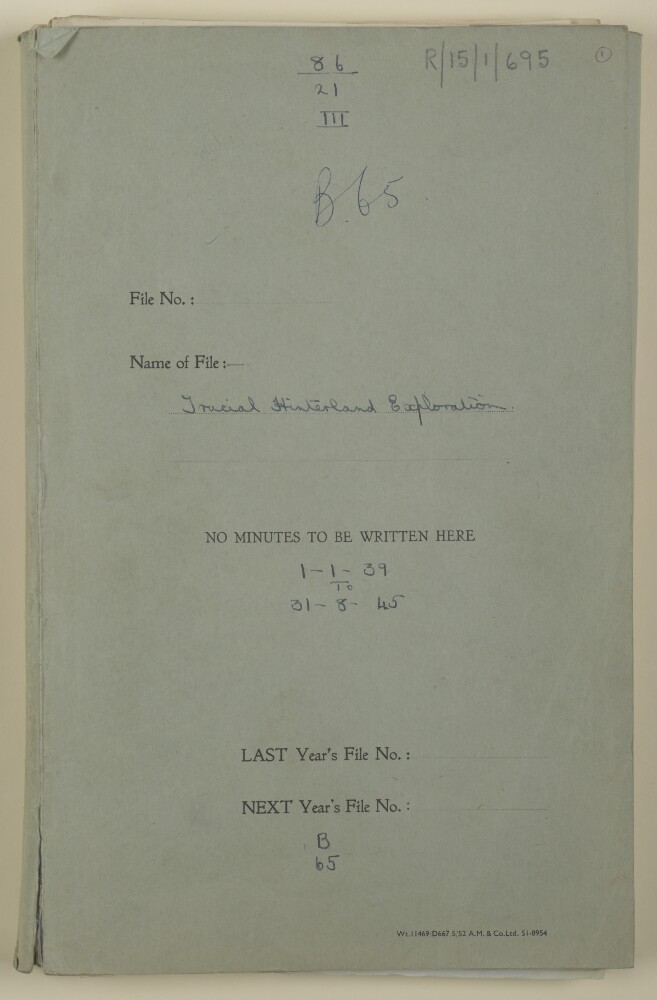
4. '86/21 - III B.65. Trucial Hinterland Exploration'
- Description:
- Abstract: The file comprises correspondence between the Political Resident in the Persian Gulf (Trenchard Craven Fowle, Charles Geoffrey Prior), the Political Agent at Bahrain (Hugh Weightman), the Political Agent at Muscat (Ralph Ponsonby Watts, Tom Hickinbotham), the India Office (John Percival Gibson, Roland Tennyson Peel) and Petroleum Concessions Limited, later Petroleum Development (Trucial Coast) Limited (Basil Henry Lermitte, Stephen Hemsley Longrigg, Thomas Fulton Williamson) regarding geological exploration of the Trucial Coast and Muscat, and its subsequent postponement owing to World War Two.The correspondence discusses initial plans for the exploration of the Trucial coast and Muscat during the winter of 1939 – 1940 and the intention that the Sultan of Muscat (Sayyid Sa‘īd bin Taymūr Āl Bū Sa‘īd ) would provide access to areas under the control of the Naim [Na‘īm] and Al Bu Shamis [Āl Bū Shāmis] tribes. Also discussed is the possibility of the Shaikh of Abu Dhabi (Shaikh Shakhbūt bin Sulṭān bin Zāyid Āl Nahyān) providing access to Baraimi [Al Buraymī ] now that a concession has been signed for his territory; and other work that might be undertaken in both Muscat and Abu Dhabi. This survey work was ultimately postponed owing to concerns over access to, and protection whilst in the relevant territory, as well as the outbreak of War in Europe.Later correspondence discusses the decision to postpone geological surveying owing to wartime conditions, and consideration of a resumption of work in 1945 with proposals for a small geological survey party working in the Baraimi and Jebel Hafit [Jabal Ḩafīt] area’s with geophysical surveys commencing in 1946. Included in the file are reports from a geologist for Petroleum Concessions Limited, Thomas Fulton Williamson, which discuss the potential problems of supplies, labour, transport, and accommodation that would have to be overcome.Other matters discussed in the volume include:news of the death of Shaikh Muhammad bin Sultan An-Nu’aimi [Sheikh Muḥammad bin Sulṭān Al-Nu`aimī] of Dhank who had been succeeded by his brother Shaikh Saqr bin Sultan [Sheikh Saqr bin Sulṭān Al-Nu`aimī] of Baraimi;the need to attempt to define the boundaries of the various Trucial Shaikh’s territories and proposing that initially each Shaikh be asked to state what they considered to be under their control so that areas of joint or disputed ownership could be identified;a meeting in Sharjah with the Political Agent at Bahrain, Shaikh Mohammed bin Saqr al-Jawassim [Sheikh Muḥammad bin Saqr Āl Qasimī] brother of the Shaikh of Sharjah, Shaikh Saqr bin Sultan of the Naim at Dhank, Shaikh Rashid bin Hamad [Rāshid Bin Ḥumaid] of Al Bu Shamis at Baraimi) and Shaikh Mohammed bin Ali bin Huweidin of the Beni Qitab (also written as Beni Chittab). That this was the first time in ten years that the Chief of the Beni Qitab had been persuaded to come to Sharjah and was considered a positive sign that could benefit Petroleum Concessions Limited in gaining access to territory under the Beni Qitab’s control;concerns in 1939 over Petroleum Concessions Limited’s intentions with regard to their concessions in the Persian Gulf and whether they actually intended exploiting them or had merely acquired them to prevent other companies from doing so.Physical description: Foliation: the main foliation sequence (used for referencing) commences at the front cover with 1 and terminates at the back cover with 128; these numbers are written in pencil, are circled, and are located in the top right corner of the recto side of each folio. An additional foliation sequence is also present in parallel between ff 2-127; these numbers are also written in pencil, but are not circled, and are located in the same position as the main sequence. A previous foliation sequence, which is also circled, has been superseded and therefore crossed out.
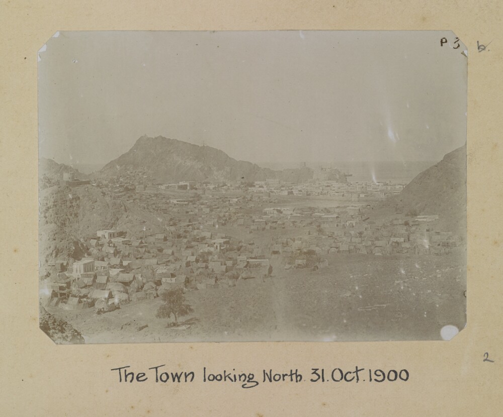
5. '[Muscat] The Town looking North. 31. Oct 1900'. Photographer: Arthur Alexander Crookshank
- Description:
- Abstract: Genre/Subject MatterGeneral view from the outskirts of the town (likely present-day Mutrah) to the harbour and promontory fort, from an elevated position, looking north-northeast. The area of the town and coastline visible in the distant middleground is the part of the town featured in the previous image (Photo 430/8/1). A ship can be seen emerging from behind the promontory right of centre on the horizon near Fort Al-Mirani.While those distant buildings are clearly several-storeyed white-washed buildings, the dwellings in the fore- and middleground are, for the most part, tents and other temporary structures. Overlooking these, on the western ridge a fortified tower can be seen in the far left of the image.A group of figures stands under a single tree in the foreground.InscriptionsUpper right, in pen, on image: ‘p. 3’; alongside image, in pencil: ‘b’Lower right, in pencil, alongside image: ‘2’Below image: 'The Town looking North. 31 Oct. 1900'Physical description: Dimensions:75 x 104 mm [landscape]Format:Materials:Condition:The image is faded throughout with surface losses in the upper left corner. White smeared spot staining in the right hand side of the image and in the lower right-hand corner originate in the printing phase.Foliation:'p 3'; 'b'; '2'Process:
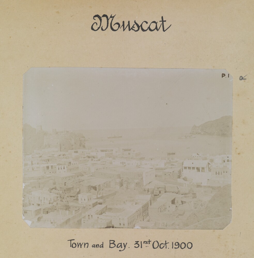
6. '[Muscat] Town and Bay. 31st Oct 1900'. Photographer: Arthur Alexander Crookshank
- Description:
- Abstract: Genre/Subject MatterGeneral view over the town out towards the harbour, from the south-west, looking north-east. Several-storeyed white-washed buildings can be seen in the fore- and middleground. To the far left, two apparently fortified towers can be seen on the foothills of the ridge at left; this is likely to be Fort Al-Mirani.In the bay, two large ships and two smaller boats, possibly dhows, can be seen.InscriptionsUpper right, in pen, on image: ‘p. 1’; alongside image, in pencil: ‘a’Lower right, in pencil, alongside image: ‘1’Below image: 'Town and Bay. 31rst Oct. 1900'Physical description: Dimensions:77 x 100 mm [landscape]Format:Materials:Condition:The image is considerably faded. There are surface losses in the left-hand lower corner and there is surface staining and residue throughout.Considerable fading.Foliation:‘p. 1’; ‘a’; ‘1’Process:
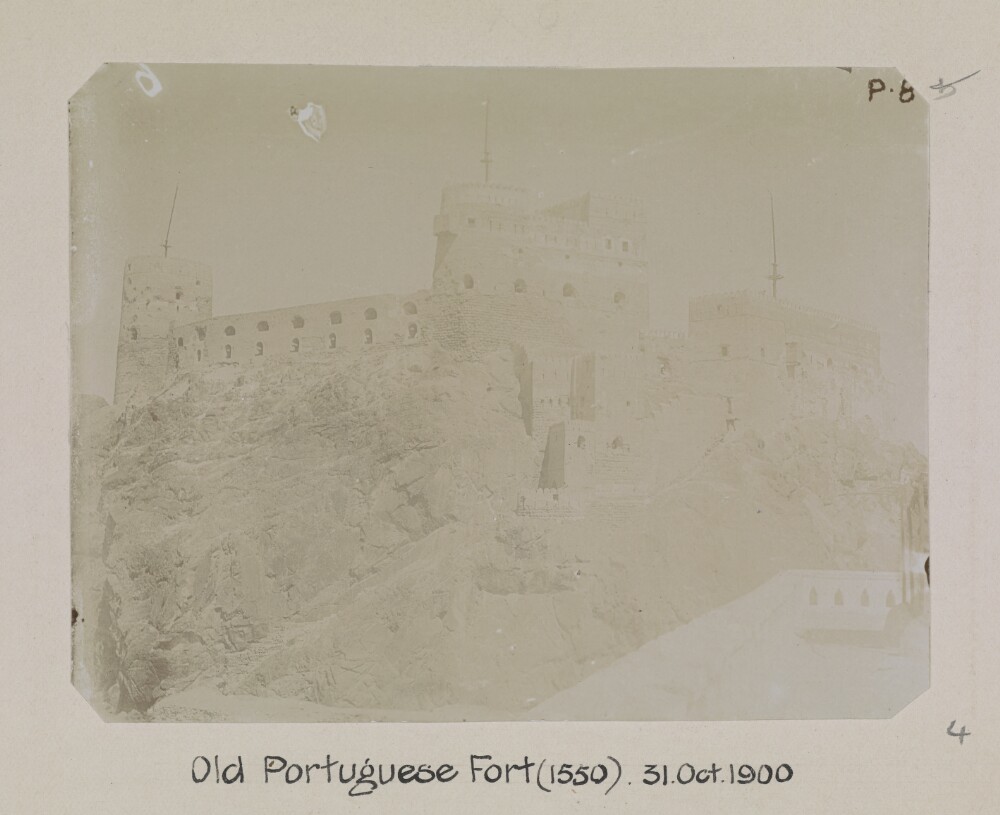
7. '[Muscat] Old Portuguese Fort (1550). 31. Oct 1900'. Photographer: Arthur Alexander Crookshank
- Description:
- Abstract: Genre/Subject MatterThis view of the Al-Jalali Fort at the south-eastern end of the Bay of Muscat was likely photographed from the roof of the British Consulate, situated along the shoreline adjacent to it (see also Photo 430/8/3).InscriptionsUpper right, in pen, on image: 'p. 8'; alongside image, in pencil: ‘b’Lower right, in pencil, alongside image: ‘4’Below image: ‘Old Portuguese Fort (1550). 31. Oct. 1900’Physical description: Dimensions:77 x 100 mm [landscape]Format:Materials:Condition:The image is considerably faded throughout. Large white spot staining in the upper left of the image probably originate in the printing phase.Foliation:'p. 8'; 'b'; '4'Process:
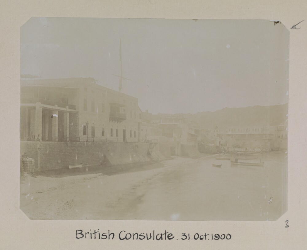
8. '[Muscat] British Consulate. 31. Oct 1900'. Photographer: Arthur Alexander Crookshank
- Description:
- Abstract: Genre/Subject MatterView from the shoreline of the British Consulate at Muscat, looking due west.The consulate is a pale-stoned, two or three-storeyed building built along the quays. Two gas lamps can be seen along the quay in front of the building and a single mashrabiyya (a form of enclosed balcony) breaks up the centre of the facade.Above the consulate a flagpole carries a flag. Figures can be seen sitting on the quay to the far left of the image. Several small boats are tied up along the shoreline.InscriptionsUpper right, in pen, on image: [illegible]; alongside image, in pencil: ‘a’Lower right, in pencil, alongside image: ‘3’Below image: ‘British Consulate. 31. Oct. 1900’Physical description: Dimensions:77 x 102 mm [landscape]Format:Materials:Condition:The image is considerably faded throughout with surface losses along the right-hand edge, lower left corner and 13 mm from left, 40 mm from lower edge. White smeared spot staining in the left-hand side of the image originate in the printing phase.Foliation:'c'; '3'Process:
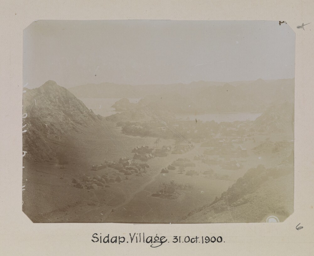
9. '[Muscat] Sidap. Village. 31. Oct 1900'. Photographer: Arthur Alexander Crookshank
- Description:
- Abstract: Genre/Subject MatterThis scene, taken from an elevated position looking southwards towards a bay, shows the village of Sidāb, approximately 3 km south of the Bay of Muscat.A well-trodden path or dried-up stream can be seen leading through the dwellings, the majority of which appear to be tents, in the direction of the shoreline. A few trees and bushes are discernible.InscriptionsUpper right, in pen, alongside image, in pencil: ‘d’Lower right, in pencil, alongside image: ‘6’Below image: ‘Sidap. Village. 31. Oct 1900’Along the left-hand side of the image, white, vertical: [illegible]Physical description: Dimensions:76 x 103 mm [landscape]Format:Materials:Condition:The image is considerably faded in the right of the image.Foliation:'d'; '6'Process:
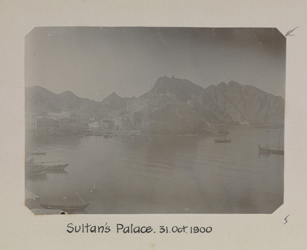
10. '[Muscat] Sultan's Palace. 31. Oct 1900'. Photographer: Arthur Alexander Crookshank
- Description:
- Abstract: Genre/Subject MatterThis view of the bay of Muscat from an elevated position in the east was likely photographed from Al-Jalali Fort. It shows the Al-Mirani fort at centre, along with the Sultan's Palace and a variety of other buildings lining the shore in the left middleground.Many small craft are visible in the middleground and foreground, while two boats are at anchor further out in the bay at the right of the image.InscriptionsUpper right, in pen, alongside image, in pencil: ‘c’Lower right, in pencil, alongside image: ‘5’Below image: ‘Sultan's Palace. 31. Oct 1900’Physical description: Dimensions:72 x 100 mm [landscape]Format:Materials:Condition:The image is faded at the left. There are some minor surface losses in the lower half of the image.Foliation:'c'; '5'Process:

11. ‘Dispatch of Three Cruizers to the Persian Gulph [Gulf] for the Suppression of Pirates.’
- Description:
- Abstract: The item consists of copies and extracts of Political Consultations and Political Letters sent to and from the Government of Bombay.The item relates to attacks on merchant ships by the Joasamee [Āl Qāsimī] and the numerous counterefforts made by the East India Company and others over several years to curb the power of the Joasamee 'pirates'. In particular the item is concerned with:Accounts of the attack on the Company ships Macaulayand DuncanThe armament and dispatch of three Company cruizers to the Gulph [Gulf] of Persia for the purpose of protecting trade in the region against the Joasamee piratesThe order to inform the Imaum [Imam] of Muscat and the English Broker at Muscat of the above expedition so that they might offer aid and assistance to the commanding officersThe prohibition of the sale of timber, teakwood and planks at British ports to Arabs as it has been discovered that some of these items are then sent to the Coast of Malabar where the Joasamee are able to source the material to repair their shipsThe successful attack on Rasul Khyma [Ra's al-Khaymah], the principal port of the Joasamee, by Captain Wainwright of His Majesty's ship La Chiffonneand Lieutenant-Colonel Smith of His Majesty's 65th RegimentIntelligence that a fleet of 18 'piratical' vessels based at Rasul Khyma are preparing to intercept merchant ships on their journey from Bussora [Basra] to IndiaInstructions to commanding officers including orders in the event of conciliatory proposals on the part of the Joasamee and orders to avoid 'all undue constraint or detriment towards the interior commerce of the Gulph'Reports of a battle between the fleet of Rehma bin Janber [Rahmah bin Jābir al-Jalhami] and the Uttobies [ʿUtūb] of Bahrein [Bahrain] in which three of Rehma's ships have been blown up and Rehma has reportedly been killed.The item also includes a note on the number of ships destroyed and men killed or wounded in the attack on Rasul Khyma (f 59 verso).Correspondents: Government of Bombay; East India Company Court of Directors; J Babington, Deputy Secretary to Government of Bombay; W J Hamilton, Secretary in the Government of Bombay Marine Department; Francis Warden, Chief Secretary to Government of Bombay; Alexander Bell, Conservator of the Forests in Malabar [Kochi]; Captain Charles Sealy, Commander of the Company's cruizer Benares; Chief Secretary to the Supreme Government; Captain Prior of His Majesty's ship Hesper; William Bruce, Acting Resident at Bushire.The title page of the item contains the following references: 'Political No. 9, Season 1814/15, Draft 20' and 'Examiner's Office November 1812-November 1813'.Physical description: Foliation: the foliation sequence for this description (used for referencing) commences at f 52, and terminates at f 80, as it is part of a larger physical volume; these numbers are written in pencil, are circled, and are located in the bottom right corner of the recto side of each folio. Pagination: the file also contains an original printed pagination sequence.
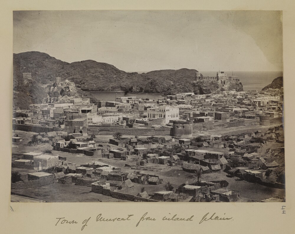
12. 'Town of Muscat from inland plain.'
- Description:
- Abstract: Genre/Subject Matter:View looking north-east over the town towards the harbour. The fortified city wall is visible in the middle-ground. In the background overlooking the harbour, Fort Capitano (Fort Al-Mirani) to the left and and Fort Jellalee (Fort Al-Jalali) to the right.The middle- and foreground is made up of various low-lying stone-built and palm-frond structures while inside the city walls the structures are several-storeyed and stone-built with some evidently white-washed.Rocky hills rise from the centre to the left of the image.Inscriptions:Lower right, in pencil alongside image: '44'Lower left, in pencil alongside image: 'b'Below image, in pen: 'Town of Muscat from inland plain.'Physical description: Dimensions:141 x 200 mmFormat:Albumen print on paperCondition:The print is in good condition with staining and creasing in the sky area in the upper right and left corners and minor surface dirt throughout.Foliation:‘b’ (crossed out); ‘44’Process:Albumen print