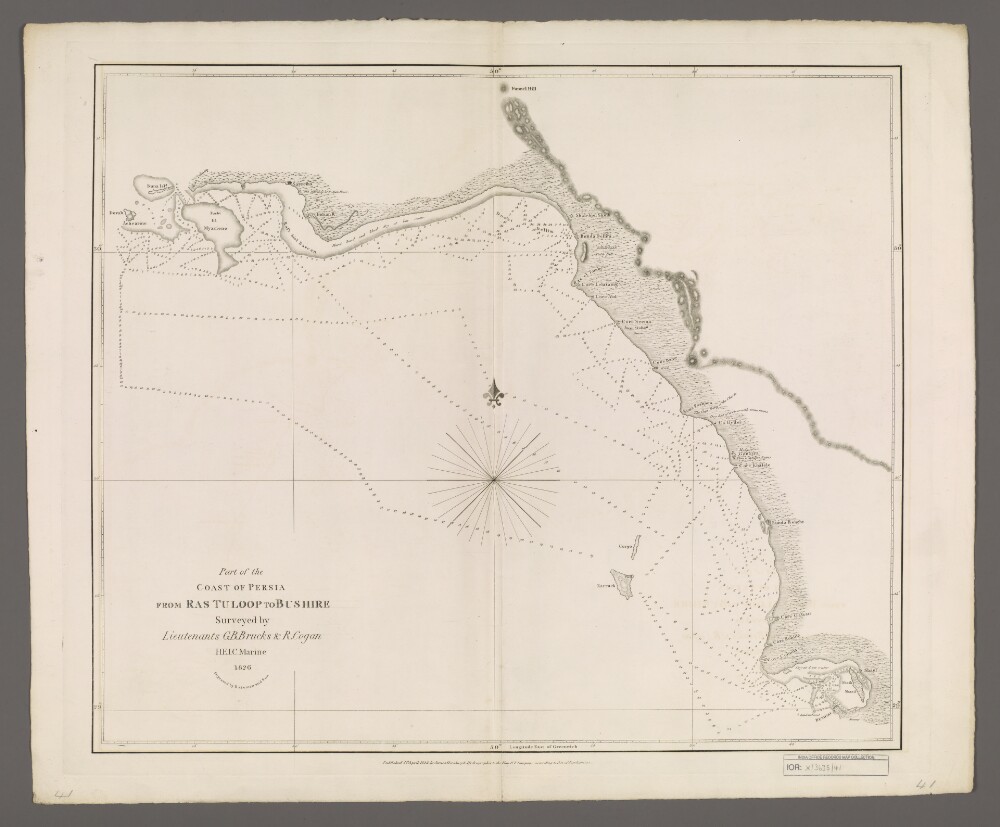
Abstract: Covers a 180-mile length of the Persian Gulf coast from Ras Tuloop [Ras Tanub, Iran] south-eastwards to Bushire [Bushehr, Iran], including a twenty-mile hinterland of Persia [Iran]. Portrays hydrology, including depths by soundings, sands and muds, relief by shading, vegetation, settlements, forts, ruins and place names, and includes topographical and hydrographic notes.Surveyed by Lieutenants George Barnes Brucks and Robert Cogan, 1826. Engraved by Bateman and Son. Published by James Horsburgh, Hydrographer to the Honourable East India Company.Physical description: Materials: Printed on paperDimensions: 500 x 592mm, on sheet 583 x 713mm