Skip to search
Skip to main content
Skip to first result
Digital Library of the Middle East
Show facets
Hide facets
English
العربية
Contact us
Contact us
To contact us about any matter related to DLME, please use the form below.
Message
Your name
Ignore this text box. It is used to detect spammers. If you enter anything into this text box, your message will not be sent.
Your email
Cancel
Digital Library of the Middle East
Preserve. Access. Inspire.
Home
Explore
Contributors
About
Search in
Everything
Title
Creator / Contributor
Identifier
search for
Search
Home
Search results
Search
Search Constraints
Start Over
You searched for:
Spatial
Red Sea
✖
Remove constraint Spatial: Red Sea
« Previous
|
13
-
24
of
62
|
Next »
Sort
by Relevance
Relevance
Title
Creator
Date (old to new)
Date (new to old)
Number of results to display per page
12
per page
per page
12
per page
24
per page
48
per page
96
per page
View results as:
List
Gallery
Slideshow
Search Results
×
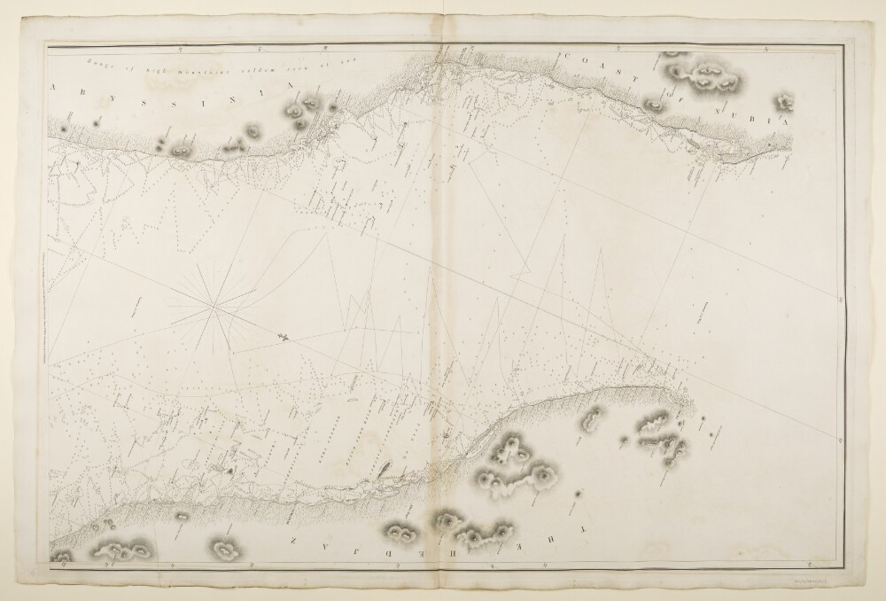
‘Chart of the Red Sea, from Jiddah, to the Straits of Bab-el-Maneb, Surveyed in the Years 1830, 31, 32 & 33 By Capt.n T. Elvon and Lieu.t H.N. Pinching, and completed in 1833 and 34 by Com.der R. Moresby, Indian Navy. T.G. Carless Lieu.t and Draughts.n I.N. Engraved by J.&C. Walker’
13 of 62
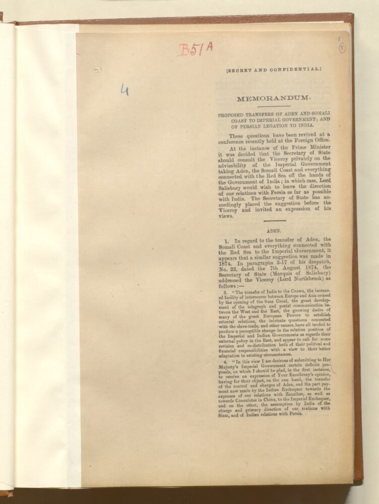
'Proposed Transfers of Aden and Somali Coast to Imperial Government; and of Persian Legation to India'
14 of 62
‘Proceedings of Govt respecting the number of Vessels requisite to be kept up as the Naval Force for the Red Sea & Persian Gulf &c’
15 of 62
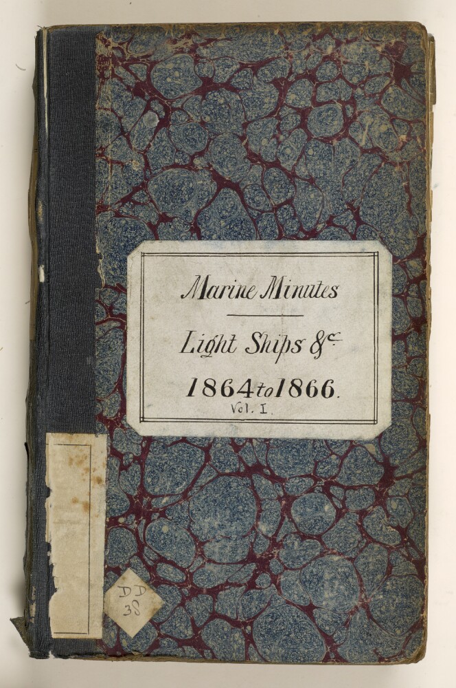
'Marine Minutes – Light Ships &c 1864 to 1866 Vol 1'
16 of 62
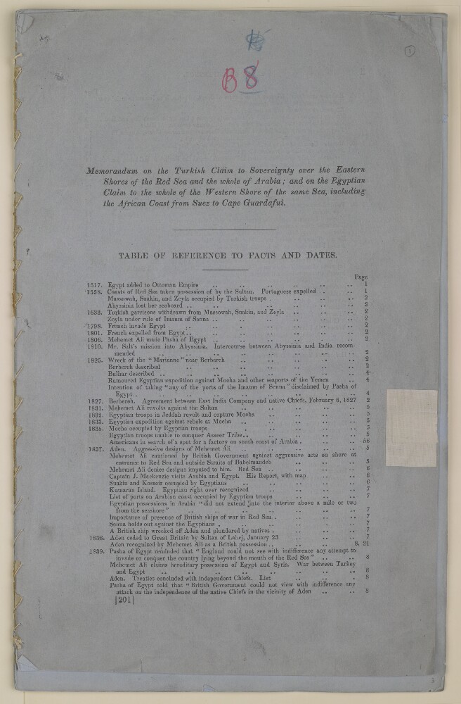
'Memorandum on the Turkish claim to sovereignty over the eastern shores of the Red Sea and the whole of Arabia; and on the Egyptian claim to the whole of the western shore of the same sea, including the African coast from Suez to Cape Guardafui.'
17 of 62
‘Muskat. His Highness the Imaum of makes certain regulations in regard to vessels putting into his Ports’
18 of 62
‘Egypt. Services rendered by Commander Barker of the Indian Navy, Commanding the Hon’ble Company’s Steamer “Ajdah”, on the occasion of the wreck near Suez of a Steamer belonging to His Highness the Vice Roy of Egypt, and presentation in consequence of a sword to that officer by His Highness, in acknowledgement of those services. –’
19 of 62
[Unidentified maritime scene, probably in Red Sea]
20 of 62
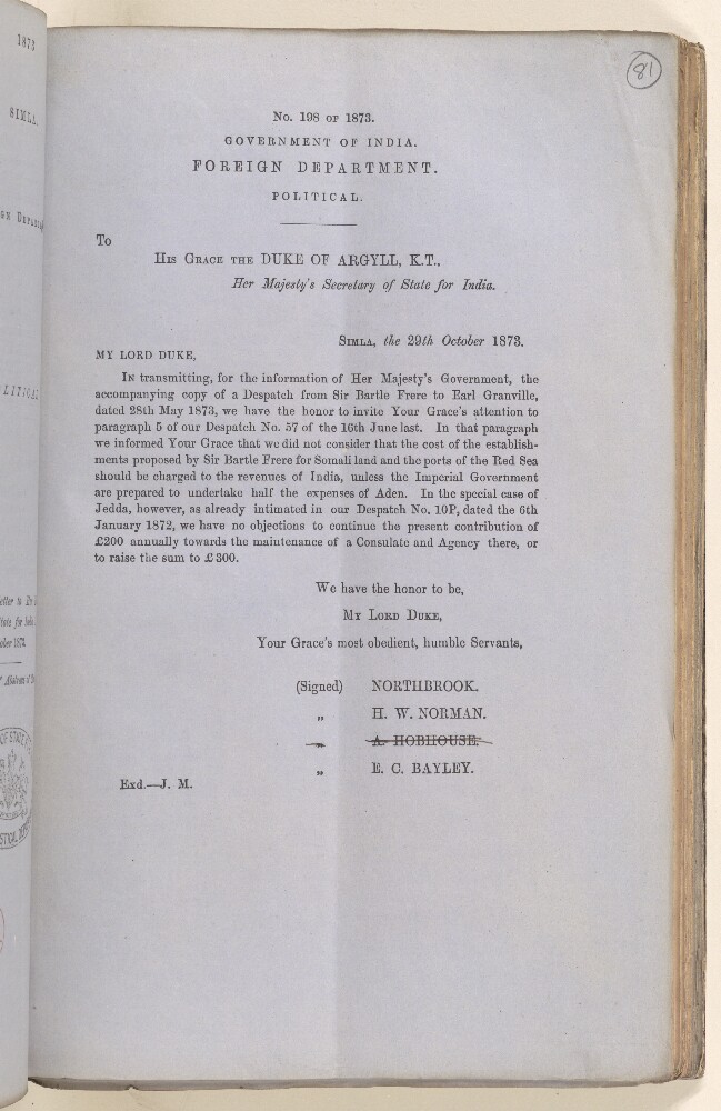
Political No. 198 of 1873, Forwarding Copies of a Letter from Sir Bartle Frere to Earl Granville, Regarding Consulate Arrangements in Jedda and Proposals to Establish Consulates for 'Somali Land' and Ports of the Red Sea
21 of 62
Affairs at Aden and Within its Vicinity, and at the Red Sea Ports
22 of 62
Steam Navigation to Internal and External Communications of India, Volume 8
23 of 62
The Slave Trade between the East Coast of Africa and Various Ports in the Persian Gulf and the Red Sea
24 of 62
« Previous
Next »
1
2
Current Page, Page 2
3
4
5
6
![[Unidentified maritime scene, probably in Red Sea]](https://images.qdl.qa/iiif/images/81055/vdc_100000001260.0x0002eb/Mss Eur G45_8_0002.jp2/full/!1000,1000/0/default.jpg)