Abstract: Confidential report detailing operations in Europe that took place during the Russo-Turkish War of 1877/78, written by Major R J Maxwell, of Section D, Intelligence Branch, Quarter Master General’s Department. The report, which covers the period November 1876 to May 1877, is organised under the following chapter headings:NarrativeMobilisation of the Russian ArmyDetails of the Russian ArmyThe movements of troops, stores, war materialsRailways, roads, bridges, etc.Events in Roumania [Romania], Servia [Serbia], etc.The Turkish ArmyTurkish fortresses, stores, guns, etc.MiscellaneousPhysical description: The report is arranged chronologically into a number of sections: preliminary; January to March 1877 inclusive; April 1877; 1 May to 5 May 1877; 7 May to 12 May 1877; 13 May to 19 May 1877; 20 May to 26 May 1877. Each section contains an identical series of chapter headings.
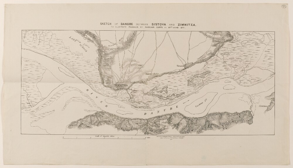
Abstract: Map of the River Danube indicating the passage of Russian troops on 27 June 1877, during the Russo-Turkish War of 1877/78. The map shows: the Danube with tributaries, islands and marshland; topography, with some indication of relief, settlements; roads. Sheet 1 shows the towns of Sistova [Svishtov] and Crivina [Krivina] on the Bulgarian side of the river, and the towns of Zimnitza [Zimnicea], Zimnicellele [Zimnicele] and Verasca [Năsturelu] on the Romanian side. Sheet 2 shows the Romanian towns of Petrosiani [Pietroşani], Petrisni [Pietrişu], Bellaria [Balariile] and Parapanu [Vedea] and Mallu de josu [Malu].A printing statement on sheet 1 states that the map was lithographed at the Intelligence Branch of the Quarter Master General’s Department, under the direction of Lieutenant-Colonel R Home, in 1877.Physical description: Dimensions:Sheet 1: 210 x 510 mm, on sheet 330 x 580 mm. Sheet 2: 330 x 450 mm, on sheet 380 x 560 mm.Materials:Printed on paper.
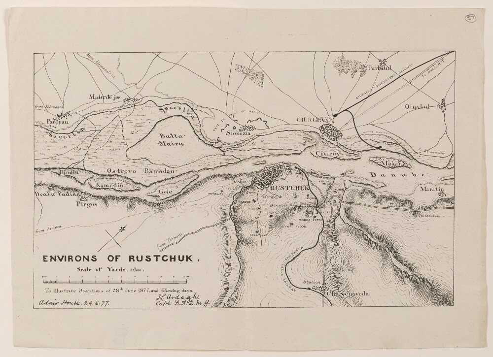
Abstract: Map of Rustchuck [Ruse] and the surrounding region, on the banks of the River Danube. The map indicates: the Danube river, with islands and marshes; topography, with some indication of relief; settlements; fortifications, batteries and cordons; roads and railways.A statement below the title of the map states that it illustrates operations of 28 June 1877 and the days that followed, during which Russian troops advanced into Ottoman territory.The map is signed by Captain H Ardagh, Deputy Assistant Quarter Master General (‘D.A.Q.M.G.’) at Adair House, 29 June 1877.Physical description: Dimensions:185 x 305 mm, on sheet 250 x 345 mm.Materials:Printed on paper.