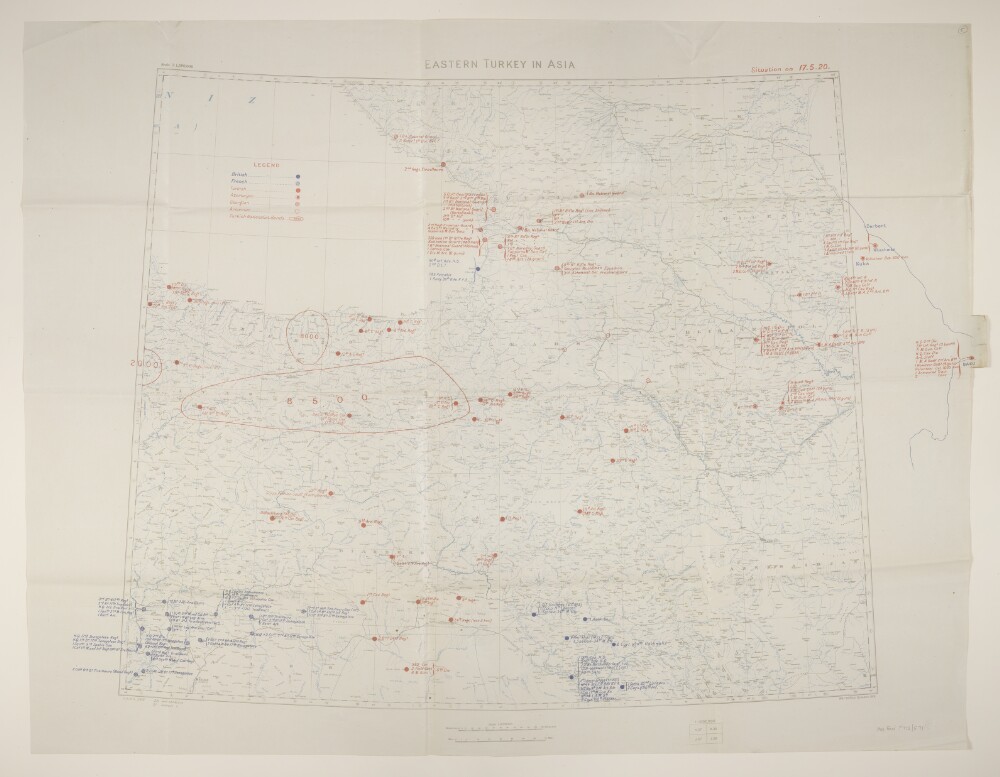
Abstract: Geographical Section, General Staff No. 2931, sheet 'Eastern Turkey in Asia', comprising a base map with overprints.The base map bears the imprint 'War Office, October, 1919' and portrays hydrology, relief by spot heights, railways, settlements, place names, and internal and international boundaries.A blue overprint depicts the position of British and French troops as at 17 May 1920; a red overprint depicts the position of Turkish, Azeri, Georgian and Armenian troops, and Turkish Nationalist Bands. The overprints extend approximately a hundred miles beyond the eastern neatline to Baku, Azerbaijan.Physical description: Materials: Printed in colourDimensions: 594 x 860mm, on sheet 712 x 930mm
Abstract: Sheet is stamped 'Secret'.Geographical Section, General Staff No. 2901, with manuscript additions portraying railway information. Only the south-east quarter of the sheet is present; the title is absent.The map bears the imprint 'Published by the Royal Geographical Society, 1910. Railways inserted to November, 1917' and portrays hydrology, relief by spot heights, roads, railways, telegraphs, settlements, place names and international boundaries. The sheet bears the printed note 'International Boundaries as in July, 1914'. A 1921 edition of this map is at Maps 46970.(44.) and includes accompanying notes (including compilation details) published by the Royal Geographical Society in 1910, although lacks a GSGS designation yet contains an additional grey plate (hachures and ancient canals) that is lacking from this version; projection information has been taken from this source.Manuscript additions provide supplementary information on railway gauge and projected railways.Date range end date taken from War Office accession stamp.Physical description: Materials: Printed in colour, with manuscript additions in coloured inkDimensions: 559 x 452mm, on sheet 585 x 483mm